
Puerto Rico Highway 102
Highway 102 | ||||
|---|---|---|---|---|
| Ruta 102 | ||||
| Route information | ||||
| Maintained by Puerto Rico DTPW | ||||
| Length | 41.6 km[1][2] (25.8 mi) | |||
| Major junctions | ||||
| West end | ||||
| ||||
| East end | ||||
| Location | ||||
| Country | United States | |||
| Territory | Puerto Rico | |||
| Municipalities | Mayagüez, Cabo Rojo, San Germán, Sabana Grande | |||
| Highway system | ||||
| ||||


Puerto Rico Highway 102 (PR-102) is a main highway in the southwestern portion of the Porta del Sol region of Puerto Rico. It begins at Puerto Rico Highway 2 north of central Mayagüez and runs through the municipalities of Cabo Rojo and San Germán, coming to an end in downtown Sabana Grande.[3]
Route description
Mayagüez
PR-102 begins as a short two-lane road at an intersection with north of the
Cabo Rojo
PR-102 continues to run south along the coastline where it enters Cabo Rojo, eventually passing through the seaside resort and fishing village of Joyuda. After leaving Joyuda, PR-102 curves eastward as Calle Pedro Albizu Campos. The highway intersects PR-100 just outside downtown Cabo Rojo. It enters the town as Calle Nuevo Carbonell and shares some of its length with PR-103 for a little over a half mile.
San Germán
Once exiting the town, the route travels a short distance through countryside until entering downtown San Germán as Calle Comercio Luna.
Sabana Grande
After leaving San Germán, the road once again travels through rural communities until it intersects PR-2 just outside downtown Sabana Grande. It enters Sabana Grande as Calle Francisco Mariano Quiñones, where it terminates south of the town plaza at the intersection of Calle 65 de Infanteria (65th Infantry Street)/PR-120 and PR-121 which continues along Francisco Mariano Quinon Street.[4]
-
-
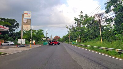
 PR-2 west approaching exit 181 to PR-102 in Rayo barrio


Major intersections
| Municipality | Location | km[1][2] | mi | Destinations | Notes |
|---|---|---|---|---|---|
Mayagüez barrio-pueblo tripoint | 0.0 | 0.0 | Western terminus of PR-102 | ||
Mayagüez barrio-pueblo | 0.3 | 0.19 | No left turn from PR-2 southbound; no access across PR-2 | ||
| 0.6– 0.7 | 0.37– 0.43 | ||||
| 1.6– 1.7 | 0.99– 1.1 | PR-3342 (Calle Concordia) – Mayagüez | |||
Mayagüez barrio-pueblo line | 3.5 | 2.2 | |||
| Cabo Rojo | Miradero | 17.3 | 10.7 | ||
| 19.3 | 12.0 | ||||
| 20.1 | 12.5 | ||||
Cabo Rojo barrio-pueblo | 20.4 | 12.7 | Western terminus of PR-103 concurrency | ||
Monte Grande–Bajura line | 21.3 | 13.2 | Eastern terminus of PR-103 concurrency | ||
| 24.8 | 15.4 | ||||
Sabana Eneas line | 27.6 | 17.1 | |||
Cotuí | |||||
| 29.6 | 18.4 | ||||
Maresúa line | 29.9 | 18.6 | |||
| 30.8– 30.9 | 19.1– 19.2 | ||||
San Germán barrio-pueblo | 31.8– 31.9 | 19.8– 19.8 | |||
| 32.1 | 19.9 | One-way street | |||
| 32.4 | 20.1 | Caín Bajo | |||
Retiro | 32.9 | 20.4 | |||
| 35.1– 35.2 | 21.8– 21.9 | ||||
| 35.3 | 21.9 | ||||
| Minillas | 37.1 | 23.1 | |||
| 39.2 | 24.4 | PR-2 exit 181; diamond interchange | |||
Rayo–Santana line | 40.0 | 24.9 | |||
Sabana Grande barrio-pueblo | 41.6 | 25.8 | Eastern terminus of PR-102 | ||
1.000 mi = 1.609 km; 1.000 km = 0.621 mi
| |||||
See also
 Puerto Rico portal
 U.S. Roads portal
References
- ^ a b Google (26 March 2020). "PR-102 west" (Map). Google Maps. Google. Retrieved 26 March 2020.
- ^ a b Google (26 March 2020). "PR-102 east" (Map). Google Maps. Google. Retrieved 26 March 2020.
- ^ "Tránsito Promedio Diario (AADT)". Transit Data (Datos de Transito) (in Spanish). DTOP PR. pp. 55–56. Archived from the original on 1 April 2019.
- OCLC 756511572.
External links
 Media related to Puerto Rico Highway 102 at Wikimedia Commons