
Roosevelt, Washington
Roosevelt, Washington | ||
|---|---|---|
FIPS code 53-59705[1] | | |
| GNIS feature ID | 1513196[2] | |
Roosevelt is an
The community was named after President Theodore Roosevelt.[5][6]
Geography
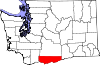
Roosevelt is in southeastern Klickitat County on the north bank of the Columbia River, sitting across from Arlington, Oregon. State Route 14 runs through the community, traveling 34 miles (55 km) east to Paterson and 32 miles (51 km) west to Maryhill.
According to the United States Census Bureau, the CDP has a total area of 3.8 square miles (9.8 km2), all of it land.[3]
Climate
This region experiences warm (but not hot) and dry summers, with no average monthly temperatures above 71.6 °F (22.0 °C). According to the
Demographics
As of the
There were 33 households, out of which 27.3% had children under the age of 18 living with them, 54.5% were married couples living together, and 36.4% were non-families. 36.4% of all households were made up of individuals, and 12.1% had someone living alone who was 65 years of age or older. The average household size was 2.39 and the average family size was 3.10.
In the CDP, the population was spread out, with 24.1% under the age of 18, 8.9% from 18 to 24, 15.2% from 25 to 44, 35.4% from 45 to 64, and 16.5% who were 65 years of age or older. The median age was 45 years. For every 100 females, there were 154.8 males. For every 100 females age 18 and over, there were 114.3 males.
The median income for a household in the CDP was $45,694, and the median income for a family was $46,250. Males had a median income of $38,750 versus $0 for females. The
References
- ^ a b "U.S. Census website". United States Census Bureau. Retrieved January 31, 2008.
- ^ "Roosevelt". Geographic Names Information System. United States Geological Survey, United States Department of the Interior.
- ^ a b "Geographic Identifiers: 2010 Census Summary File 1 (G001), Roosevelt CDP, Washington". American FactFinder. U.S. Census Bureau. Archived from the original on February 13, 2020. Retrieved July 11, 2019.
- ^ "Revisiting Roosevelt: the landfill of a truly epic scale". Retrieved August 7, 2023.
- ^ Meany, Edmond S. (1923). Origin of Washington geographic names. Seattle: University of Washington Press. p. 248.
- ^ "Seattle Neighborhoods: Ravenna - Roosevelt — Thumbnail History". Retrieved August 7, 2023.
- ^ Climate Summary for Roosevelt, Washington
 | ||||
| CDPs | ||||
| Unincorporated communities | ||||
| Ghost towns | ||||
| Indian reservation | ||||
| Footnotes | ‡This populated place also has portions in an adjacent county or counties | |||