
Trout Lake, Washington
Trout Lake, Washington | ||
|---|---|---|
FIPS code 53-72450[1] | | |
| GNIS feature ID | 1527414[2] | |
Trout Lake is an
Geography

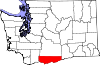
Trout Lake is in the northwest corner of Klickitat County, 14 miles (23 km) south of the 12,276-foot (3,742 m) summit of Mount Adams. State Route 141 passes through the community, traveling 22 miles (35 km) south to the town of White Salmon and 5 miles (8 km) west to its terminus at Gifford Pinchot National Forest.
According to the United States Census Bureau, the Trout Lake CDP has a total area of 7.0 square miles (18.1 km2), of which 0.04 square miles (0.1 km2), or 0.61%, are water.[3] The community sits in the Trout Lake Valley, drained to the southeast by Trout Lake Creek which flows to the White Salmon River, a south-flowing tributary of the Columbia River.
Climate
| Climate data for Mount Adams Ranger Sation, Washington, 1991–2020 normals: 1950ft (594m) | |||||||||||||
|---|---|---|---|---|---|---|---|---|---|---|---|---|---|
| Month | Jan | Feb | Mar | Apr | May | Jun | Jul | Aug | Sep | Oct | Nov | Dec | Year |
| Mean daily maximum °F (°C) | 38.6 (3.7) |
43.2 (6.2) |
49.3 (9.6) |
58.0 (14.4) |
67.6 (19.8) |
73.9 (23.3) |
83.9 (28.8) |
83.7 (28.7) |
75.2 (24.0) |
59.8 (15.4) |
45.2 (7.3) |
36.8 (2.7) |
59.6 (15.3) |
| Daily mean °F (°C) | 32.2 (0.1) |
34.8 (1.6) |
39.3 (4.1) |
45.6 (7.6) |
53.7 (12.1) |
59.4 (15.2) |
66.9 (19.4) |
66.4 (19.1) |
58.8 (14.9) |
47.5 (8.6) |
37.5 (3.1) |
31.1 (−0.5) |
47.8 (8.8) |
| Mean daily minimum °F (°C) | 25.8 (−3.4) |
26.5 (−3.1) |
29.3 (−1.5) |
33.2 (0.7) |
39.9 (4.4) |
44.9 (7.2) |
49.8 (9.9) |
49.1 (9.5) |
42.4 (5.8) |
35.1 (1.7) |
29.8 (−1.2) |
25.3 (−3.7) |
35.9 (2.2) |
| Average precipitation inches (mm) | 8.16 (207) |
5.13 (130) |
4.71 (120) |
2.35 (60) |
1.55 (39) |
1.03 (26) |
0.34 (8.6) |
0.67 (17) |
1.38 (35) |
3.52 (89) |
7.04 (179) |
7.82 (199) |
43.71 (1,110) |
| Average snowfall inches (cm) | 34.0 (86) |
15.4 (39) |
8.4 (21) |
1.3 (3.3) |
0 (0) |
0 (0) |
0 (0) |
0 (0) |
0 (0) |
0.1 (0.25) |
7.2 (18) |
28.0 (71) |
94.4 (240) |
| Source 1: NOAA[4] | |||||||||||||
| Source 2: WRCC (precipitation & snowfall)[5] | |||||||||||||
Demographics
As of the
There were 224 households, out of which 28.1% included children under the age of 18, 64.7% included a married husband and wife, 4.0% included a male householder with no wife present, 7.6% had a female householder with no husband present, and 23.7% were non-families. The average household size was 2.46 and the average family size was 2.81.
The demographic spread included 130 (23.3%) under the age of 18, 329 (59.1%) aged 20 to 64, and 85 (15.3%) who were 65 years of age or older. By gender, the population was 51.7% (288) male and 48.3% (269) female. The median age was 44.8 years.
In 2011, the American Community Survey estimated a median income of $31,563 (adjusted for inflation, 2011 dollars) for an individual, and $56,250 for a household.[7]
References
- ^ "U.S. Census website". United States Census Bureau. Retrieved January 31, 2008.
- ^ "Trout Lake". Geographic Names Information System. United States Geological Survey, United States Department of the Interior.
- ^ a b "Geographic Identifiers: 2010 Census Summary File 1 (G001), Trout Lake CDP, Washington". American FactFinder. U.S. Census Bureau. Archived from the original on February 13, 2020. Retrieved July 11, 2019.
- ^ "Mt Adams RS, Washington 1991-2020 Monthly Normals". Retrieved October 6, 2023.
- ^ "Mount Adams Ranger Stn, WA". Western Regional Climate Center. Retrieved February 18, 2016.
- ^ "U.S. Census website". United States Census Bureau. Retrieved May 14, 2011.
- ^ "American Community Survey". US Census Bureau. Archived from the original on February 12, 2020.
External links
 | ||||
| CDPs | ||||
| Unincorporated communities | ||||
| Ghost towns | ||||
| Indian reservation | ||||
| Footnotes | ‡This populated place also has portions in an adjacent county or counties | |||
| Authority control databases: National |
|---|