
Sesvenna Alps
| Sesvenna Alps | |
|---|---|
 | |
| Highest point | |
| Peak | Piz Sesvenna |
| Elevation | 3,204 m (10,512 ft) |
| Coordinates | 46°42′21″N 10°24′10″E / 46.70583°N 10.40278°E |
| Geography | |

| |
| Countries | Switzerland, Italy and Austria |
| States | Graubünden, South Tyrol and Tyrol (state) |
| Parent range | Central Eastern Alps |
The Sesvenna Alps are a mountain range located in the Alps of eastern Switzerland, northern Italy and western Austria.
Geography
Sesvenna Alps are considered to be part of the
Engadine Valley, warranting them the name Engadine Dolomites.[1]
The Sesvenna Alps are separated from the
Inn (the Engadine) and Adige
.
The highest peak is Piz Sesvenna, closely followed by the high peaks overlooking Scuol: Piz Pisoc, Piz Plavna Dadaint and Piz Lischana.
Peaks
The main peaks of the Sesvenna Alps are:
| Peak | Elevation | |
|---|---|---|
| m | ft | |
| Piz Sesvenna | 3204 | 10,512 |
| Piz Pisoc | 3178 | 10,427 |
| Piz Plavna Dadaint | 3168 | 10,394 |
| Piz Plavna Dadaint | 3166 | 10,387 |
| Piz Nuna | 3124 | 10,249 |
Piz Minger |
3114 | 10,217 |
| Piz Lischana | 3110 | 10,204 |
| Piz Madlain | 3099 | 10,167 |
| Piz Cristanas | 3092 | 10,144 |
| Piz Laschadurella | 3046 | 9,993 |
| Piz d'Arpiglias | 3027 | 9,931 |
| Piz Sampuoir | 3023 | 9,918 |
| Piz Terza | 2909 | 9,544 |
| Piz dal Fuorn | 2906 | 2534 |
| Piz Macun | 2889 | 9,478 |
| Piz Lad | 2808 | 9,213 |
| Piz Ajüz | 2788 | 9,147 |
Passes
The main passes of the Sesvenna Alps are:
| Mountain pass | location 1 | type | Elevation | |
|---|---|---|---|---|
| m | ft | |||
| Fuorcla Sesvenna | S-charl to Mals | footpath | 2824 | 9265 |
| Schlining Pass | Sent to Mals | bridle path | 2301 | 7549 |
| S-charl Pass | S-charl to Taufers | bridle path | 2296 | 7532 |
Ofen Pass |
Zernez to Val Müstair | road | 2155 | 7070 |
Gallery
-
 Piz Lad
 -
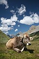 Pasture below Fuorcla Sesvenna
 -
 Lischanahütte near Piz Lischana
 -

-
 The village of S-charl


See also
References
- Swisstopo topographic maps (1:25,000)
Mountain ranges of the Central Eastern Alps according to the AVE | ||
|---|---|---|
|  | |
| Authority control databases: National |
|---|