
Tōkai region
This article needs additional citations for verification. (December 2009) |
Tōkai region | |
|---|---|
 Map of Japan with the Tōkai region highlighted | |
| Country | Japan |
| Region | Chūbu, Kansai |
| Largest city | Nagoya |
| Prefectures | Shizuoka, Aichi, Gifu, Mie |
| Area | |
| • Total | 29,316.53 km2 (11,319.18 sq mi) |
| Population (March 1, 2010) | |
| • Total | 15,138,397 |
| • Density | 520/km2 (1,300/sq mi) |
The Tōkai region (東海地方, Tōkai-chihō) is a subregion of the Chūbu region and Kansai region in Japan that runs along the Pacific Ocean. The name comes from the Tōkaidō, one of the Edo Five Routes. Because Tōkai is a sub-region and is not officially classified, there is some disagreement about where exactly the region begins and ends, however Japanese maps widely conclude that the region includes Shizuoka, Aichi, Gifu and Mie prefectures.
The largest major city in the region is
Tōkai is a heavy manufacturing area and is one of the most industrial regions in Japan. Its coast is lined with densely populated cities with economies that thrive on factories.
The Tōkai region has experienced a number of
Railroads
Economy
Economy of Tōkai subregion is largely based on the Chūkyō metropolitan area that lies within its borders. Note that the Chūkyō metropolitan area is also known as Greater Nagoya as the largest and most influential city of the metropolitan area is Nagoya. Automobile giants Toyota and Suzuki are located in Tōkai subregion. Yamaha corporation is also located in Tōkai subregion.
Demographics
Per Japanese census data,[3] and,[4] Tōkai subregion much like Chūkyō metropolitan area has experienced continuous population growth throughout the 20th century.
Since around 2010 though, the Tōkai subregion has experienced population decline.
| Year | Pop. | ±% |
|---|---|---|
| 1920 | 5,779,000 | — |
| 1930 | 6,700,000 | +15.9% |
| 1940 | 7,649,000 | +14.2% |
| 1950 | 8,868,000 | +15.9% |
| 1960 | 10,085,000 | +13.7% |
| 1970 | 11,778,000 | +16.8% |
| 1980 | 13,316,000 | +13.1% |
| 1990 | 14,222,000 | +6.8% |
| 2000 | 14,775,732 | +3.9% |
| 2010 | 15,138,397 | +2.5% |
| 2020 | 14,985,454 | −1.0% |
Major cities
- Designated city
- Hamamatsu City: (designated city)
- Nagoya City: (designated city, the capital of Aichi Prefecture)
- Shizuoka City: (designated city, the capital of Shizuoka Prefecture)
- Core city
- Gifu City: (core city, the capital of Gifu Prefecture)
- Special city
- Yokkaichi City: (special city)
- Other major cities
- Tsu City: (the capital of Mie Prefecture)
-

-

-
 Shizuoka City
 -
 Gifu City
 -
 Yokkaichi City
 -


.jpg)


Other major cities
- Toyota City: a core city
- Okazaki City: a core city
- Toyohashi City: a core city
- Ichinomiya City: a special city
- Kasugai City: a special city
- Fuji City: a special city
- Numazu City: a special city
-

-

-
-

-

-

-
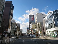
 Numazu City
.jpg)


.jpg)


Companies
- Toyota Motor Company
- Yamaha
- Kawai Musical Instruments
- Suzuki
- Roland Corporation
Universities
- Nagoya University
- Nanzan University
- Nagoya Institute of Technology
- Gifu University
- Mie University
- Chukyo University
- Toyohashi University of Technology
- Nihon University College of International Relations
- Shizuoka University
Airports
- Chūbu Centrair International Airport
- Nagoya Regional Airport
- Shizuoka Airport
Sports clubs
Baseball
Football
- Júbilo Iwata
- Nagoya Grampus
- Shimizu S-Pulse
- F.C. Gifu
- Honda F.C.
- F.C. Kariya
Basketball
Power generation
The Hamaoka Nuclear Power Plant is located within the Tōkai region.
See also
Notes
- ^ Karan, Pradyumna Prasad. (2005). Japan in the 21st Century: Environment, Economy, and Society, p. 36, p. 36, at Google Books.
- ^ a b Two grave issues concerning the expected Tokai Earthquake Kiyoo Mogi, Earth Planets Space, Vol. 56 (No. 8), pp. li-lxvi, published 2004, accessed 2011-03-11
- ^ Aichi 1995-2020 population statistics
- ^ Tōkai subregion 1920-2000 population statistics
| International | |
|---|---|
| National | |