
Chūgoku region
Chūgoku region
中国地方 | |
|---|---|
UTC+9 (JST) | |
 |
The Chūgoku region (Japanese: 中国地方, Hepburn: Chūgoku-chihō, IPA: [tɕɯːɡokɯ̥ tɕiꜜhoː]), also known as the San'in-San'yō (山陰山陽地方, San'in-San'yō-chihō) region, is the westernmost region of Honshū, the largest island of Japan. It consists of the prefectures of Hiroshima, Okayama, Shimane, Tottori and Yamaguchi.[3] In 2010, it had a population of 7,563,428.[1]
History
Chūgoku literally means "middle country", but the origin of the name is unclear. Historically, Japan was divided into a number of
Historically, Chūgoku referred to the 16 provinces of San'indō (山陰道) and San'yōdō (山陽道), which led to the region's alternative name described below. However, because some of the easternmost provinces were later subsumed into prefectures based primarily in Kansai, those areas are, strictly speaking, not part of the Chūgoku region in modern usage.
In
The city of
From the founding of the
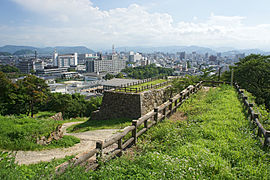
Geography


The Chūgoku region consists of the following prefectures:
neighbor the Chūgoku region.The Chūgoku region is characterized by irregular rolling hills and limited plain areas and is divided into two distinct parts by mountains running east and west through its center.
Demographics
The two largest metropolitan areas in Chūgoku region are Hiroshima and Okayama whose total population of the two metropolitan areas amount to 2.808 million as of 2020.[4][5] Their Urban Employment Area amounts to around 3 million people for the Chūgoku region. The rest of Chūgoku region is sparsely populated and very rural.
Per Japanese census data,[6][7] Chūgoku region as a whole has experienced a steady population decline since 1992 with some prefectures within the region experiencing the decline since 1985. The region reached a peak population of roughly 7.8 million in 1991.
| Year | Pop. | ±% |
|---|---|---|
| 1920 | 4,971,000 | — |
| 1930 | 5,341,000 | +7.4% |
| 1940 | 5,718,000 | +7.1% |
| 1950 | 6,797,000 | +18.9% |
| 1960 | 6,944,000 | +2.2% |
| 1970 | 6,997,000 | +0.8% |
| 1980 | 7,586,000 | +8.4% |
| 1990 | 7,746,000 | +2.1% |
| 2000 | 7,732,499 | −0.2% |
| 2010 | 7,563,428 | −2.2% |
| 2020 | 7,328,339 | −3.1% |
Cities
- Designated cities


- Core cities
- Kurashiki (population: 480,000)
- Fukuyama (population: 460,000)
- Shimonoseki (population: 260,000)
- Kure (population: 220,000)
- Matsue (population: 210,000)
- Tottori(population: 200,000)
-

-

-

-

-

-
 Tottori City

.jpg)


- Other major cities
- Yamaguchi(population: 200,000)
-
 Yamaguchi City

Sightseeing
- Hiroshima Prefecture: Onomichi
- Okayama Prefecture: Tamano
- Shimane Prefecture: Iwami Ginzan
- Tottori Prefecture: Kurayoshi
- Yamaguchi Prefecture: Akiyoshidai
Fiction
- Lian Hearn used a feudal Chūgoku (translated as the Middle Country) as the setting for her Tales of the Otori trilogy.
- In B. Ichi, Chugoku is referred to as "the land of martial arts".
See also
- Geography of Japan
- List of regions in Japan
- Names of China
- San'in region
- San'yō region
- Chūgoku dialect and Umpaku dialect
References
- ^ a b Ministry of Internal Affairs and Communications Statistics Bureau (26 October 2011). "平成 22 年国勢調査の概要" (PDF). Retrieved 6 May 2012.
- ^ "県民経済計算(平成23年度 - 令和2年度)(2008SNA、平成27年基準計数)<47都道府県、4政令指定都市分>".
- ^ Chugoku Regional Tourism Promotion Association "Overview of Chugoku Region" Archived 2016-08-07 at the Wayback Machine, Chugoku Regional Tourism Portal Site: Navigate Chugoku. Accessed 15 September 2013.
- ^ Hiroshima metro
- ^ Okayama metro
- ^ Hiroshima 1995-2020 population statistics
- ^ Chūgoku region 1920-2000 population statistics
Bibliography
 This article incorporates text from this source, which is in the public domain. Dolan, Ronald E.; Worden, Robert L., eds. (1992). Japan: A Country Study. Federal Research Division.
- Tony Gibb By Bike around Chugoku