
Tochigi Prefecture
You can help expand this article with text translated from the corresponding article in Japanese. (December 2016) Click [show] for important translation instructions.
|
Tochigi Prefecture
栃木県 | |
|---|---|
| Japanese transcription(s) | |
| • Japanese | 栃木県 |
| • Rōmaji | Tochigi-ken |
Mashiko Pottery Center Ōya Stone Museum Watarase Reservoir | |
|
US$ 85.0 billion (2019) | |
| ISO 3166 code | JP-09 |
| Website | www |
| Symbols of Japan | |
| Bird | Blue-and-white flycatcher (Cyanoptila cyanomelana) |
| Flower | Yashio tsutsuji (Rhododendron albrechtii) |
| Tree | Japanese horse chestnut (Aesculus turbinata) |

.jpg)
.jpg)
.jpg)
.jpg)


Tochigi Prefecture (栃木県, Tochigi-ken[a]) is a landlocked prefecture of Japan located in the Kantō region of Honshu.[3] Tochigi Prefecture has a population of 1,897,649 (1 June 2023) and has a geographic area of 6,408 km2 (2,474 sq mi). Tochigi Prefecture borders Fukushima Prefecture to the north, Gunma Prefecture to the west, Saitama Prefecture to the south, and Ibaraki Prefecture to the southeast.

City Town
Prefectural overview
Situated among the inland prefectures of the northern part of the Kantō region, Tochigi is contiguous with Ibaraki, Gunma, Saitama, and Fukushima Prefectures.
The climate of Tochigi may be classified as a humid temperate zone with broad variations in temperature. Winters are arid with dry winds, while summers are humid with frequent thunderstorms.
The population of Tochigi as of November 2010 is approximately 2,005,096.
Located in the center of the prefecture is the largest open plain in the Kantō region. Shirane (2,578 metres (8,458 ft)), Nantai (2,484 metres (8,150 ft)) and Nasudake (1,917 metres (6,289 ft)) mountain are in the northern part of the area. Kinugawa, Nakagawa, and Watarase River originate in this region, which flow across the Kanto plain before emptying into the Pacific Ocean. Tochigi is the 20th largest prefecture in Japan with a total area of 6,408.09 square km.
As of 1 April 2012, 21% of the total land area of the prefecture was designated as Natural Parks, namely Nikkō National Park, Oze National Park, and eight Prefectural Natural Parks.[6]
History
Before the Meiji Restoration, Tochigi was known as Shimotsuke Province.[7]
In the early 15th century, the Ashikaga Gakkō, Japan's oldest school of higher education, was re-established in the prefecture, holding over 3,000 students by the 16th century. Saint Francis Xavier introduced Ashikaga to the world as the best university in Japan.[citation needed]
In the early 17th century, Japan was unified under the
In the late 19th century, the Tokugawa shogunate fell and the new government established the prefectures. The prefectural capital was established in the city of Tochigi after the unification of Utsunomiya Prefecture and Tochigi Prefecture in 1873.[8] By 1884, however, the capital was transferred to Utsunomiya.
In March 2011, following the
Geography
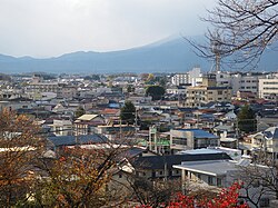
The chief city of Utsunomiya is famous for its many
-
 Nikkō Cedar Avenue
 -
 The Kegon Falls in Nikkō
 -
 Iroha Slope, a view of attraction spot in Nikkō
 -

-
 Otawara
 -


.jpg)
.jpg)


Cities
| Year | Pop. | ±% p.a. |
|---|---|---|
| 1920 | 1,046,479 | — |
| 1925 | 1,090,428 | +0.83% |
| 1930 | 1,141,737 | +0.92% |
| 1935 | 1,195,057 | +0.92% |
| 1940 | 1,206,657 | +0.19% |
| 1945 | 1,546,355 | +5.09% |
| 1950 | 1,550,462 | +0.05% |
| 1955 | 1,547,580 | −0.04% |
| 1960 | 1,513,624 | −0.44% |
| 1965 | 1,521,656 | +0.11% |
| 1970 | 1,580,021 | +0.76% |
| 1975 | 1,698,003 | +1.45% |
| 1980 | 1,792,201 | +1.09% |
| 1985 | 1,866,066 | +0.81% |
| 1990 | 1,935,168 | +0.73% |
| 1995 | 1,984,390 | +0.50% |
| 2000 | 2,004,817 | +0.21% |
| 2005 | 2,016,631 | +0.12% |
| 2010 | 2,007,683 | −0.09% |
| 2015 | 1,974,255 | −0.34% |
| 2020 | 1,933,146 | −0.42% |
| Source: Censuses[10] | ||
Fourteen cities are located in Tochigi Prefecture:
- Ashikaga
- Kanuma
- Mooka
- Nasukarasuyama
- Nasushiobara
- Nikkō
- Ōtawara
- Oyama
- Sakura
- Sano
- Shimotsuke
- Tochigi
- Utsunomiya(capital)
- Yaita
Towns
These are the towns in each district:
Mergers
List of governors of Tochigi Prefecture (from 1947)
| No. | Governor (Birth–Death) |
Term of office | |
|---|---|---|---|
| 37–38 | Jyukichi Kodaira (小平重吉) (1886–1960) |
12 April 1947 | 4 February 1955 |
| 39 | Kichi Ogawa (小川喜一) (1904–1979) |
5 February 1955 | 4 February 1959 |
| 40–43 | Nobuo Yokokawa (横川信夫) (1901–1975) |
5 February 1959 | 7 December 1974 |
| 44–46 | Yuzuru Funada (船田譲) (1923–1985) |
8 December 1974 | 8 December 1984 |
| 47–50 | Fumio Watanabe (渡辺文雄) (1929–) |
9 December 1984 | 8 December 2000 |
| 51 | Akio Fukuda (福田昭夫) (1948–) |
9 December 2000 | 8 December 2004 |
| 52–55 | Tomikazu Fukuda (福田富一) (1953–) |
9 December 2004 | Present |
Industry and agriculture

Located close to Tōkyō, Tochigi is home to many corporations and industrial zones, including the
Industrial manufacturing accounts for 36.6% of the prefecture's total output. Vehicle parts and accessories are the primary products, followed by vehicles, radios and televisions, pharmaceuticals, and wireless communication equipment.
Below are goods manufactured in Tochigi with the highest market share in Japan:
| Product | Share |
|---|---|
| Camera lenses | 71.3% |
| X-ray equipment for medical use | 54.5% |
| Machinery and appliances for dental use | 23.5% |
| X-ray equipment parts | 57.5% |
| Injection molded plastic parts | 14.1% |
(The 2004 industrial analysis report published by the Ministry of Economy, Trade and Industry)
The annual gross agricultural output in Tochigi is about 274 billion yen. Rice, vegetables, and livestock are produced in the region. Tochigi is also known for strawberries, Chinese chives, and Japanese pears sold throughout Japan and exported to other countries. Approximately 55% of Tochigi is covered by forests. Mushrooms, such as Shiitake mushrooms, make up half of the forest industry, with an output of approximately 5.6 billion yen.
Education
Tochigi is home to many universities and colleges including those for science and technology, literature, medicine, education, and art. Below is an alphabetical list of some of the universities located in Tochigi.
- Ashikaga Institute of Technology
- Bunsei University of Art, Utsunomiya
- Dokkyo University School of Medicine, Mibu
- Hakuoh University, Oyama
- Otawara
- Jichi Medical University, Shimotsuke
- Oyama National College of Technology
- Sakushin Gakuin University, Utsunomiya
- Sano College
- Teikyo University, Utsunomiya
- Tochigi College of Industry and Technology (Central), Utsunomiya
- Tochigi College of Industry and Technology (North), Nasu
- Tochigi College of Industry and Technology (South), Ashikaga
- Utsunomiya Kyowa University, Utsunomiya and Nasushiobara
- Utsunomiya University
People
Sports
The sports teams and events listed below are based in Tochigi.

Association football
Ice hockey
- Nikkō)
Basketball
Motorsport
- Twin Ring Motegi circuit
- Nikkō Circuit
Cycling
Tourism
Nikkō National Park is famous for its


A more recent and modern attraction is the
Tochigi has many traditional festivals and events such as Nikkō Tōshō-gū's 1000 Samurai Procession and Horseback Archery Festival, and the city of Tochigi's Autumn Festival where doll floats are pulled around the city once every five years.
Other attractions include:
- Ashikaga Flower Park
- Cannabis Museum
- Edo Wonderland Nikko Edomura
- Futarasan Shrine
- Kegon Falls
- Kinugawa (hot spring)
- Kirifuri Falls
- Lake Chūzenji
- Mashiko
- Nakagawa Aquatic Park
- Nasu Animal Kingdom
- Nasu resort area
- Nikkō Tōshō-gū
- Rinnō-ji
- Shiobara Hot Spring
- Tobu World Square
Transportation and access
Roads
Traversing the prefecture along the north–south axis and connecting to the rest of the country are the Tōhoku Expressway and the new and old Route 4. From east to west spans Route 50, connecting southern Tochigi with Ibaraki and Gunma Prefectures.
Also connecting Tochigi, Gunma, and Ibaraki is the
Rail

The Tōhoku Shinkansen and the JR Utsunomiya Line are the main railways running north and south in Tochigi. Shinkansen runs from Tokyo Station to Oyama in south Tochigi in 43 minutes. Utsunomiya can be reached by rail in as little as 48 minutes, and many parts of Tochigi are within commuting range of central Tokyo. To the east and west, the Mito and Ryōmō Lines connect Tochigi to Ibaraki and Gunma.
Freight is served by the Utsunomiya Freight Terminal.
- East Japan Railway Company
- Karasuyama Line
- Mito Line
- Nikkō Line
- Ryōmō Line
- Shōnan-Shinjuku Line
- Tōhoku Shinkansen
- Utsunomiya Line (Tōhoku Main Line)
- Mooka Railway
- Tobu
- Isesaki Line
- Nikkō Line
- Kinugawa Line
- Utsunomiya Line
- Sano Line
- Utsunomiya Light Rail
- LIGHTLINE (Utsunomiya Haga Light Rail Line)
- Watarase Keikoku Line
- Yagan Railway
Air travel
Fukushima Airport is approximately an hour's drive from Utsunomiya on the Tōhoku Expressway. International and national air transportation is through Narita International Airport to the east of Tokyo, approximately three hours by vehicle from Utsunomiya.
Notes
- ^ Japanese pronunciation: [toꜜ.tɕi.ɡʲi, -ŋʲi, to.tɕi.ɡʲiꜜ, -ŋʲiꜜ, to.tɕi.ɡʲiꜜ.keɴ, -ŋʲiꜜ.keɴ][2]
References
- ^ "2020年度国民経済計算(2015年基準・2008SNA) : 経済社会総合研究所 - 内閣府". 内閣府ホームページ (in Japanese). Retrieved 2023-05-18.
- ^ NHK Broadcasting Culture Research Institute, ed. (24 May 2016). NHK日本語発音アクセント新辞典 (in Japanese). NHK Publishing.
- ^ Nussbaum, Louis-Frédéric. (2005). "Tochigi prefecture" in Japan Encyclopedia, p. 967, p. 967, at Google Books; "Kantō" in p. 479, p. 479, at Google Books.
- ^ Nussbaum, "Utsunomiya" at p. 1019, p. 1019, at Google Books.
- ^ "World Heritage Committee: Report of the 23rd Session, Marrakesh 1999". whc.unesco.org. Retrieved 28 March 2018.
- ^ "General overview of area figures for Natural Parks by prefecture" (PDF). Ministry of the Environment. 1 April 2012. Retrieved 18 November 2013.
- ^ Nussbaum, "Provinces and prefectures" at p. 780, p. 780, at Google Books.
- ^ "Tochigi Prefecture / History". Tochigi Prefecture. Tochigi Prefectural Office. Retrieved 24 May 2020.
- ^ "Nuclear Radiation Levels and Effect on Human Health as Sieverts increase in Japan – What you need to Know - Green World Investor". greenworldinvestor.com. Retrieved 28 March 2018.
- ^ "Statistics Bureau Home Page". www.stat.go.jp.
- ^ Gardening World Records Archived 2008-10-14 at the Wayback Machine. Retrieved on 2 November 2008.
Sources
- Nussbaum, Louis-Frédéric and Käthe Roth (2005). Japan Encyclopedia. Cambridge, Mass.: Harvard University Press. OCLC 58053128.
External links
- Tochigi Prefecture Official Website (in Japanese)
- Tochigi International Association Website (in English)
| Core city |  | |
|---|---|---|
| Cities | ||
| Districts | ||
| International | |
|---|---|
| National | |
| Geographic | |
| Academics | |