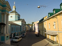
Tagansky District
55°44′29″N 37°39′15″E / 55.74139°N 37.65417°E
Tagansky District (
Yauza Rivers near the mouth of the latter. Population: 116,744 (2010 Russian census);[1] 109,993 (2002 Census).[2]
The district takes its name from the former Taganskaya copper-smiths lived in the 16th century. Tagan is the old Russian word for their product, a trivet to set a pot on (known in English as "brand-iron"). 
The modern center of the Taganka district is the
Athonite metochion and the Bolvanovka church
.
Apart from Taganka proper, the modern district includes other historic neighbourhoods such as Kulishki in the eastern Bely Gorod, Khitrovka, Solyanka, Krutitsy, and Rogozhskaya sloboda (the spiritual centre of Old Believers). Major sights include the 18th-century Foundling Home and at least three walled monasteries — the Andronikov, the Pokrovsky, and the Novospassky.
References
- ^ Russian Federal State Statistics Service (2011). Всероссийская перепись населения 2010 года. Том 1 [2010 All-Russian Population Census, vol. 1]. Всероссийская перепись населения 2010 года [2010 All-Russia Population Census] (in Russian). Federal State Statistics Service.
- ^ Federal State Statistics Service (May 21, 2004). Численность населения России, субъектов Российской Федерации в составе федеральных округов, районов, городских поселений, сельских населённых пунктов – районных центров и сельских населённых пунктов с населением 3 тысячи и более человек [Population of Russia, Its Federal Districts, Federal Subjects, Districts, Urban Localities, Rural Localities—Administrative Centers, and Rural Localities with Population of Over 3,000] (XLS). Всероссийская перепись населения 2002 года [All-Russia Population Census of 2002] (in Russian).
External links

