
Takhatgarh
Takhatgarh | ||
|---|---|---|
city | ||
Vidhan Sabha constituency Sumerpur | | |
| Civic agency | Takhatgarh Municipality | |
| Avg. annual temperature | 28 °C (82 °F) | |
| Avg. summer temperature | 38 °C (100 °F) | |
| Avg. winter temperature | 18 °C (64 °F) | |
Takhatgarh is a town in
. The town is one of the nine municipalities in the district, located near the district border. It is only about 160 years old.History
The town is named after

It is said that this well was dug by the 60,000 sons of
After their settlement also the Thakur was coming there, and one soldier of king Pir Singh was killed there in struggle with Thakur. Pir Bavasi Majar is situated there now. In 1858 (
Geography
Takhatgarh is located at 25°20′N 73°00′E / 25.33°N 73.0°E.[1] It has an average elevation of 221 metres (725 feet) Area of Takhatgarh is 24 km2.
It is located near the
Economy
Here people are mostly agriculture dependent and many people do business in other states like Maharashtra, Karnataka, Tamil Nadu, Gujarat etc. Except SBI, here three more banks are Bank of Baroda, MGB Gramin Bank and Pali Co-operative Bank.
In 1961–62, the highest per capita income was recorded at Rs. 17.86 per capita in Takhatgarh Panchayat.[3] The Panchayat was richest in the Rajasthan that time.
Administration

Takhatgarh comes under
Takhatgarh municipality is the only municipality in Rajasthan, which also manages the water supply to the town.
Transport

The usual mode of transport is state-owned buses, although private buses are also a part of it, whereas for long journeys trains are preferred and the most preferred station is
Demographics
As of 2011[update] India census,[5] Takhatgarh had a population of 16,729. Males constitute 51% of the population and females 49%. Density per km2 is 678. Growth rate of population from 1991 to 2001 is 28.48% and 2001 to 2011 is 5.8% . Takhatgarh has an average literacy rate of 97%, lower than the national average of 99%: male literacy is 97%, and female literacy is 97%. In Takhatgarh, 14% of the population is under 6 years of age.[6]
| Year | Pop. | ±% |
|---|---|---|
| 1951 | 5,256 | — |
| 1981 | 11,106 | +111.3% |
| 1991 | 12,305 | +10.8% |
| 2001 | 15,809 | +28.5% |
| 2011 | 16,729 | +5.8% |
| Data is based on Government of India Census. Source: [World Gazetteer:Pali][7] | ||
People and culture


There are mainly three religion
Here people speak mostly
Education


There is one Govt high school, namely Sanghvi Keshari Senior Secondary School, having classes VIII to XII, three Govt. upper primary schools and three Govt Girls Schools out of them one is up to Senior Secondary level. While in Private there are many primary and middle schools out of which Defence Secondary School(An English Medium School), Abhay Nobles School,[8] Tagore Public Senior Secondary school located at Jalore road Takhatgarh, is one of the best schools of Takhatgarh, Sainik Children Academy, Saraswati Bal Vidya Mandir and Ray Gandhi Adarsh Vidya Mandir school are main. New Adarsh School is located at Adarsh Nagar in front of the bus stand. On the whole there are totally 22 schools in Takhatgarh. A government girls college is started in Takhatgarh in 2021. One girls college Tagore Girls College, situated at Jalore road Takhatgarh affiliated with Jay Narayan Vyas university Jodhpur. In Takhatgarh one more college namely Shri Rajat College is also there and it is situated near new bus stand. Shri Rajat College, Takhatgarh is working in the field of computer education and distance education. In computer education it is approved from RKCL, Jaipur and providing RS-CIT course. In distance education it is approved centre from NIMS University, Jaipur, Jaipur National University, Jaipur and Jayoti Vidhyapeeth Women's University, Jaipur providing courses like BA, MA, BSC, MSC, BCOM, BCA, PGDCA, MCA, BBA, MBA, DMLT, BMLT, MMLT, etc.
Sub-areas

Some areas in Takhatgarh are:
- Jodha Nagar (PadarliRoad)
- Sainik Colony (Ex Soldiers Coloney)
- Sav. Shri Sher Singh Ji Jodha Margh (Gogra road)
- Khedawas
- Dhorawas
- Mahaveer Basti
- Chakki Gali
- Ramdev Gali
- Sutharo ki gali
- Hanumanji ki Gali
- Main Bazar
- Chunda Gali
- Jogni Gali
- Nehru chauk (Chauhta)
- Kachramuta Gali
- Balana Gali
- Holi Chauk
- Masjid area
- Nehru Road
- Chauraha
- Vishwakarma Colony
- Chandanbala Nagar
- Taskavawas
- Adarsh Basti
- Bandhara Gali
- Talavo gali
- Bandi Gali
- Banshilal Baldia Marg
- Bheru Chauk
- Bhilo ki Basti
- Ulariya Marg
- Bokra Gali
- Gogra Road
- Kalalo Ki Gali
- Kharchiyawas
- Nag Chuak
- Sado Ki Gali
- Harijan Basti
- Ramkavawas
- Rabariyo ka was
- Rajpura Road
- Pechka Gali
- Suni Gali
- Sanga Gali
- Sri Ram Colony
Photo gallery
-
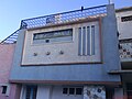 Radio design in a building, Takhatgarh, Pali district, Rajasthan
 -
 Talab, Takhatgarh, Pali district, Rajasthan
 -
 Talab, Takhatgarh, Pali district, Rajasthan
 -
 Shri Ambika Devi, Takhatgarh, Pali district, Rajasthan
 -
 Shri Ambikadevi,Padarli, Jalore district, Rajasthan


References
- ^ Falling Rain Genomics, Inc - Takhatgarh
- ^ Takhatgarh Map
- ^ Sugan Chand Jain (1967). "Community development and panchayati raj in India", p. 180
- ^ City profile
- ^ "Census of India 2001: Data from the 2001 Census, including cities, villages and towns (Provisional)". Census Commission of India. Archived from the original on 16 June 2004. Retrieved 1 November 2008.
- ^ Takhatgath Population
- ^ "World Gazetteer". Archived from the original on 9 February 2013.
- ^ School website