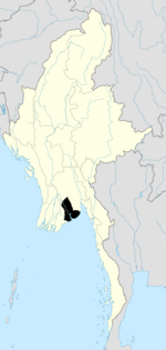
Tamwe Township
Tamwe Township
တာမွေ မြို့နယ် | |
|---|---|
Township of UTC6:30 (MST) | |
| Postal codes | 11211, 11212 |
| Area code(s) | 1 (mobile: 80, 99) |
| YCDC[2] | |
Tamwe Township (also Tarmwe Township; Burmese: တာမွေ မြို့နယ်, pronounced [tàmwè mjo̰nɛ̀]) is located in east central Yangon, Myanmar. The township comprises 20 wards, and shares borders with Yankin Township in the north, Thingangyun Township and Mingala Taungnyunt Township in the east, Bahan Township in the west, and Mingala Taungnyunt township in the south.[2]
Etymology
"Tamwe" derives from the Mon language term "Tamoa" (Mon: တာမွဲ; [ta mòa]), which means "one toddy palm tree."[3][4]
Education
The township has 30
high schools.[2]
Population
As of 2014 March, Tamwe has a population of 165,313 with 45.2% male residents and 54.8% female residents.[5]
Landmarks

The following is a list of landmarks protected by the city in Tamwe township.[6]
| Structure | Type | Address | Notes |
|---|---|---|---|
| St. Francis' Catholic Church | Church | 131 Kyaikkasan Road |
Ocean Supermarket Shwegondine Road |
References
Wikimedia Commons has media related to Tamwe Township.
- ^ Myo Lwin (16–22 March 2009). "Sputum microscopy centre opens in Tarmwe". The Myanmar Times. Archived from the original on 24 March 2009.
- ^ a b c "Tamwe Township". Yangon City Development Committee. Archived from the original on 2 October 2011. Retrieved 15 March 2009.
- JSTOR 40860260.
- ^ Banyar, Ko (7 November 2013). "မွန်တို့ဌာနေ ရာမည တိုင်းက မွန် အခေါ်အဝေါ်များ". Phophtaw News Association. Archived from the original on 26 June 2015.
- ^ "Tamwe (Township, Myanmar) - Population Statistics, Charts, Map and Location". www.citypopulation.de. Retrieved 14 March 2020.
- ^ "Special Reports: Heritage List". The Myanmar Times. 29 October 2001. Archived from the original on 15 June 2009.


