
Tanegashima
Native name: 種子島 | |
|---|---|
NASA photo of Tanegashima | |
Tanegashima is the easternmost of the Ōsumi Islands, just south of the major island of Kyushu | |
| Geography | |
| Location | East China Sea |
| Coordinates | 30°34′26″N 130°58′52″E / 30.57389°N 130.98111°E |
| Archipelago | Ōsumi Islands |
| Area | 444.99 km2 (171.81 sq mi) |
| Length | 57.2 km (35.54 mi) |
| Coastline | 186 km (115.6 mi) |
| Highest elevation | 282 m (925 ft) |
| Administration | |
Japan | |
| Kagoshima Prefecture | |
| Demographics | |
| Population | 33,000 (2010) |
| Pop. density | 74.15/km2 (192.05/sq mi) |
| Ethnic groups | Japanese |
Tanegashima (種子島) is one of the
.Geography
Tanegashima is the easternmost and the second largest (after Yakushima) of the Ōsumi Islands. It is located approximately 43 kilometres (23 nmi) south of the southern tip of
The island is of volcanic origin; however, unlike neighboring Yakushima, it presents a flat appearance, with its highest elevation at only 282 metres (925 ft) above sea level. The island has a length of 57 kilometres (31 nmi) and a width ranging from 5 kilometres (2.7 nmi) to 10 kilometres (5.4 nmi). The climate is subtropical. The island, along with neighbouring Yakushima, has been recognised as an
- Gallery
-
 In the vicinity of Inu Castle Coast, Daikoya District
 -
 Town area of Nakatane (中種子町), Kagoshima, Japan
 -
 Weathered rocks near Mt. Iwasaki
 -
 Chikura Caverns
 -
 Cape Kadokura
 -
 Ōsumi islands map


History
Tanegashima has a long history of Kofun. Other burials on Tanegashima, namely the Yokomine and Hirota sites, attest to a uniquely well-developed Yayoi period culture at the end of the 4th century AD.[2] The artifacts include magatama, an engraved pendant, and emblems with apparent writing.[3]
During the
Sometime around 1140, the whole island of Tanegashima became part of the Shimazu Estate, the largest medieval shōen of Japan. In the early Kamakura period, the positions of the land steward of the Shimazu Estate and the military governor of Ōsumi Province were given to the Shimazu clan. However, the clan lost these positions to the Hōjō clan, the de facto ruler of the shogunate. The Hōjō clan sent the Higo clan as deputy governors. A branch line of the Higo clan made itself autonomous on Tanegashima after the Hōjō clan was annihilated and began to claim the clan name of Tanegashima.[5]
The Tanegashima clan ruled the island until the
Introduction of firearms into Japan
Tanegashima is traditionally known as the site of the introduction of European firearms to Japan in 1543. Until modern times,
In his memoirs published in 1614, Portuguese adventurer turned author,
During the
- Gallery
-
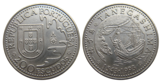 Portuguese escudo commemorating the Portuguese arrival at Tanegashima
 -
 First Westerners in Japan in 1542


Knife industry
- Gallery
-
 Nishinoomote City on Tanegashima
 -
 Tanegashima government building
 -
 Nishinoomote Minato Ward from "New Satsuma" (mid December 2012)


Tanegashima Space Center
The
The Space Science and Technology Museum is near the TSC. It offers an intricate view of rocket history and technology in Japan. Though most of the displays are in Japanese, there are English tour pamphlets available.
- Gallery
-
 Full view of the Yoshinobu Launch Complex during roll out of the H-IIA rocket in February 2014
 -
 Overlooking the Osaki Range, surrounded by green mountains and the sea of coral reefs.
 -
 Space Science and Technology Museum
 -
 The H-IIA F11 launch vehicle lifting off from Tanegashima Space Center
 -
 A Mitsubishi Heavy Industries (MHI) H-IIA rocket at TSC
_Mission_(12812960063).jpg)


_Mission_(12858254354).jpg)
Climate
Tanegashima has a humid subtropical climate (Köppen climate classification Cfa) with hot, humid summers and mild winters. Precipitation is high throughout the year, but is highest in the months of May, June and September.
| Climate data for Tanegashima (1991−2020 normals, extremes 1948−present) | |||||||||||||
|---|---|---|---|---|---|---|---|---|---|---|---|---|---|
| Month | Jan | Feb | Mar | Apr | May | Jun | Jul | Aug | Sep | Oct | Nov | Dec | Year |
| Record high °C (°F) | 24.4 (75.9) |
25.6 (78.1) |
26.9 (80.4) |
28.1 (82.6) |
30.6 (87.1) |
32.7 (90.9) |
34.9 (94.8) |
35.9 (96.6) |
34.1 (93.4) |
31.3 (88.3) |
28.8 (83.8) |
27.2 (81.0) |
35.9 (96.6) |
| Mean daily maximum °C (°F) | 14.2 (57.6) |
15.2 (59.4) |
17.6 (63.7) |
21.0 (69.8) |
24.1 (75.4) |
26.8 (80.2) |
30.4 (86.7) |
31.0 (87.8) |
29.1 (84.4) |
25.1 (77.2) |
21.1 (70.0) |
16.7 (62.1) |
22.7 (72.9) |
| Daily mean °C (°F) | 11.7 (53.1) |
12.3 (54.1) |
14.5 (58.1) |
17.8 (64.0) |
21.2 (70.2) |
24.0 (75.2) |
27.5 (81.5) |
28.1 (82.6) |
26.2 (79.2) |
22.3 (72.1) |
18.1 (64.6) |
13.8 (56.8) |
19.8 (67.6) |
| Mean daily minimum °C (°F) | 8.5 (47.3) |
9.0 (48.2) |
11.1 (52.0) |
14.5 (58.1) |
18.1 (64.6) |
21.3 (70.3) |
25.1 (77.2) |
25.7 (78.3) |
23.6 (74.5) |
19.5 (67.1) |
14.9 (58.8) |
10.5 (50.9) |
16.8 (62.3) |
| Record low °C (°F) | 0.0 (32.0) |
−0.6 (30.9) |
2.1 (35.8) |
4.5 (40.1) |
10.0 (50.0) |
15.2 (59.4) |
17.5 (63.5) |
20.6 (69.1) |
14.9 (58.8) |
10.3 (50.5) |
4.5 (40.1) |
2.6 (36.7) |
−0.6 (30.9) |
| Average precipitation mm (inches) | 96.5 (3.80) |
122.5 (4.82) |
160.4 (6.31) |
198.0 (7.80) |
233.3 (9.19) |
556.4 (21.91) |
261.7 (10.30) |
188.7 (7.43) |
293.2 (11.54) |
194.5 (7.66) |
134.8 (5.31) |
92.7 (3.65) |
2,532.5 (99.70) |
| Average rainy days | 9.5 | 10.3 | 12.6 | 10.8 | 11.1 | 17.0 | 9.6 | 11.0 | 11.6 | 9.3 | 9.2 | 8.2 | 130.2 |
| Average relative humidity (%)
|
65 | 66 | 69 | 71 | 76 | 84 | 83 | 81 | 79 | 73 | 69 | 65 | 73 |
| Mean monthly sunshine hours | 107.1 | 114.9 | 140.1 | 163.1 | 158.5 | 114.7 | 222.7 | 222.8 | 166.6 | 157.9 | 129.7 | 119.4 | 1,822 |
| Source 1: JMA[8] | |||||||||||||
| Source 2: JMA[9] | |||||||||||||
Sporting events
The Tanegashima "Rocket Marathon" takes place in March each year.[10]
Notable people
- Miyu Uehara – gravure idol and TV personality
- Kōbō Kenichi – sumo wrestler
- Wakashimazu Mutsuo – sumo wrestler
References
- ^ "Yakushima and Tanegashima islands". BirdLife Data Zone. BirdLife International. 2021. Retrieved 7 February 2021.
- ^ "Hirota". archaeology.jp. Retrieved 2018-04-22.
- ^ "Ancient Japanese writing symbols [From the Golden Stamp to Documents from the Shoso-in]|Special Exhibitions|Exhibitions|National Museum of Japanese History". Archived from the original on 2013-07-29. Retrieved 2013-09-30.
- ^ Suzuki Yasutami 鈴木靖民 (1997). "Nantō-jin no raichō wo meguru kisoteki kōsatsu 南島人の来朝をめぐる基礎的考察". Higashi Ajia to Nihon 東アジアと日本 (in Japanese). pp. 347–398.
- ^ Kamiyaku-chō kyōdoshi henshū-iinkai 上屋久町郷土誌編集委員会, ed. (1984). Kamiyaku-chō kyōdoshi 上屋久町郷土誌. Kamiyaku-chō Kyōiku-iinkai 上屋久町教育委員会.
- ISBN 0804705259.
- ^ Yara Ken'ichirō 屋良健一郎 (2012). "Chūsei kōki no Tanegashima-shi to minami Kyūshū kaiiki 中世後期の種子島氏と南九州海域". Shigaku-zasshi 史学雑誌. 121 (11): 1–36.
- ^ 観測史上1~10位の値(年間を通じての値). JMA. Retrieved February 18, 2022.
- ^ 気象庁 / 平年値(年・月ごとの値). JMA. Retrieved February 18, 2022.
- ^ JAXA March 2005 News
Sources
- Lidon, Olof. Tanegashima: The Arrival of Europe in Japan, NIAS Press (2002) ISBN 8791114128
External links
 Tanegashima travel guide from Wikivoyage
 Geographic data related to Tanegashima at OpenStreetMap
| International | |
|---|---|
| National | |