
Tavener, Texas
Tavener, Texas | ||
|---|---|---|
ZIP code 77435 | ||
| Area code | 979 | |
Tavener is an unincorporated community in Fort Bend County, Texas, United States. It is a part of the Greater Houston metropolitan area.
History
In 1890, the Texas and New Orleans Railroad added a stop and named it Tavener after Charlie Tavener, an early resident. The community received a post office in 1910. Four years later, the 25-person settlement boasted a lumberyard, general store, and telephone service. Postal service ceased in the 1930s. The community had a population of 50 and four commercial establishments in 1933. Only one business remained in 1945, but the number of residents remained steady. By 1953, only 20 people were recorded as living in the settlement. In 1970, the population was 30 persons. It continued to be listed on county maps in 1987, but there were no population estimates after that.[1]
Geography
Tavener is located 12 mi (19 km) west of
Education
In 1926, Tavener had one school attended by 135 white children and a second segregated school with 28 black children.[1]
Today, the Brazos Independent School District operates schools in the area.
Gallery
-
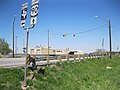 View east at the intersection of US 90A and FM 1952
 -
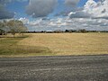
 View south from Engel and Buls Roads
 -
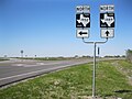
 View north from Buls Road toward US 90A
 -
 FM 1952 and FM 1489 intersection north of Tavener
 -
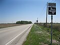 View south on FM 1875 near US 90A east of Tavener


References
- ^ a b c Hardin, Stephen L. "Handbook of Texas Online: TAVENER, TEXAS". Texas State Historical Association. Retrieved December 2, 2012.
Municipalities and communities of Fort Bend County, Texas, United States | ||
|---|---|---|
| Cities |  | |
| Town | ||
| Villages | ||
| CDPs | ||
| Other communities | ||
| Former communities | ||
| Ghost towns | ||
| Footnotes | ‡This populated place also has portions in an adjacent county or counties ±Former CDP annexed by Missouri City ^Former CDP annexed by Sugar Land #Still active as a community, but is no longer listed as a census-designated place | |
| ||