
Orchard, Texas
Orchard, Texas | ||
|---|---|---|
FIPS code 48-54192[3] | | |
| GNIS feature ID | 1343307[4] | |
| Website | orchardtexas | |
Orchard is a city in western Fort Bend County, Texas, United States, within the Houston–Sugar Land–Baytown metropolitan area. The community is located along State Highway 36 (SH 36) and the BNSF Railway between Rosenberg in Fort Bend County and Wallis in Austin County. The population was 352 at the 2010 census,[5] down from 408 at the 2000 census.
Geography
Orchard is located at 29°36′7″N 95°58′8″W / 29.60194°N 95.96889°W (29.602015, –95.968821).
According to the United States Census Bureau, the city has a total area of 0.39 square miles (1.0 km2), all land.[5]
-
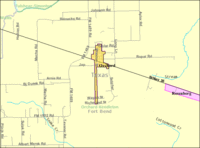 Map of Orchard
 -
 City limit sign on Hwy 36 looking SE
 -
 Hwy 36 and FM 1489 intersection
 -
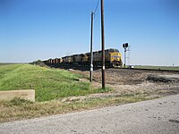 Union Pacific freight at Long Lane


Demographics
| Census | Pop. | Note | %± |
|---|---|---|---|
| 1980 | 408 | — | |
| 1990 | 373 | −8.6% | |
| 2000 | 408 | 9.4% | |
| 2010 | 352 | −13.7% | |
| 2019 (est.) | 407 | [2] | 15.6% |
| U.S. Decennial Census[8] | |||
As of the
There were 147 households, out of which 39.5% had children under the age of 18 living with them, 61.2% were married couples living together, 8.2% had a female householder with no husband present, and 24.5% were non-families. 21.1% of all households were made up of individuals, and 8.8% had someone living alone who was 65 years of age or older. The average household size was 2.78 and the average family size was 3.26.
In the city, the population was spread out, with 28.4% under the age of 18, 11.5% from 18 to 24, 31.1% from 25 to 44, 20.1% from 45 to 64, and 8.8% who were 65 years of age or older. The median age was 33 years. For every 100 females, there were 103.0 males. For every 100 females age 18 and over, there were 102.8 males.
The median income for a household in the city was $47,000, and the median income for a family was $59,063. Males had a median income of $40,089 versus $27,396 for females. The
Government and infrastructure
The United States Postal Service operates the Orchard Post Office at 218 Missouri Street.[9]
Fort Bend County does not have a hospital district. OakBend Medical Center serves as the county's charity hospital which the county contracts with.[10]
-
 US Post Office on Missouri Street
 -
 Orchard Town Center on Kibler Road


Education
Orchard is served by the
The designated community college for Brazos ISD is Wharton County Junior College (the legislation still states "Wallis-Orchard").[11]
-
 Brazos High School, Hwy 36 in Wallis
 -
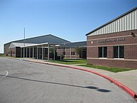 Brazos Elementary School in Orchard


References
- ^ "2019 U.S. Gazetteer Files". United States Census Bureau. Retrieved August 7, 2020.
- ^ a b "Population and Housing Unit Estimates". United States Census Bureau. May 24, 2020. Retrieved May 27, 2020.
- ^ a b "U.S. Census website". United States Census Bureau. Retrieved January 31, 2008.
- ^ "US Board on Geographic Names". United States Geological Survey. October 25, 2007. Retrieved January 31, 2008.
- ^ a b "Geographic Identifiers: 2010 Demographic Profile Data (G001): Orchard city, Texas". U.S. Census Bureau, American Factfinder. Retrieved August 30, 2016.[dead link]
- ^ "US Gazetteer files: 2010, 2000, and 1990". United States Census Bureau. February 12, 2011. Retrieved April 23, 2011.
- ^ Google (June 2, 2013). "Orchard, Texas" (Map). Google Maps. Google. Retrieved June 2, 2013.
- ^ "Census of Population and Housing". Census.gov. Retrieved June 4, 2015.
- ^ "Post Office Location - ORCHARD." United States Postal Service. Retrieved on December 4, 2008.
- ^ Knipp, Bethany (November 2, 2016). "Fort Bend County lacks hospital district". Community Impact Newspaper. Retrieved October 18, 2021.
- ^ Texas Education Code Sec. 130.211. WHARTON COUNTY JUNIOR COLLEGE DISTRICT SERVICE AREA.
External links
- City of Orchard official website
- Orchard, Texas from the Handbook of Texas Online
| Counties |  | |
|---|---|---|
| "Principal" cities | ||
| Other cities |
For a complete listing, see list of cities and towns in Houston–The Woodlands–Sugar Land MSA | |
| Unincorporated areas | ||
| Bodies of water | ||
Municipalities and communities of Fort Bend County, Texas, United States | ||
|---|---|---|
| Cities |  | |
| Town | ||
| Villages | ||
| CDPs | ||
| Other communities | ||
| Former communities | ||
| Ghost towns | ||
| Footnotes | ‡This populated place also has portions in an adjacent county or counties ±Former CDP annexed by Missouri City ^Former CDP annexed by Sugar Land #Still active as a community, but is no longer listed as a census-designated place | |
| ||