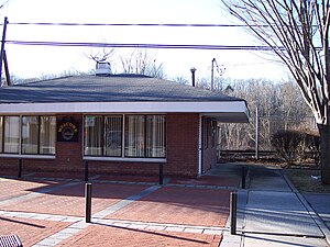
Thornwood station
This article needs additional citations for verification. (December 2009) |
Thornwood | |||||||||||||||||||||
|---|---|---|---|---|---|---|---|---|---|---|---|---|---|---|---|---|---|---|---|---|---|
 | |||||||||||||||||||||
| General information | |||||||||||||||||||||
| Location | Commerce Street and Franklin Avenue Thornwood, New York | ||||||||||||||||||||
| Coordinates | 41°07′16″N 73°46′56″W / 41.1211°N 73.7822°W | ||||||||||||||||||||
| Owned by | Thornwood-Hawthorne Chamber of Commerce | ||||||||||||||||||||
| Line(s) | Harlem Line | ||||||||||||||||||||
| Platforms | 1 side | ||||||||||||||||||||
| Tracks | 2 | ||||||||||||||||||||
| History | |||||||||||||||||||||
| Opened | c.1891 | ||||||||||||||||||||
| Closed | March 5, 1984[1] | ||||||||||||||||||||
| Previous names | Sherman Park (c. 1891–1914)[2] | ||||||||||||||||||||
| Former services | |||||||||||||||||||||
| |||||||||||||||||||||
Thornwood station was a stop on the
History
The
Richardson Romanesque
depot was replaced with a simple brick structure.
As with most of the Harlem Line, the merger of New York Central with
Pleasantville station (1 mile north) as a replacement. The former station house, which is located where New York State Route 141 moves from Commerce Street to Franklin Avenue is now occupied by the Thornwood-Hawthorne Chamber of Commerce, which was established the year after the station was closed.[6]
References
- ^ Walzer, E.B. (March 5, 1984). "The Train Doesn't Stop Here Anymore". The Herald-Statesman. p. A12. Retrieved December 31, 2017.
- ^ New York State Railroads: Passenger Stations and Stops
- ^ Shown on timetable effective 1 January 1984 but not on timetable effective 28 October 1984
- ^ Harlem Line Timetables effective 1 January 1984 and 30 October 1977
- ISBN 0-962120-65-0.
- ^ Thornwood-Hawthorne Chamber of Commerce (Established in 1985, according to the seal)
External links
