
Titlis
| Titlis | |
|---|---|
Alpine mountains above 3000 m | |
| Coordinates | 46°46′21″N 8°26′14″E / 46.77250°N 8.43722°E |
| Naming | |
| Language of name | German |
| Geography | |
 Titlis Location in Switzerland | |
| Country | Obwalden and Bern |
| Parent range | Uri Alps |
| Topo map | Swiss Federal Office of Topography swisstopo |
| Geology | |
| Mountain type | Limestone |
| Climbing | |
| First ascent | 1739 |
| Easiest route | By cable car from Engelberg |
Titlis is a mountain of the
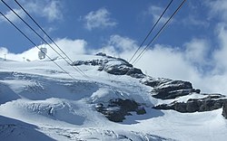
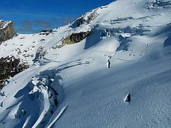
The last part of cable car leads above the glacier. At Klein Titlis, it is possible to visit an illuminated glacier cave from an entrance within the cable-car station, which also includes shops and restaurants. The Titlis Cliff Walk, the highest elevation suspension bridge in Europe, opened in December 2012, giving views across the Alps. Many people use Titlis as a cheaper and easier option than Jungfraujoch.
Geography

Titlis straddles the border between
Titlis is the highest mountain in the portion of the Uri Alps north of the
The northern side of the massif is covered by the Titlis Glacier (
History
In earlier times, Titlis was known under the names Wendenstock or Nollen. The Reissend Nollen and the Wendenstöcke are the nearest western neighbours to the mountain, slightly lower than Titlis, but with sharp rugged peaks.[3] In a document of 1435 the mountain is called Tuttelsberg (Tutilos mountain), referencing to a man named Tutilos, who was probably a local farmer. The name, from Tutilos Berg, became Titlisberg and later Titlis.[4]
The first ascent of Titlis was probably made in the year 1739. It was done by Ignaz Hess, J. E. Waser and two other men from Engelberg.[5] The first written evidence of an ascent is found in the Engelberger Dokumente. They mention a party of four men that reached the summit in 1744.[3][dead link]
On 21 January 1904 the first ski ascent of Titlis was made by Joseph Kuster and Willi Amrhein.[6]
In March 1967 the cable car to Klein Titlis (3,032 m) was inaugurated.
In December 2012, the Titlis Cliff Walk opened to commemorate the 110th anniversary of the Engelberg-Gerschnialp cableway.
Telecommunications
Klein Titlis hosts a significant telecommunications site, used for high capacity point-to-point microwave radio links and VHF/UHF repeaters. Licensed band radio links are regulated by the Swiss Federal Office of Communications.[7]
Weather
The summit of Titlis is located above the snow line, thus it has a cold, snowy climate with permanent snow cover and freezing temperatures.
Gallery
-
 Stand-Klein Titlis cableway (July 2010)
 -
 Titlis Glacier (October 2005)
 -
 Stand-Klein Titlis cable car, old version (March 2008)
 -
 Titlis from Pilatus


See also
- List of mountains of Switzerland
References
- ^ Retrieved from the Swisstopo topographic maps [1] and Google Earth. The key col is the Susten Pass (2,260 m).
- Chli Sustenhorn.
- ^ a b Titlis Archived 6 July 2011 at the Wayback Machine brauchtumschweiz.ch. Retrieved 16 February 2010
- ^ Berge und ihre Namen Archived 6 July 2011 at the Wayback Machine berge.ch. Retrieved 16 February 2010
- ^ Kev Reynolds, Alpine pass route: Sargans to Montreux, p. 82
- ^ History of skiing Archived 15 March 2011 at the Wayback Machine fis-ski.com. Retrieved 16 February 2010
- ^ "Swiss federal office of communications".
- Swisstopo maps
External links
| International | |
|---|---|
| National | |
| Other | |