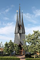
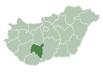
Tolna County
Tolna County
Tolna vármegye | ||
|---|---|---|
|
Region Southern Transdanubia | | |
| County seat | Szekszárd | |
| Districts | ||
| Government | ||
| • President of the General Assembly | Tamás Fehérvári (Fidesz-KDNP) | |
| Area | ||
| • Total | 3,703.16 km2 (1,429.80 sq mi) | |
| • Rank | 15th in Hungary | |
| Population (2018) | ||
| • Total | 219,317[1] | |
| • Rank | 18th in Hungary | |
| GDP | ||
| • Total | HUF 592 billion €1.900 billion (2016) | |
| Postal code | 702x – 7252, 7352 – 7361 | |
| Area code(s) | (+36) 74, 75 | |
| ISO 3166 code | HU-TO | |
| Website | www | |
Tolna (
History
Tolna (in Latin: comitatus Tolnensis) was also the name of a historic administrative county (
Demographics
Religion in Tolna County (2011 census)
In 2015, Tolna had a population of 225,936 and the population density was 61 inhabitants per square kilometre (160/sq mi).
| Year | County population[3] | Change |
|---|---|---|
| 1949 | 275,644 | n/a |
| 1960 | -1.29% | |
| 1970 | -4.90% | |
| 1980 | 2.90% | |
| 1990 | -4.73% | |
| 2001 | -1.57% | |
| 2011 | -7.74% | |
| 2015 | -1.95% | |
| 2018 | -3.01% |
Ethnicity
Besides the Hungarian majority, the main minorities are the Germans (approx. 10,000) and Roma (8,500).
Total population (2011 census): 230,361
Ethnic groups (2011 census):[4]
Identified themselves: 214,953 persons:
- Hungarians: 194,685 (90,57%)
- Germans: 10,195 (4,74%)
- Roma: 8,768 (4,08%)
- Others and indefinable: 1 305 (0,61%)
Approx. 32,000 persons in Tolna County did not declare their ethnic group at the 2011 census.
Religion
Religious adherence in the county according to 2011 census:[5]
- Catholic – 108,755 (Roman Catholic – 108,392; Greek Catholic– 331)
- Reformed – 18,533;
- Evangelical – 6,800;
- Other religions – 2,734;
- Non-religious – 35,803;
- Atheism – 2,194;
- Undeclared – 55,542.
Regional structure

| No. | English and Hungarian names |
Area (km2) |
Population (2011) |
Density (pop./km2) |
Seat | No. of municipalities |
| 1 | Bonyhád District Bonyhádi járás |
476.77 | 31,567 | 66 | Bonyhád | 25 |
| 2 | Dombóvár District Dombóvári járás |
509.02 | 32,331 | 64 | Dombóvár | 16 |
| 3 | Paks District Paksi járás |
836.00 | 49,433 | 59 | Paks | 15 |
| 4 | Szekszárd District Szekszárdi járás |
656.18 | 60,122 | 92 | Szekszárd | 17 |
| 5 | Tamási District Tamási járás |
1,019.94 | 38,705 | 38 | Tamási | 32 |
| 6 | Tolna District Tolnai járás |
205.24 | 18,203 | 89 | Tolna (town) | 4 |
| Tolna County | 3,703.16 | 231,183 | 64 | Szekszárd | 109 | |
|---|---|---|---|---|---|---|
Politics
The Tolna County Council, elected at the
| Party | Seats | Current County Assembly | ||||||||
|---|---|---|---|---|---|---|---|---|---|---|
| Fidesz-KDNP | 8 | |||||||||
| Movement for a Better Hungary (Jobbik) | 3 | |||||||||
| Hungarian Socialist Party (MSZP) | 2 | |||||||||
| Democratic Coalition (DK) | 1 | |||||||||
| People's Party (Néppárt) | 1 | |||||||||
Presidents of the General Assembly
| List of presidents since 1990[7] | |
|---|---|
| Tamás Fehérvári (Fidesz-KDNP) | 2014– |
Municipalities
Tolna County has 1
- City with county rights
(ordered by population, as of 2011 census)
 Szekszárd (34,296) – county seat
- Towns
 Paks (19,369)
 Dombóvár (19,010)
 Bonyhád (13,630)
 Tolna (11,126)
 Dunaföldvár (8,775)
 Tamási (8,349)
 Bátaszék (6,370)
 Simontornya (4,057)
 Nagymányok (2,338)
 Gyönk (2,052)
- Villages
- Alsónána
- Alsónyék
- Aparhant
- Attala
- Báta
- Bátaapáti
- Belecska
- Bikács
- Bogyiszló
- Bonyhádvarasd
- Bölcske
- Cikó
- Csibrák
- Csikóstőttős
- Dalmand
- Decs

- Diósberény
- Döbrököz
- Dunaszentgyörgy
- Dúzs
- Értény
- Fadd

- Fácánkert
- Felsőnána
- Felsőnyék
- Fürged
- Gerjen
- Grábóc
- Györe
- Györköny
- Gyulaj
- Harc
- Hőgyész

- Iregszemcse
- Izmény
- Jágónak
- Kajdacs
- Kakasd
- Kalaznó
- Kapospula
- Kaposszekcső
- Keszőhidegkút
- Kéty
- Kisdorog
- Kismányok
- Kisszékely
- Kistormás
- Kisvejke
- Kocsola
- Koppányszántó
- Kölesd
- Kurd
- Lápafő
- Lengyel
- Madocsa
- Magyarkeszi
- Medina
- Miszla
- Mórágy
- Mőcsény
- Mucsfa
- Mucsi
- Murga
- Nagydorog

- Nagykónyi
- Nagyszékely
- Nagyszokoly
- Nagyvejke
- Nak
- Németkér
- Ozora
- Őcsény
- Pálfa
- Pári
- Pincehely

- Pörböly
- Pusztahencse
- Regöly
- Sárpilis
- Sárszentlőrinc
- Sióagárd
- Szakadát
- Szakály
- Szakcs
- Szálka
- Szárazd
- Szedres
- Tengelic
- Tevel
- Tolnanémedi
- Udvari
- Újireg
- Varsád
- Váralja
- Várdomb
- Várong
- Závod
- Zomba
![]() municipalities are large villages.
municipalities are large villages.
Gallery
-
Szekszárd, the capital of the county
-
Lake in Tamási
-
Holy Spirit Church in Paks
-
Landscape in Gemenc Forest
-
Pipo de Ozora Castle in Ozora
-
Simontornya Castle
-
Calvary in Dunaföldvár
-
Apponyi Mansion in Lengyel
References
- ^ nepesseg.com, population data of Hungarian settlements
- ^ Regions and Cities > Regional Statistics > Regional Economy > Regional GDP per Capita, OECD.Stats. Accessed on 16 November 2018.
- ^ népesség.com, "Tolna megye népessége 1870-2015"
- ^ 1.1.6. A népesség anyanyelv, nemzetiség és nemek szerint – Frissítve: 2013.04.17.; Hungarian Central Statistical Office (in Hungarian)
- ^ 2011. ÉVI NÉPSZÁMLÁLÁS, 3. Területi adatok, 3.17 Tolna megye, (in Hungarian) [1]
- ^ A Tolna Megyei Önkormányzat Közgyűlésnek tagjai, (in Hungarian) [2]
- ^ Önkormányzati választások eredményei (in Hungarian)
External links
- Official site in Hungarian and German
- Tolnai Népújság (teol.hu) - The county portal


