Volkerak

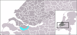
The Volkerak is a
Before 1987, it was a tidal river open to the North Sea, but it was closed off as part of the Delta Works; it is now a fresh water lake.
Delta Works
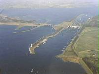
The Volkerak is navigable by sea-going ships. On the eastern end are the Volkerak Locks (Volkeraksluizen) connecting it to the Hollands Diep. At the western end is the Philipsdam and Krammer Locks (Krammersluizen)[1] connecting it to the Eastern Scheldt (Oosterschelde), and also the Grevelingendam and Grevelingen Lock (Grevelingensluis)[2] connecting it to the Grevelingen Grevelingen. Finally, the Scheldt–Rhine Canal connects it to the port of Antwerp and thus the North Sea, providing access for ocean-going vessels.
Future
Due to the low supply of fresh water to the now-enclosed Volkerak, and runoff of agricultural nutrients, the lake suffers from algal bloom throughout the summer,[3] and swimming is prohibited. The decision to transform it again into a salt water lake could be taken between 2015 and 2020.
References
- ^ "The Krammer Locks (Krammersluizen)". Deltawerken Online. Stichting Deltawerken Online. Retrieved 14 November 2021.
- ^ "Grevelingen dam". Deltawerken Online. Stichting Deltawerken Online. Retrieved 14 November 2021.
- PMID 16705982.
External links
51°39′N 4°18′E / 51.65°N 4.3°E


