
Waring, Texas
Waring, Texas | ||
|---|---|---|
ZIP code 78074 | ||
| GNIS feature ID | 1349492 | |
Waring is an
Metropolitan Statistical Area
.
Founded in 1887 by R.P.M. Waring, the community was named for its founder's hometown of Waringford in Ireland; the name was not changed until 1901. From its foundation until service ceased in 1970, the community was a station on the Kerrville branch of the San Antonio and Aransas Pass Railway.[5]
Major roads
- Waring Welfare Road
- Farm to Market Road 1621
| Census | Pop. | Note | %± |
|---|---|---|---|
| 1890 | 100 | — | |
| 1900 | 150 | 50.0% | |
| 1910 | 200 | 33.3% | |
| 1920 | 300 | 50.0% | |
| 1930 | 284 | −5.3% | |
| 1950 | 80 | — | |
| 1970 | 73 | — | |
| 1990 | 73 | — | |
| 2000 | 59 | −19.2% | |
| 2010 | 73 | 23.7% | |
| [citation needed] | |||
Gallery
-
 Waring School
 -
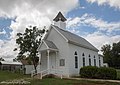 Waring Church
 -
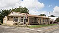 Office building
.jpg)
.jpg)
.jpg)
References
- ^ Rand McNally. The Road Atlas '08. Chicago: Rand McNally, 2008, pp. 100-101.
- ^ U.S. Geological Survey Geographic Names Information System: Waring, Texas
- ^ Zip Code Lookup
- ^ "U.S. Census website". United States Census Bureau. Retrieved January 31, 2008.
- ^ Waring, Texas, Handbook of Texas Online, 2008-01-11. Accessed 2008-09-26.
External links
Municipalities and communities of Kendall County, Texas, United States | ||
|---|---|---|
| Cities | 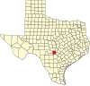 | |
| CDP | ||
| Other communities | ||
| Ghost towns | ||
| Footnotes | ‡This populated place also has portions in an adjacent county or counties | |
| ||
 | This article about a location in Kendall County, Texas is a stub. You can help Wikipedia by expanding it. |