
Wilson County, Texas
Wilson County | |
|---|---|
UTC−5 (CDT) | |
| Congressional district | 15th |
| Website | www |
Wilson County is a
History
This section needs additional citations for verification. (February 2022) |
Native Americans
Archeological evidence in the Wilson County area reveals early habitation from the
]Explorations and county established
In September 1718
The first two land grants in the area were to Luis Menchaca and Andrés Hernández,[8] who established ranches circa 1832–1833.
Anglos began arriving in the 1840s,[6] and Southern planters in 1850 and 1860, followed by German and Polish immigrants from other counties.
Wilson County was formed in 1860 from Bexar County and Karnes County. Sutherland Springs[9] was designated the county seat.
Wilson County voted in favor of secession[6] from the Union, and sent several military units to serve. Wartime hardships were compounded by a three-year drought.
Following the civil war, the county seat[10] was moved to Floresville. The 1872 courthouse was destroyed by fire and replaced in 1884 with a new building[11] designed by Alfred Giles.
The San Antonio and Aransas Pass Railway[13] reached Floresville in 1886. In 1898 the San Antonio and Gulf Railroad[14] was extended to Stockdale.
Geography
According to the
Major highways
- U.S. Highway 87
 U.S. Highway 181
 State Highway 97
Adjacent counties
- Guadalupe County (north)
- Gonzales County (northeast)
- Karnes County (southeast)
- Atascosa County (southwest)
- Bexar County (northwest)
Demographics
| Census | Pop. | Note | %± |
|---|---|---|---|
| 1870 | 2,556 | — | |
| 1880 | 7,118 | 178.5% | |
| 1890 | 10,655 | 49.7% | |
| 1900 | 13,961 | 31.0% | |
| 1910 | 17,066 | 22.2% | |
| 1920 | 17,289 | 1.3% | |
| 1930 | 17,606 | 1.8% | |
| 1940 | 17,066 | −3.1% | |
| 1950 | 14,672 | −14.0% | |
| 1960 | 13,267 | −9.6% | |
| 1970 | 13,041 | −1.7% | |
| 1980 | 16,756 | 28.5% | |
| 1990 | 22,650 | 35.2% | |
| 2000 | 32,408 | 43.1% | |
| 2010 | 42,918 | 32.4% | |
| 2020 | 49,753 | 15.9% | |
| U.S. Decennial Census[16]> 1850–2010[17] 2010[18] 2020[19] | |||
| Race / Ethnicity | Pop 2010[18] | Pop 2020[19] | % 2010 | % 2020 |
|---|---|---|---|---|
White alone (NH)
|
25,186 | 27,877 | 58.68% | 56.03% |
Black or African American alone (NH)
|
644 | 693 | 1.50% | 1.39% |
Alaska Native alone (NH)
|
125 | 148 | 0.29% | 0.30% |
| Asian alone (NH) | 143 | 229 | 0.33% | 0.46% |
| Pacific Islander alone (NH) | 9 | 24 | 0.02% | 0.05% |
| Some Other Race alone (NH) | 25 | 187 | 0.06% | 0.38% |
| Mixed Race/Multi-Racial (NH) | 374 | 1,363 | 0.87% | 2.74% |
| Hispanic or Latino (any race) | 16,412 | 19,232 | 38.24% | 38.65% |
| Total | 42,918 | 49,753 | 100.00% | 100.00% |
Note: the US Census treats Hispanic/Latino as an ethnic category. This table excludes Latinos from the racial categories and assigns them to a separate category. Hispanics/Latinos can be of any race.
As of the
There were 11,038 households, out of which 40.00% had children under the age of 18 living with them, 66.50% were married couples living together, 9.20% had a female householder with no husband present, and 20.00% were non-families. 17.10% of all households were made up of individuals, and 7.80% had someone living alone who was 65 years of age or older. The average household size was 2.89 and the average family size was 3.26.
In the county, the population was spread out, with 29.20% under the age of 18, 7.60% from 18 to 24, 28.60% from 25 to 44, 23.20% from 45 to 64, and 11.50% who were 65 years of age or older. The median age was 36 years. For every 100 females, there were 99.70 males. For every 100 females age 18 and over, there were 97.00 males.
The median income for a household in the county was $40,006, and the median income for a family was $45,681. Males had a median income of $31,716 versus $23,582 for females. The
Communities
Cities
- Elmendorf (mostly in Bexar County)
- Floresville (county seat)
- La Vernia
- Nixon (mostly in Gonzales County)
- Stockdale
Towns
Unincorporated communities
Ghost towns
Education
School districts include:[21]
- Falls City Independent School District
- Floresville Independent School District
- La Vernia Independent School District
- Nixon-Smiley Consolidated Independent School District
- Poth Independent School District
- Stockdale Independent School District
All of the county is in the service area of
Notable people
- John Connally, governor of Texas and U.S. Secretary of the Navy and Treasury
- Merrill Connally, an actor and a county judge
- Wayne Connally, a member of both houses of the Texas State Legislature
- Frank Hamer, Texas Ranger
- Stephen Willeford, civilian who intervened during the Sutherland Springs church shooting
Gallery
-
 The "Peanut Marker" at the Wilson County Courthouse lawn commemorates the life of Joe T. Sheehy (1886–1967), who introduced peanut farming to the area in 1916.
 -
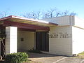 The Wilson County Public Library near the courthouse.
 -
 The Wilson County Hardware store in Floresville.


Politics
Wilson County is a strongly Republican county in presidential elections. It last voted for a Democrat in 1976, when it supported Georgia's Jimmy Carter. More recently, in 2020, it gave a quarter of its vote to Democratic candidate Joe Biden. The last time a Democratic candidate won 35% or more of Wilson County's vote was in 1996.
| Year | Republican | Democratic | Third party | |||
|---|---|---|---|---|---|---|
| No. | % | No. | % | No. | % | |
| 2020 | 18,463 | 73.76% | 6,350 | 25.37% | 219 | 0.87% |
| 2016 | 13,998 | 72.17% | 4,790 | 24.70% | 607 | 3.13% |
| 2012 | 12,218 | 71.01% | 4,821 | 28.02% | 166 | 0.96% |
| 2008 | 10,904 | 66.63% | 5,362 | 32.76% | 100 | 0.61% |
| 2004 | 10,400 | 69.87% | 4,409 | 29.62% | 76 | 0.51% |
| 2000 | 7,509 | 64.19% | 3,997 | 34.17% | 192 | 1.64% |
| 1996 | 4,530 | 49.96% | 3,713 | 40.95% | 824 | 9.09% |
| 1992 | 3,766 | 39.13% | 3,711 | 38.56% | 2,148 | 22.32% |
| 1988 | 4,436 | 52.65% | 3,953 | 46.92% | 36 | 0.43% |
| 1984 | 4,588 | 61.72% | 2,829 | 38.05% | 17 | 0.23% |
| 1980 | 3,443 | 51.91% | 3,097 | 46.70% | 92 | 1.39% |
| 1976 | 1,926 | 32.63% | 3,973 | 67.32% | 3 | 0.05% |
| 1972 | 2,953 | 58.68% | 2,072 | 41.18% | 7 | 0.14% |
| 1968 | 1,321 | 31.46% | 2,336 | 55.63% | 542 | 12.91% |
| 1964 | 718 | 17.12% | 3,472 | 82.77% | 5 | 0.12% |
| 1960 | 1,248 | 30.02% | 2,905 | 69.88% | 4 | 0.10% |
| 1956 | 1,519 | 41.30% | 2,149 | 58.43% | 10 | 0.27% |
| 1952 | 1,823 | 45.40% | 2,187 | 54.47% | 5 | 0.12% |
| 1948 | 593 | 19.64% | 2,313 | 76.59% | 114 | 3.77% |
| 1944 | 676 | 19.13% | 2,666 | 75.46% | 191 | 5.41% |
| 1940 | 605 | 18.01% | 2,750 | 81.87% | 4 | 0.12% |
| 1936 | 286 | 9.99% | 2,573 | 89.84% | 5 | 0.17% |
| 1932 | 174 | 6.66% | 2,435 | 93.22% | 3 | 0.11% |
| 1928 | 622 | 29.33% | 1,499 | 70.67% | 0 | 0.00% |
| 1924 | 495 | 20.17% | 1,633 | 66.54% | 326 | 13.28% |
| 1920 | 820 | 46.09% | 753 | 42.33% | 206 | 11.58% |
| 1916 | 346 | 27.64% | 869 | 69.41% | 37 | 2.96% |
| 1912 | 95 | 9.18% | 778 | 75.17% | 162 | 15.65% |
See also
- List of museums in South Texas
- National Register of Historic Places listings in Wilson County, Texas
- Recorded Texas Historic Landmarks in Wilson County
- Wilson County Courthouse and Jail
References
- ^ "Wilson County, Texas". United States Census Bureau. Retrieved January 30, 2022.
- ^ "Find a County". National Association of Counties. Retrieved June 7, 2011.
- ^ "Native Peoples of the South Texas Plains During Early Historic Times". Texas Beyond History. Retrieved May 13, 2010. UT Texas at Austin
- ^ "Artistic Expression". Texas Beyond History. Retrieved May 13, 2010.
- ^ Blake, Robert Bruce: Pedro de Rivera y Villalón from the Handbook of Texas Online. Retrieved May 13, 2010. Texas State Historical Association
- ^ a b c Long, Christopher: Wilson County from the Handbook of Texas Online. Retrieved May 13, 2010. Texas State Historical Association
- ISBN 978-0-87081-766-3.
- ^ "Menchaca-Hernández Compromise" (PDF). Texas General Land Office. Archived (PDF) from the original on October 9, 2022. Retrieved May 13, 2010.[permanent dead link] Texas General Land Office
- ^ "Sutherland Springs, Texas". Texas Escapes - Blueprints For Travel, LLC. Retrieved May 13, 2010. Texas Escapes - Blueprints For Travel, LLC.
- ^ "Floresville, Texas". Texas Escapes - Blueprints For Travel, LLC. Retrieved May 13, 2010. Texas Escapes - Blueprints For Travel, LLC.
- ^ "Wilson County Courthouse". Texas Escapes - Blueprints For Travel, LLC. Retrieved May 13, 2010. Texas Escapes - Blueprints For Travel, LLC.
- ^ "Fence Cutting Wars, Texas Adjutant General R.N. Steagal Letter To John Ireland March 31, 1884". Texas State Library and Archives Commission. Retrieved May 13, 2010. Texas State Library and Archives Commission
- ^ "San Antonio and Aransas Pass Railway". Archived from the original on September 12, 2006. Retrieved May 13, 2010.
- ^ Williams, Howard C: Texas and New Orleans Railroad from the Handbook of Texas Online. Retrieved May 13, 2010. Texas State Historical Association
- ^ "2010 Census Gazetteer Files". United States Census Bureau. August 22, 2012. Retrieved May 12, 2015.
- US Census Bureau.
- ^ "Texas Almanac: Population History of Counties from 1850–2010" (PDF). Texas Almanac. Archived (PDF) from the original on March 19, 2013. Retrieved May 12, 2015.
- ^ a b "P2 HISPANIC OR LATINO, AND NOT HISPANIC OR LATINO BY RACE - 2010: DEC Redistricting Data (PL 94-171) - Wilson County, Texas". United States Census Bureau.
- ^ a b "P2 HISPANIC OR LATINO, AND NOT HISPANIC OR LATINO BY RACE - 2020: DEC Redistricting Data (PL 94-171) - Wilson County, Texas". United States Census Bureau.
- ^ "U.S. Census website". United States Census Bureau. Retrieved May 14, 2011.
- ^ Texas Education Code, Sec. 130.162. ALAMO COMMUNITY COLLEGE DISTRICT SERVICE AREA..
- ^ Leip, David. "Dave Leip's Atlas of U.S. Presidential Elections". uselectionatlas.org. Retrieved November 5, 2017.
External links
- Wilson County from the Handbook of Texas Online
- Historic Wilson County materials, hosted by the Portal to Texas History.
- Wilson County Historical Society
- Wilson County government's website
Places adjacent to Wilson County, Texas | ||||||||||||||||
|---|---|---|---|---|---|---|---|---|---|---|---|---|---|---|---|---|
| ||||||||||||||||
Municipalities and communities of Wilson County, Texas, United States | ||
|---|---|---|
| Cities | 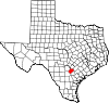 | |
| Town | ||
| Unincorporated communities | ||
| Ghost towns | ||
| Footnotes | ‡This populated place also has portions in an adjacent county or counties | |
| ||
| International | |
|---|---|
| National | |