
Zwartewaterland
Zwartewaterland | |
|---|---|
Municipality | |
 Harbour of Genemuiden | |
|
UTC+2 (CEST) | |
| Postcode | 8060–8064, 8280–8299 |
| Area code | 038 |
| Website | www |

Zwartewaterland (Dutch pronunciation: [ˌzʋɑrtəˈʋaːtərlɑnt] ⓘ) is a municipality in the province Overijssel in the eastern Netherlands.
Geography
This mainly rural municipality lies south of
Vecht
also flows into the Zwarte Water.
Hasselt lies about 5 km (3.1 mi) north of Zwolle.
Genemuiden and Zwartsluis lie 5 km further north, almost opposite one another, near the Zwarte Water. Aquatic sport tourism is important to the local economy.
Population centres
The most important places are printed in bold type.
- Cellemuiden
- De Velde
- Genemuiden (population on 1 January 2007: 9,985)
- Hasselt, Overijssel, Netherlands (pop. 6,963)
- Kamperzeedijk-Oost
- Kamperzeedijk-West
- Kievitsnest
- Mastenbroek
- Zwartewatersklooster
- Zwartsluis (pop. 4,810).
Hasselt and Zwartsluis have small ports with some industry. Genemuiden is the biggest of the three towns, and is home to the majority of Zwartewaterland's population and industry.
Sights
- A small part of the National Park "De Wieden" (see Steenwijkerland) is immediately north of Zwartsluis
- The town hall was built between 1550 and 1615.
- Saint Stephen's Church a Gothic church built in 1466.
- Every year on the feast of Corpus Christi a Roman Catholic pilgrimage to Hasselt is held, with a procession. For that purpose a special church was built in 1933.
Notable people

- Kiliaen van Rensselaer (1586 in Hasselt – ca.1643) diamond and pearl merchant, co-founder of the Dutch West India Company
- Jan de Koning (1926 in Zwartsluis – 1994) politician
- Jaap Drupsteen (born 1942 in Hasselt) graphic designer[6]
- Eelco Gelling (born 1946 in Zwartsluis) blues guitarist
- Afke Schaart (born 1973 in Zwartsluis) former politician
Sport
- Gerard Nijboer (born 1955 in Hasselt) former long-distance runner, competed in three consecutive Summer Olympics
- Willeke Knol(born 1991 in Hasselt) racing cyclist
- Pascal Eenkhoorn (born 1997 in Genemuiden) cyclist
Gallery
-
 Hasselt
 -
 Overzicht van Hasselt vanaf de Sint Stephanuskerk
 -
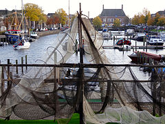 Binnenhaven, Genemuiden
.jpg)
_vanaf_de_Sint_Stephanuskerk_(26).JPG)

References
- ^ "Gemeentelijke indeling op 1 januari 2001" [Municipal divisions on 1 January 2001]. cbs.nl (in Dutch). CBS. Retrieved 2 April 2014.
- ^ "Samenstelling college" [Members of the board] (in Dutch). Gemeente Zwartewaterland. Retrieved 3 April 2014.
- ^ "Kerncijfers wijken en buurten 2020" [Key figures for neighbourhoods 2020]. StatLine (in Dutch). CBS. 24 July 2020. Retrieved 19 September 2020.
- ^ "Postcodetool for 8061CB". Actueel Hoogtebestand Nederland (in Dutch). Het Waterschapshuis. Retrieved 2 April 2014.
- ^ "Bevolkingsontwikkeling; regio per maand" [Population growth; regions per month]. CBS Statline (in Dutch). CBS. 1 January 2021. Retrieved 2 January 2022.
- ^ IMDb Database retrieved 2 May 2019
External links
 Media related to Zwartewaterland at Wikimedia Commons
- Official website
Places adjacent to Zwartewaterland | ||||||||||||||||
|---|---|---|---|---|---|---|---|---|---|---|---|---|---|---|---|---|
| ||||||||||||||||
Overijssel province | ||
|---|---|---|
| Municipalities |  | |
| Regions | ||