
Flevoland
This article needs additional citations for verification. (April 2010) |
Flevoland | |
|---|---|
Province of the Netherlands | |
|
States of Flevoland | |
| Area (2023)[1] | |
| • Total | 2,412 km2 (931 sq mi) |
| • Land | 1,410 km2 (540 sq mi) |
| • Water | 1,002 km2 (387 sq mi) |
| • Rank | 10th |
| Population (1 January 2023)[2] | |
| • Total | 444,701 |
| • Rank | 11th |
| • Density | 315/km2 (820/sq mi) |
| • Rank | 8th |
| GDP | |
| • Total | €15.476 billion |
| • Per capita | €36,600 |
| ISO 3166 code | NL-FL |
| HDI (2021) | 0.923[4] very high · 9th |
| Website | www |
Flevoland (Dutch pronunciation:
The province had a population of about 445,000
Etymology
Flevoland was named after
History
After a flood in 1916, the decision was made to enclose and reclaim the Zuiderzee, an inland sea within the Netherlands, and thus the Zuiderzee Works started. Other sources[7] indicate other times and reasons, but also agree that in 1932, the Afsluitdijk was completed, which closed off the sea completely. The Zuiderzee was later divided into IJsselmeer (mere at the end of the river IJssel) and Markermeer, planned to be mostly drained to make the Markerwaard. The Markerwaard was never built due to post-War fiscal austerity.[citation needed]
The first land reclaimed was the northeast polder (Noordoostpolder) in 1942. This took in the former small islands Urk and Schokland. It was at first added to the Province of Overijssel.
In the southwest the Flevopolder – larger than the above – was then reclaimed; its northeastern half in 1957 and its southwestern half in 1968.
A key feature of the latter is a narrow body of water, kept at 3 metres below sea level, along the former coastline to stabilize the water table and prevent coastal towns from losing their waterfront and access to the sea. Thus, the Flevopolder became an artificial island joined to the mainland by bridges. The municipalities on the three parts voted to become a province, shortly before this was effected in 1986.
Since that time, Flevoland is the youngest of the 12 provinces of the Netherlands. Its current sources of revenue are the cultivation of flowers, farming and tourism. In recent times, it has built many wind turbines as a source of renewable energy.
Geography
Zuiderzee Works


Eastern Flevoland (Oostelijk Flevoland or Oost-Flevoland) and Southern Flevoland (Zuidelijk Flevoland or Zuid-Flevoland), unlike the Noordoostpolder, have broad channel between them and the mainland: the Veluwemeer and Gooimeer, respectively, making them, together, the world's largest artificial island.
They are two polders with a joint hydrological infrastructure, with a dividing dike in the middle, the Knardijk, that will keep one polder safe if the other is flooded. The two main drainage canals that traverse the dike can be closed by
A new element in the design of Eastern Flevoland is the larger city Lelystad (1966), named after Cornelis Lely, the man who had played a crucial role in designing and realising the Zuiderzee Works. Other more conventional settlements already existed by then; Dronten, the major local town, was founded in 1962, followed by two smaller satellite villages, Swifterbant and Biddinghuizen, in 1963. These three were incorporated in the new municipality of Dronten on 1 January 1972.
Southern Flevoland has only one pumping station, the diesel-powered De Blocq van Kuffeler. Because of the hydrological union of the two Flevolands, it simply joins the other three in maintaining the water level of both polders. Almere relieves the housing shortage and increasing overcrowding on the old land. Its name is derived from the early medieval name for Lake Almere. Almere was to be divided into three major settlements initially; the first, Almere-Haven (1976) situated along the coast of the Gooimeer (one of the peripheral lakes), the second and largest was to fulfill the role of city centre as Almere-Stad (1980), and the third was Almere-Buiten (1984) to the northwest towards Lelystad. In 2003, the municipality made a new Structuurplan which started development of three new settlements: Overgooi in the southeast, Almere-Hout in the east, and Almere-Poort in the West. In time, Almere-Pampus could be developed in the northwest, with possibly a new bridge over the IJmeer towards Amsterdam.
The Oostvaardersplassen is a landscape of shallow pools, islets, and swamps. Originally, this low part of the new polder was destined to become an industrial area. Spontaneous settlement of interesting flora and fauna turned the area into a nature park, of such importance that the new railway line was diverted. The recent decline in agricultural land use will in time make expanding natural land use possible, and connect the Oostvaardersplassen to the Veluwe.
The centre of the polder most closely resembles the prewar polders in that it is almost exclusively agricultural. In contrast, the southeastern part is dominated by extensive forests. Here is also found the only other settlement of the polder, Zeewolde (1984), again a more conventional town acting as the local centre. Zeewolde became a municipality at the same time as Almere on 1 January 1984, which in the case of Zeewolde meant that the municipality existed before the town itself, with only farms in the surrounding land to be governed until the town started to grow.
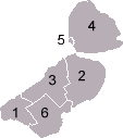
Municipalities
 |
Demographics
| Year | Pop. | ±% |
|---|---|---|
| 1986 | 177,000 | — |
| 1990 | 211,507 | +19.5% |
| 2000 | 317,206 | +50.0% |
| 2010 | 387,881 | +22.3% |
| 2020 | 423,021 | +9.1% |
| Source: Population dynamics; birth, death and migration per region, CBS StatLine, 4 August 2023 | ||
On 1 January 2023, Flevoland had a total population of 444,701 and a population density of 315/km2 (820/sq mi).[1] It is the 2nd least populous province of the Netherlands, with only Zeeland having fewer people. The city of Almere is the most populous municipality in the province.
Religion
In 2015, 15.5% of the population belonged to the
Politics

The King's Commissioner of Flevoland is
Economy
The gross domestic product (GDP) of the province was €14 billion in 2018, accounting for 1.8% of the Netherlands economic output. GDP per capita adjusted for purchasing power was €29,500 or 98% of the EU27 average in the same year.[11]
Transport
Rail


The Flevopolder is served by the Flevolijn, running from Weesp to Lelystad, and the Hanzelijn, continuing from Lelystad towards Zwolle. The two railways stations of the province with intercity services are Almere Centrum and Lelystad Centrum.
| Trajectory | Railway stations in Flevoland |
|---|---|
| Weesp–Lelystad | North Holland – Almere Poort – Almere Muziekwijk – Almere Centrum – Almere Parkwijk – Almere Buiten – Almere Oostvaarders – Lelystad Centrum |
| Lelystad–Zwolle | Lelystad Centrum – Dronten – Overijssel |
Furthermore, Lelystad Zuid is a planned railway station between Almere Oostvaarders and Lelystad Centrum. It has been partially constructed preceding the opening of the railway in 1988, but construction has been put on indefinite hold because of slower-than-expected development of the city of Lelystad.
Amongst the cities with direct train connections to Flevoland are
Airport
There is one airport in the province: Lelystad Airport. A second airport, Noordoostpolder Airport near Emmeloord, was closed in the late 1990s due to town expansion.
Events
References
- ^ a b Statistieken provincie Flevoland - Gegevens over meer dan 100 onderwerpen!, AlleCijfers.nl
- ^ "CBS StatLine". opendata.cbs.nl.
- ^ "EU regions by GDP, Eurostat". Retrieved 18 September 2023.
- ^ "Sub-national HDI - Area Database - Global Data Lab". hdi.globaldatalab.org. Retrieved 13 September 2018.
- ISBN 0761473238.
- ^ a b "Regionale kerncijfers Nederland" [Regional key figures Netherlands]. CBS Statline (in Dutch). CBS. 17 June 2020. Retrieved 21 June 2020.
- ^ "Pagina niet gevonden". Provincie Flevoland. 21 February 2019. Archived from the original on 3 August 2013.
- ^ Helft Nederlanders is kerkelijk of religieus, CBS, 22 december 2016
- ^ "Leen Verbeek". Archived from the original on 2 April 2015. Retrieved 6 March 2015.
- ^ "Uitslag Provinciale Statenverkiezingen 2019". Provincie Flevoland. 25 March 2019.
- ^ "Regional GDP per capita ranged from 30% to 263% of the EU average in 2018". Eurostat. Archived from the original on 9 October 2022.
External links
- Official website
- Zuiderzee Museum
 Flevoland travel guide from Wikivoyage
Municipalities of Flevoland | ||
|---|---|---|
 | ||
| ||
| ||
 | ||
| International | |
|---|---|
| National | |
| Geographic | |