
Ōtemachi Station (Tokyo)
This article needs additional citations for verification. (May 2022) |
T09 M18 Z08 C11 I09 Otemachi Station 大手町駅 | |||||||||||||||||||||||||||||||||||||||||||
|---|---|---|---|---|---|---|---|---|---|---|---|---|---|---|---|---|---|---|---|---|---|---|---|---|---|---|---|---|---|---|---|---|---|---|---|---|---|---|---|---|---|---|---|
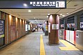
 Otemachi Station Entrance | |||||||||||||||||||||||||||||||||||||||||||
| General information | |||||||||||||||||||||||||||||||||||||||||||
| Location | Chiyoda, Tokyo Japan | ||||||||||||||||||||||||||||||||||||||||||
| Operated by | |||||||||||||||||||||||||||||||||||||||||||
| Line(s) | |||||||||||||||||||||||||||||||||||||||||||
| Platforms | 4 island platforms (Chiyoda/Mita/Tozai/Hanzomon lines) | ||||||||||||||||||||||||||||||||||||||||||
| Tracks | 10 | ||||||||||||||||||||||||||||||||||||||||||
| Construction | |||||||||||||||||||||||||||||||||||||||||||
| Structure type | Underground | ||||||||||||||||||||||||||||||||||||||||||
| Other information | |||||||||||||||||||||||||||||||||||||||||||
| Station code |
| ||||||||||||||||||||||||||||||||||||||||||
| History | |||||||||||||||||||||||||||||||||||||||||||
| Opened | 20 July 1956 | ||||||||||||||||||||||||||||||||||||||||||
| |||||||||||||||||||||||||||||||||||||||||||
| |||||||||||||||||||||||||||||||||||||||||||


Ōtemachi Station (大手町駅, Ōtemachi-eki) is a major subway station in Chiyoda, Tokyo, Japan, jointly operated by Tokyo Metro and Toei Subway. It is served by five lines, more than any other station on the Tokyo underground network, and is thus the biggest subway station in Tokyo.[1] It is Tokyo Metro's second busiest station, after Ikebukuro.[2]
Ōtemachi Station is within walking distance (either at street level or via underground passages) of Tokyo Station.
Lines
Station layout
Tokyo Metro
| 1 | M Marunouchi Line | for Ginza, Shinjuku, and Ogikubo |
| 2 | M Marunouchi Line | for Ochanomizu and Ikebukuro |
| 3 | T Tozai Line | for Toyo-Katsutadai
|
| 4 | for Takadanobaba and Nakano JB Chūō Line (Local) for Mitaka | |
| 5 | C Chiyoda Line | for Odakyu Odawara Line for Hon-Atsugi and Isehara
|
| 6 | for | |
| 7 | Z Hanzōmon Line | for Chuo-rinkan
|
| 8 | for Kinshicho and Oshiage
TS Tobu Skytree Line for Tōbu-dōbutsu-kōen TI Tobu Isesaki Line for Kuki TN Tōbu Nikkō Line for Minami-Kurihashi |
-
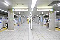
 Marunouchi Line platform 1 (July 2022)
 -
 Marunouchi Line platform 2 (July 2022)
 -
 Tozai Line platform (July 2022)
 -
 Chiyoda Line platform (July 2022)
 -
 Hanzomon Line platform (July 2022)


Toei
| 1 | I Mita Line |
|
| 2 | for Sugamo and Nishi-takashimadaira |
-
 Mita Line platform (June 2022)

History
The station opened on July 20, 1956 as a station on the Marunouchi Line. The Tōzai Line platforms opened on October 1, 1966 as a terminus of the line from Nakano, becoming through platforms on September 14, 1967. The Chiyoda Line platforms opened on December 20, 1969 as the terminus of the line from Kita-Senju; they became through platforms on March 20, 1971. The Mita Line platforms opened on June 30, 1972, and the Hanzōmon Line platforms on January 26, 1989.[3]
With the exception of the Mita Line, the station facilities of the remaining lines were inherited by Tokyo Metro after the privatization of the Teito Rapid Transit Authority (TRTA) in 2004.[4]
Surrounding area
References
- ^ "Otemachi". Tokyo-Tokyo.com. Retrieved 12 April 2013.
- ^ 各駅の乗降人員ランキング [Station usage ranking] (in Japanese). Tokyo Metro. Retrieved 23 May 2018.
- ^ "Tokyo Subway". Robert Schwandl. Retrieved 12 April 2013.
- ^ "「営団地下鉄」から「東京メトロ」へ" [From "Teito Rapid Transit Authority" to "Tokyo Metro"]. Tokyo Metro Online. 2006-07-08. Archived from the original on 16 May 2012. Retrieved 29 May 2022.
External links
- Otemachi Station information (Tokyo Metro) (in English)
- Otemachi Station information (Toei) (in English)

| Shinkansen lines |
|
|---|---|
passing through Central Tokyo |
|
| |
in satellite cities or suburbs | |
| |
| |
| Other commuter rail lines | |
| Trams | |
| Monorails | |
| People movers | |
| Hinterland | |
| Funiculars and aerial lifts | |
| Public ferries | |
| Major terminals | |
| Miscellaneous |
|