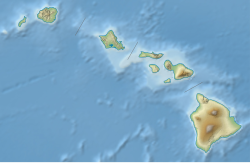
1975 Hawaii earthquake
Appearance
| UTC time | 1975-11-29 14:47:43 |
|---|---|
| ISC event | 722344 |
| USGS-ANSS | ComCat |
| Local date | November 29, 1975 |
| Local time | 04:47:43 |
| Magnitude | Mw 7.7[1] |
| Depth | 10.0 km (6.2 mi) [1] |
| Epicenter | 19°26′N 155°09′W / 19.44°N 155.15°W [1] |
| Areas affected | Hawaii United States |
| Total damage | $4–4.1 million [2][3] |
| Max. intensity | MMI VIII (Severe)[3] |
| Tsunami | 14.3 m (47 ft) [4] |
| Casualties | 2 dead [3] several–28 injured [3][4] |
NOAA
The 1975 Hawaii earthquake occurred on November 29 with a
Kilauea
volcano.
The event generated a large tsunami that was as high as 47 feet (14 m) on Hawaii'i island and was detected in Alaska, California, Japan, Okinawa, Samoa, and on Johnston and Wake Islands. Significant changes to the shorelines along the southern coast of the Big Island with subsidence of 12 feet (3.7 m) was observed, causing some areas to be permanently submerged. The source of the event was the Hilina Slump, which was also responsible for the more powerful 1868 Hawaii earthquake and tsunami.
See also
References
- ^
- doi:10.7289/V5TD9V7K
- ^ United States Government Printing Office, pp. 205, 210, 211
- ^ a b USGS (September 4, 2009), PAGER-CAT Earthquake Catalog, Version 2008_06.1, United States Geological Survey
External links
- USGS Hawaiian Volcano Observatory
- Tsunami Animation: Hawaii 1975 – Pacific Tsunami Warning Center
- The International Seismological Centre has a bibliography and/or authoritative data for this event.

