
A166 road
 | ||
|---|---|---|
A614 | ||
| East end | A614 | |
| Location | ||
| Country | ||
| Road network | ||
| ||
The A166 road is a trunk road between the outskirts of York and Driffield in the historic county of Yorkshire. The road used to terminate at the seaside town of Bridlington, until the opening of the Driffield by-pass caused the final section to be renumbered as the A614.
History
The A166 follows the path of an old
There are a number of
- Kitty Hill, round barrow[4]
- Garrowby Hill Top Farm, three round barrows[5][6][7]
- Cot Nab Farm, two round barrows and multiple linear dykes[8][9][10]
- South Wold Farm, linear boundary dyke, two round barrows[11][12][13]
- Fordham Farm, round barrow[14]
In 1983, the Driffield by-pass was built and became the route of the A166, which had previously gone through the centre of the busy market town. The by-pass was renumbered in 1996 to become the A614 and thus shorten the historic old road.
In 2008, a feasibility study was carried out and proposals were put forward on behalf of the East Riding of Yorkshire Council for an alternative crossing of the River Derwent at Stamford Bridge.[15] The current Grade II listed bridge only allows for one way flow and is controlled by traffic lights. It has a record for causing peak hour delays during the working week. Alternative routes included utilising the disused York to Beverley railway line crossing downstream from the current bridge. Also adding a new structure right next to the existing bridge was put forward. Other proposals involved two routes to the north of the river, one crossing just north of the caravan site on Buttercrambe Road and the other a complete new by-pass missing the village altogether. The report concluded that the best options did not score well enough for the Regional Transport Board to take forward and should not be pursued.
In 2009, the stretch of the A166 along Main Road and York Road, between the turnings for the B1248, in Wetwang was the location for the third and final intermediate sprint, which was won by Thomas De Gendt of Belgium, during that year's Tour of Britain Stage 1 from Scunthorpe to York.[16]
Route
The road starts as an exit on the Grimston Bar interchange on the
Just south of the hamlet of Garrowby the road takes a sharp turn south and then back east at the foot of Garrowby Hill. The hill is the highest point on the Yorkshire Wolds and was the subject of a painting[17] by David Hockney. The road up the hill covers 2.4 miles (3.9 km), rising from 177 feet (54 m) to 791 feet (241 m) at an average gradient of 4.8%.[18] Part way up the hill, is the southerly turn off toward Bishop Wilton. Shortly after this junction an emergency stopping track can be seen on the downward side of the road. Consisting of gravel and sand, this is intended for vehicles to use in the event of a mechanical problem. There are several places where the road has been widened to allow slower traffic ascending or descending to pull to the left and allow faster vehicles to pass. In the next 3 miles (4.8 km), there are junctions with the routes to Great Givendale and Pocklington to the south and Thixendale to the north. At a dip and curve in the road known as Stone Dale, the road once more goes in a north east direction.
The A166 next runs through
Only junctions with classified designations are included in the table below.
| A166 Road | |||
| Northbound* exits | Junction | Southbound* exits | Coordinates |
|---|---|---|---|
| Grimston Bar Junction A64 (road)
|
Grimston Bar Roundabout |
Start of road | 53°57′28″N 1°00′41″W / 53.95778°N 1.01139°W |
| Fimber, Sledmere, B1251 | 54°01′12.4″N 0°39′45.6″W / 54.020111°N 0.662667°W | ||
| North Grimston, Malton, B1248 | Tibthorpe, Bainton, Lund, Beverley B1248 | 54°01′07.2″N 0°35′35.5″W / 54.018667°N 0.593194°W Northbound 54°01′10.0″N 0°34′25.7″W / 54.019444°N 0.573806°W Southbound | |
| Sledmere, B1252 | 54°01′27.8″N 0°30′42.6″W / 54.024389°N 0.511833°W | ||
| A614 road to Bridlington | York Road Roundabout |
A614 road to Goole York Road, Driffield, End of road |
54°00′31.7″N 0°27′13.1″W / 54.008806°N 0.453639°W |
Gallery
-
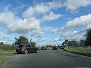 Grimston Bar junction showing A1079 and A166 exits
 -
 Duke of York on the A166 at Gate Helmsley
 -
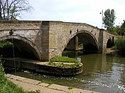 The road bridge at Stamford Bridge over the River Derwent
 -
 Garrowby Hill with Emergency Stopping Track
 -
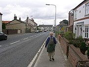 Fridaythorpe on the A166
 -
 Village pond at Wetwang
 -
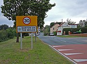 Garton on the Wolds
 -
 Driffield Bypass


References
- ^ "Roman Road". British History Online. Retrieved 1 June 2013.
- ^ "Turnpike Trusts". Retrieved 1 June 2013.
- ^ Macmahon, K.A. (1964). Roads and Turnpike Trusts in East Yorkshire. East Yorkshire Local History Society. p. 46.
- ^ Historic England. "Kitty Hill round barrow (1007837)". National Heritage List for England. Retrieved 14 June 2017.
- ^ Historic England. "Round barrow 100m north west of farm on Garrowby Hill Top (1008418)". National Heritage List for England. Retrieved 14 June 2017.
- ^ Historic England. "Round barrow 200m east of farm on Garrowby Hill Top (1008438)". National Heritage List for England. Retrieved 14 June 2017.
- ^ Historic England. "Round barrow 300m north-east of farm on Garrowby Hill Top (1008437)". National Heritage List for England. Retrieved 14 June 2017.
- ^ Historic England. "Round barrow 300m south west of Cot Nab Farm (1008319)". National Heritage List for England. Retrieved 14 June 2017.
- ^ Historic England. "Round barrow 350m west of Cot Nab Farm (1008314)". National Heritage List for England. Retrieved 14 June 2017.
- ^ Historic England. "Sections of multiple linear dykes 125m south west of Cot Nab Farm (1015611)". National Heritage List for England. Retrieved 14 June 2017.
- ^ Historic England. "Section of linear boundary dyke 390m west of South Wold Farm (1015610)". National Heritage List for England. Retrieved 14 June 2017.
- ^ Historic England. "Round barrow south of South Wold Farm (1009385)". National Heritage List for England. Retrieved 14 June 2017.
- ^ Historic England. "Round barrow south east of South Wold Farm (1009384)". National Heritage List for England. Retrieved 14 June 2017.
- ^ Historic England. "Round barrow 350m south east of Fordham Farm (1013165)". National Heritage List for England. Retrieved 14 June 2017.
- ^ "Alternative Crossing of the River Derwent Feasibility Study, A166 Stamford Bridge" (PDF). JMP Consultants Limited. Archived from the original (PDF) on 19 February 2014. Retrieved 10 May 2013.
- ^ "2009 Tour of Britain Stage 1 Results". Cycling News. 12 September 2009. Retrieved 27 September 2020.
- ^ "David Hockney Gallery". David-Hockney.org. Retrieved 26 September 2020.
- ^ "Garrowby Hill". MapMyRide. Retrieved 30 June 2017.
A roads in Zone 1 of the Great Britain road numbering scheme | ||
|---|---|---|