
Bannockburn
Bannockburn
| |
|---|---|
 The centre of Bannockburn | |
 Bannockburn Location within the Stirling council area | |
| Population | 6,720 (2020)[1] |
| OS grid reference | NS811902 |
| • Edinburgh | 35 mi (56 km) ESE |
| • London | 410 mi (660 km) SSE |
| Council area | |
| Lieutenancy area | |
| Country | Scotland |
| Sovereign state | United Kingdom |
| Post town | STIRLING |
| Postcode district | FK7 |
| Dialling code | 01786 |
| Police | Scotland |
| Fire | Scottish |
| Ambulance | Scottish |
| UK Parliament | |
| Scottish Parliament | |
| Website | www.bannockburn.co.uk |
Bannockburn (
History
Land in the vicinity of Bannockburn town, probably between the Pelstream and Bannock burns (hence Bannockburn),

Bannockburn village used to be famous for its carpet and tweed factories
The turnpike road between Edinburgh and Stirling was constructed in the 1750s and passed through Bannockburn. The route originally passed over the Old Bridge, until the construction in 1819 of a circular-arch stone bridge, built by engineer Thomas Telford, spanning the burn downstream of the battle site.[6]: 178–9 [HES 3] Growth of both Stirling and Bannockburn during the 19th and 20th centuries means that the two now form a contiguous conurbation, and Bannockburn was latterly incorporated into the city (then royal burgh) of Stirling. Bannockburn had a population of 7,352 at the time of the 2001 census.[8]
The area contains most necessary amenities, including a library, and local shops. It is served by Bannockburn Primary School, in the centre of the community, and Bannockburn High School in nearby Broomridge. Several new private housing schemes have been built in and around Bannockburn since the 1990s, increasing pressure on the already overcrowded high school. As a result of this, in 2007 and 2008 Bannockburn High School was extended to provide additional capacity.
Between 1852 and 1949 Bannockburn had a railway station on the Scottish Central Railway,[9] located next to the site of the bus depot. Nowadays, however, residents wishing to use the train must travel into the centre of Stirling. Introduction of a new station with a park-and-ride facility was proposed in the Strategic Transport Projects Review in 2009.[10] Bannockburn is served by the 38, 51 and C30 bus services.
Sports
Bannockburn and Hillpark have two amateur football teams, Bannockburn Amateurs[11] (Est. 1968) and Milton FC[12] (Est. 1972). Bannockburn Amateurs won the West of Scotland Amateur Cup for the fifth time in 2019.
Bannockburn also hosts its own Rugby Club. Formerly known as St Modans HSFP RFC (Est. 1978), it changed its name to Bannockburn RFC in 1996. Bannockburn currently plays in the Scottish Hydro Electric Regional League: Caledonia Division 2 Midlands.
Bannockburn also plays host to St Modans HSFP Cricket Club, who play in the Strathmore and Perthshire Cricket Union Division 1. In July 2013, playing against Perth Doo'cot CC, St Modans scored 329 runs in response to Perth's 326, making it what is believed to be the highest scoring game ever recorded in the SPCU.[13]
-
 2009 Milton FC Team
 -
 Bannockburn Amateurs West of Scotland Cup Winners 2009
 -
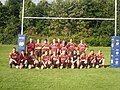 Bannockburn RFC


Places of worship
The town also has a Gospel Hall and two Church of Scotland churches. Christadelphians meet in a hall on Main Street.[16] The hall used to be a carpet factory.[17]
Notes and references
- ^ "Mid-2020 Population Estimates for Settlements and Localities in Scotland". National Records of Scotland. 31 March 2022. Retrieved 31 March 2022.
- ^ "OS 25 inch map 1892-1949, with Bing opacity slider". National Library of Scotland. Ordnance Survey. Retrieved 12 October 2017.
- ^ Penny Guide to Stirling, Stirling Castle, Wallace Monument, Bannockburn, Etc. R.S. Shearer. 1895. p. 20. Retrieved 5 April 2017.
- ^ Ronald, James (1897). The Merchants' guide book to Stirling and district. Stirling: E. MacKay. pp. 52–54.
- ^ Illustrated guide to Stirling and the national Wallace monument (9th ed.). Stirling: Mackay, Eneas. 1897. p. 21. Retrieved 7 October 2017.
- ^ ISBN 0859764206.
- ^ Francis Groome, ed. (1885). Ordnance Gazetteer of Scotland: A Survey of Scottish Topography, Statistical, Biographical and Historical. Thomas C Jack. Retrieved 19 December 2018.
- ^ "2001 CENSUS RESULTS BANNOCKBURN COMMUNITY COUNCIL AREA" (PDF). Corporate Services, Stirling Council. Archived from the original (PDF) on 9 January 2009. Retrieved 3 June 2009.
- ^ Brown, David (12 April 2009). "Bannockburn Railway Station". Bannockburn Community Website. Archived from the original on 4 February 2017. Retrieved 3 February 2017.
- ^ "Annex A: Summary of Draft Investments". Strategic Transport Projects Review Final Report. Transport Scotland. 2 November 2009. Retrieved 3 February 2017.
- ^ Bannockburn Amateurs Archived February 17, 2009, at the Wayback Machine
- ^ Milton Amateurs FC Archived April 8, 2009, at the Wayback Machine
- ^ Morton, Donald (30 July 2013). "Cricket: Big Ben chimes out in style". Daily Record. Retrieved 28 July 2021.
- ^ "Murrayfield United Free Church Of Scotland". Retrieved 4 November 2017.
- ^ "Our Lady and St Ninian's". Retrieved 4 April 2017.
- ^ 'Stirling' on searchforhope.org
- ^ J. Smith, 'Bannockburn: The Capital of Tartan Weaving Archived February 6, 2010, at the Wayback Machine' (2008) on Bannockburn Community Website
Historic Environment Scotland
- ^ Historic Environment Scotland. "Battle Of Bannockburn (47243)". Canmore. Retrieved 2 April 2009.
- ^ Historic Environment Scotland. "Stirling, Borestone Brae, Bore Stone (46169)". Canmore. Retrieved 2 April 2009.
- ^ Historic Environment Scotland. "Bannockburn, New Road, Bridge (222053)". Canmore. Retrieved 2 April 2009.
External links
- . Encyclopædia Britannica. Vol. 3 (11th ed.). 1911.
- Map sources for Bannockburn
- Bannockburn Community Website
| International | |
|---|---|
| National | |