
Bellvue, Colorado
Bellvue, Colorado | |
|---|---|
MDT) | |
| ZIP Code | 80512[2] |
Bellvue is an unincorporated community and U.S. Post Office in Larimer County, Colorado. It is a small agricultural community located in Pleasant Valley, a narrow valley just northwest of Fort Collins near the mouth of the Poudre Canyon between the Dakota Hogback ridge and the foothills of the Rocky Mountains. The ZIP Code of the Bellvue Post Office is 80512.[2]
Description
The community is lush area on the south side of the
in the valley just north of the Bellvue town site.History
The first white settlers arrived in the valley soon after Antoine Janis became the first white settler in northern Colorado in 1858. The farm and pasture lands were squatted upon in the two years that followed, so that most was claimed by G.R. Sanderson, one of these first settlers, who built the first irrigation ditch in the county in June 1860. The ditch was the second one constructed in northern Colorado. Sanderson sold his claim to J.H. Yeager in 1864, and the ditch came to be known as the Yeager ditch.
Another early settler, Samuel Bingham, settled on the west slope of Bingham Hill in 1860. In 1860, Abner Loomis, who was also an early prominent resident of Fort Collins, settled on a ranch in the valley. Other early settlers in the 1860s included Benjamin T. Whedbee, Perry J. Bosworth, C.W. Harrington, and Louis Blackstock.
In 1873, Jacob Flowers arrived in the valley and set up a homestead on a parcel of land he purchased from Joseph Mason. Flowers had migrated westward from Ohio and Missouri after the Civil War and had settled temporarily in Greeley in 1872. The following year, Flowers followed the Poudre upstream and founded the town of "Bellevue" later that year (the name was later shortened).

The area was considered desirable by the
Flowers also constructed a track and bandstand south of town that was used for horse racing, community celebrations, traveling medicine shows, and dog and pony shows.
Geography
Bellvue is located at 40°37′32″N 105°10′16″W / 40.62556°N 105.17111°W (40.625679,-105.171089).
See also
 Geography portal
 North America portal
 United States portal
 Colorado portal
 Mountains portal
 History portal
- Outline of Colorado
- State of Colorado
- Colorado cities and towns
- Colorado counties
- Colorado metropolitan areas
- Front Range Urban Corridor
- North Central Colorado Urban Area
- Fort Collins-Loveland, CO Metropolitan Statistical Area
References
- ^ "US Board on Geographic Names". United States Geological Survey. October 25, 2007. Retrieved January 31, 2008.
- ^ a b "ZIP Code Lookup". United States Postal Service. Archived from the original (JavaScript/HTML) on September 3, 2007. Retrieved September 3, 2007.
- ISBN 0-918654-42-4.
External links
Municipalities and communities of Larimer County, Colorado, United States | ||
|---|---|---|
| Cities | 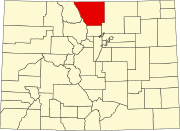 | |
| Towns | ||
| CDPs | ||
| Unincorporated communities | ||
Ghost towns | ||
| Footnotes | ‡This populated place also has portions in an adjacent county or counties | |
| ||
| International | |
|---|---|
| National | |
| Geographic | |