Big Schloss
Appearance
| Big Schloss | |
|---|---|
 | |
| Highest point | |
| Elevation | 2,964 ft (903 m) |
| Coordinates | 38°56′26″N 78°39′57″W / 38.94056°N 78.66583°W[1] |
| Geography | |
Ridge and Valley Appalachians | |
| Topo map | USGS Wardensville, Wolf Gap, Woodstock |
| Climbing | |
| Easiest route | Hike |
Big Schloss is a peak in the
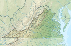
Topozone, the actual summit is in Virginia.[2] The trail is part of the Lee Ranger District. It features a rocky outcropping of white sandstone with expansive views into Trout Run Valley in West Virginia and Little Schloss Mountain in Virginia.[2][3]
German settlers gave Big Schloss its name. Schloss is German for "castle", and the name is a reference to the rocky outcrop.[2][3] German was the common language in the area for several years.[3]
A number of
Potomac Appalachian Trail Club maintains the trails leading up to Big Schloss. A bridge provides access to the Big Schloss rock outcropping. In the Fall of 2010, the bridge was replaced with new stairs, 20' of new handrails, and two new concrete abutments.[5]
References
- ^ "Big Schloss". Geographic Names Information System. United States Geological Survey, United States Department of the Interior. Retrieved Mar 29, 2013.
- ^ a b c d "Big Schloss". SummitPost.org. Retrieved 2011-05-07.
- ^ ISBN 0-915746-89-1.
- ^ "Wolf Gap Recreation Area". U.S. Forest Service. Archived from the original on 2017-06-04. Retrieved 2021-02-22.
- ^ "Big Schloss Trail Bridge Replacement - Shenandoah County, VA - GW & Jefferson National Forest". Retrieved 2010-08-29.
External links
- "Big Schloss Trip report". Retrieved 2011-05-08. with extensive details of the flora in the area

