
Rocky Mountain (Rockbridge County, Virginia)
| Rocky Mountain | |
|---|---|
| Highest point | |
| Elevation | 1,241 metres (4,072 ft) |
| Prominence | 695 m (2,280 ft)[1] |
| Coordinates | 37°47.73′N 79°10.85′W / 37.79550°N 79.18083°W |
| Geography | |
| Location | Amherst / Rockbridge counties, Virginia, U.S. |
| Parent range | Blue Ridge Mountains |
| Topo map | USGS Montebello |
Rocky Mountain is a peak of the Blue Ridge Mountains in Virginia. It is located about 2 miles (3.5 km) east of Irish Gap, on the border of Rockbridge County and Amherst County; it is the highest point of both counties. Rocky Mountain is flanked to the northeast by Elk Pond Mountain, to the southwest by Grapevine Ridge, and to the south by Tar Jacket Ridge (3,860 ft / 1,180 m).
Rocky Mountain stands within the
James River, which drains into Chesapeake Bay
.
The northwest side of Rocky Mtn. drains into the Nettle Springs Branch of Nettle Creek, thence into Irish Creek, the South River, the Maury River
, and the James River.
The southwest side of Rocky Mtn. drains into Statons Creek, thence into the Pedlar River and the James.
The east side of Rocky Mtn. drains into the Greasy Spring Branch of the South Fork of the Tye River
and the James.
Rocky Mountain is located in the
George Washington National Forest
.
The summit of Rocky Mtn. is occupied by several radio towers, accessed by a dead-end dirt road. A VDEN packet node, ROCKND, is also located on this mountaintop.
The National Scenic Trail from Georgia to Maine, passes 0.3 miles (0.5 km) to the southeast of the summit, while the Blue Ridge Parkway
passes 0.6 mi (0.97 km). (1 km) to the northwest.
Notes
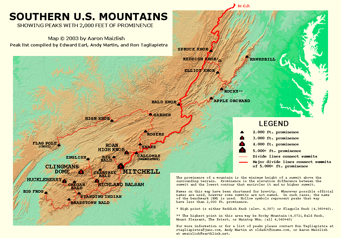
- Key col at 37°57′N 79°11′W / 37.950°N 79.183°W at 1,790±10 ft, but "The highest point in this area may be Rocky Mountain (4,072 [ft]), Bald Knob, Mount Pleasant, The Priest, or Maintop Mtn. (all 4,040+40)". http://www.peaklist.org/USmaps/southeastsummits.gif
External links
- U.S. Geological Survey Geographic Names Information System: Rocky Mountain
- PeakBagger.com: Rocky Mountain
This Rockbridge County, Virginia state location article is a stub. You can help Wikipedia by expanding it. |
This Amherst County, Virginia state location article is a stub. You can help Wikipedia by expanding it. |