
Coniston, Cumbria
| Coniston | |
|---|---|
| Village and parish | |
 Coniston | |
 Coniston Location within Cumbria | |
| Population | 928 (2011)[1] |
| OS grid reference | SD2996 |
| Civil parish |
|
| Unitary authority | |
| Ceremonial county | |
| Region | |
| Country | England |
| Sovereign state | United Kingdom |
| Post town | CONISTON |
| Postcode district | LA21 |
| Dialling code | 015394 |
| Police | Cumbria |
| Fire | Cumbria |
| Ambulance | North West |
| UK Parliament | |
Coniston is a village and
Coniston is 25 miles (40 km) northeast of Barrow-in-Furness, 20 miles (32 km) west of Kendal and 42 miles (68 km) north of Lancaster.
History
Coniston grew as both a farming village, and to serve local copper and slate mines.
The poet and
The philosopher
The painter Henry Robinson Hall lived and worked and was buried in Coniston.[7]
Donald Campbell added to the profile of the village and lake when he broke four World Water Speed Records on the lake in the 1950s. He died attempting to break the world water speed record for the eighth time in 1967, when his jet boat, "Bluebird K7", crashed at 290 mph (470 km/h), having already set the record for the seventh time at Dumbleyung Lake, Western Australia in 1964. His body and boat (Bluebird K7) were discovered and recovered by divers in 2001 and he was buried in the new graveyard in Coniston in September 2001. A new wing has been built at the Ruskin Museum to accommodate the fully restored Bluebird K7 boat. It opened in late 2009 with the K7 due to have arrived in late 2011 or early 2012.[8]
The whole village was powered by hydroelectricity during the 1920s but this became so heavily taxed that the people there were forced to return to the national grid. Since 7 March 2007 a hydro-electric scheme has been in use to power up to 300 homes; being sited near the original.[4]
Buses
The main bus service in Coniston is a Stagecoach Cumbria service 505 which goes to Ambleside, Windermere and occasionally Kendal.[9]
Etymology
Coniston was called "Coningeston" in the 12th century, a name derived from konungr, the Old Norse for king, and tūn the Old English for farmstead or village. This would give the village the title of "The king's estate".[10] Ekwall[11] speculated that this town could have been the centre of a 'small Scandinavian mountain kingdom'.[12]
Geography
Coniston is located on the western shore of the northern end of
Governance
Coniston is part of the
Before Brexit, it was in the North West England European Parliamentary Constituency.
For
The total population of this ward as taken at the 2011 Census was 1,575.[18]
The village also has its own
Leisure and tourism
The creation of the Lake District National Park in 1951 provided a boost to tourism, with attractions such as the
The village also has a football team, Coniston AFC, who play their home games at Coniston sports and social centre.
Climate
As with the rest of the
| Climate data for Grizedale 91m asl, 1971–2000, Extremes 1960– (Weather Station 2.5 miles SE of Coniston) | |||||||||||||
|---|---|---|---|---|---|---|---|---|---|---|---|---|---|
| Month | Jan | Feb | Mar | Apr | May | Jun | Jul | Aug | Sep | Oct | Nov | Dec | Year |
| Record high °C (°F) | 12.2 (54.0) |
14.0 (57.2) |
19.4 (66.9) |
24.9 (76.8) |
26.5 (79.7) |
29.8 (85.6) |
30.1 (86.2) |
30.3 (86.5) |
26.7 (80.1) |
21.7 (71.1) |
16.4 (61.5) |
13.0 (55.4) |
30.3 (86.5) |
| Mean daily maximum °C (°F) | 6.2 (43.2) |
6.6 (43.9) |
8.6 (47.5) |
11.3 (52.3) |
15.0 (59.0) |
17.2 (63.0) |
19.2 (66.6) |
18.8 (65.8) |
16.0 (60.8) |
12.8 (55.0) |
9.1 (48.4) |
7.1 (44.8) |
12.3 (54.2) |
| Mean daily minimum °C (°F) | 0.2 (32.4) |
0.4 (32.7) |
1.5 (34.7) |
2.6 (36.7) |
4.8 (40.6) |
7.7 (45.9) |
9.8 (49.6) |
9.6 (49.3) |
7.8 (46.0) |
5.1 (41.2) |
2.4 (36.3) |
1.0 (33.8) |
4.4 (39.9) |
| Record low °C (°F) | −14.4 (6.1) |
−15.2 (4.6) |
−12.2 (10.0) |
−6 (21) |
−6.9 (19.6) |
−2.6 (27.3) |
1.1 (34.0) |
−1.1 (30.0) |
−1.7 (28.9) |
−5.9 (21.4) |
−9.8 (14.4) |
−14.2 (6.4) |
−15.2 (4.6) |
| Average precipitation mm (inches) | 199.48 (7.85) |
147.56 (5.81) |
171.31 (6.74) |
97.43 (3.84) |
89.89 (3.54) |
102.37 (4.03) |
114.14 (4.49) |
142.84 (5.62) |
156.36 (6.16) |
208.18 (8.20) |
196.1 (7.72) |
214.35 (8.44) |
1,902.57 (74.90) |
| Source 1: YR.NO[22] | |||||||||||||
| Source 2: Royal Dutch Meteorological Institute[23]
| |||||||||||||
Mining and minerals
Two slate quarries still operate at Coniston, one in Coppermines Valley, the other at Brossen Stone on the east side of the Coniston Old Man. Both work Coniston's volcanic slates, being blue at Low-Brandy Crag in Coppermines Valley, and light green at Brossen Stone (bursting stone). The scenery around Coniston derives from
Services
Coniston is also an important local centre, with a secondary school (John Ruskin School), primary school (Coniston Church of England Primary School), bank, petrol station and other such services. It has also repeatedly been highly placed in the Village of the Year award, winning it in 1997.
Twinning
The village is twinned with Illiers-Combray.[24] The French village is associated with Marcel Proust for whom Ruskin's work was a source of inspiration.
Gallery
-
 St Andrew's Church
 -
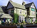 Yewdale Hotel
 -
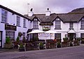 Black Bull
 -
 Church Beck
 -
 Farmstead near Coniston
 -
 Tarn Hows Cottage
 -
 View over Coniston Water
 -
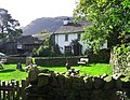 Yew Tree Farm
 -
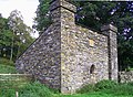 Old Dog House
 -
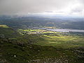 Village from Old Man


See also
- Listed buildings in Coniston, Cumbria
- Coniston Hall
- Coniston Mountain Rescue Team
- John Ruskin School
- Henry Robinson Hall
References
- ^ Office for National Statistics. Retrieved 28 April 2021.
- ^ UK Census (2001). "Local Area Report – Coniston Parish (16UG014)". Nomis. Office for National Statistics. Retrieved 28 April 2021.
- ^ Ordnance Survey Map (1946) – Coniston Village, Accessed 18 July 2014.
- ^ a b c The Story of Coniston, 2nd edition, by Alastair Cameron and Elizabeth Brown, privately published, Coniston 2003.
- ISBN 978-0-85361-667-2)
- ^ W. G. Collingwood (1893) The Life of John Ruskin (2 vols.) (Methuen) (The Life of John Ruskin, sixth edition (1905))
- ^ Census Returns of England and Wales for 1921, the National Archives, Kew (Surrey) 1921.
- ^ "Ruskin Museum". ruskinmuseum.com. Archived from the original on 9 August 2006. Retrieved 22 July 2009.
- ^ "CNL Winter 23 Lakes by Bus" (PDF). stagecoachbus.com.
- ^ "English Place-names by Heikki Rajala, Innervate – University of Nottinghamshire, vol. 2, 2009–2010" (PDF). www.nottingham.ac.uk. Retrieved 23 April 2015.
- ^ Ekwall, Eilert (1922). The place-names of Lancashire. Manchester: Chetham Society.
- ISBN 0904889726.
- ^ "Coniston". Lake District Hotel and Information Guide. Retrieved 28 October 2014.
- ^ "Lancashire Walks, Coniston" (PDF). Lancashire Walks. Retrieved 28 October 2014.
- ^ "Tim Farron". theyworkforyou.com. Archived from the original on 1 June 2013.
- ^ "Westmorland & Lonsdale general election 2019".
- ^ "Westmorland and Furness Council wards map" (PDF).
- ^ "Ward population 2011". Retrieved 10 June 2015.
- ^ "Coniston Parish Council". 16 January 2023.
- KNMI. Archived from the originalon 5 June 2012. Retrieved 7 November 2011.
- KNMI. Archived from the originalon 5 June 2012. Retrieved 7 November 2011.
- ^ "Grizedale Climate". YR.NO. Retrieved 7 November 2011.
- KNMI. Retrieved 7 November 2011.
- Westmorland Gazette. Retrieved 5 June 2017.
External links
- Coniston Community Website
- Coniston Mountain Rescue Team
- Coniston Webcam – A view of Coniston village.
- Lakelandcam- daily walkabout photos centered on Coniston and environs
- Cumbria County History Trust: Church Coniston (nb: provisional research only - see Talk page)
- Cumbria County History Trust: Hawkshead and Monk Coniston with Skelwith (nb: provisional research only – see Talk page)
| International | |
|---|---|
| National | |