
Cucaita
Cucaita | |
|---|---|
Municipality and town | |
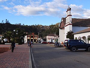
 View of Cucaita | |
|
UTC-5 (Colombia Standard Time) | |
| Website | Official website |
Cucaita is a municipality in the Central Boyacá Province, part of Boyacá Department, Colombia. The urban centre is situated on the Altiplano Cundiboyacense at a distance of 20 kilometres (12 mi) from the department capital Tunja. Cucaita borders Sora in the north, Tunja in the east and south and Samacá in the south and west.[1]
Etymology
The name Cucaita is derived from Chibcha and means either "Seminary enclosure" or "Shade of the farming fields".[1][2]
History
The area of Cucaita in the times before the
zaque of nearby Hunza
.
Modern Cucaita was founded on August 12, 1556 by friar Juan de Los Barrios.[1]
Economy
Main economical activities of Cucaita are agriculture (predominantly onions and peas), livestock farming and minor carbon mining.[1]
Born in Cucaita
- Rafael Antonio Niño, former professional cyclist
Gallery

-
 View of Cucaita
 -
 Central square
 -
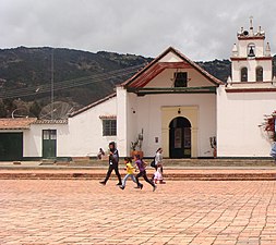 Church of Cucaita
 -
 Church interior


-
 Monument to Rafael Antonio Niño
 -
 Rural Cucaita
 -
 Farmfields


References
- ^ a b c d (in Spanish) Official website Cucaita Archived 2015-05-29 at archive.today
- ^ (in Spanish) Etymology Municipalities Boyacá - Excelsio.net
External links
Wikimedia Commons has media related to Cucaita.