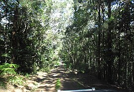
Danbulla National Park and State Forest
| Danbulla National Park and State Forest Queensland | |
|---|---|
 | |
| Managing authorities | Queensland Parks and Wildlife Service |
| See also | Protected areas of Queensland |
Danbulla National Park and State Forest is a national park and state forest complex in Queensland, Australia, around 60 km west of Cairns.[1]
The forest is spectacular and covers an area of 12,000 hectares, including eucalyptus, acacia and pine plantations.[2]
The elevation of the terrain is 737 meters.[3]
References
- ^ Department of National Parks, Recreation, Sport and Racing (11 October 2012). "About Danbulla". Queensland Government. Archived from the original on 11 June 2013. Retrieved 15 December 2012.
{{cite web}}: CS1 maint: multiple names: authors list (link) - ^ Science (24 November 2010). "About | Danbulla National Park and State Forest". Parks and forests | Department of Environment and Science, Queensland. Retrieved 15 March 2022.
- ^ "Danbulla National Park - Danbulla Rd, Danbulla QLD 4872, Australia". australia247.info. 29 May 2020. Retrieved 16 March 2022.
See also
17°06′22″S 145°36′41″E / 17.106202°S 145.611481°E
