Divisions of British India
| Colonial India | ||||||||||||||
|---|---|---|---|---|---|---|---|---|---|---|---|---|---|---|
 | ||||||||||||||
|
||||||||||||||
|
||||||||||||||
|
||||||||||||||

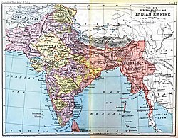
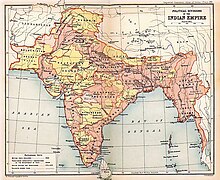
The divisions of British India were the administrative divisions of the Government of the British Raj or the Indian Empire.[1]
Divisions in Bengal
The seven Bengal Regulation Districts were named as 'divisions' in 1851:
- Jessore Division, area 14,853 sq mi, population 5,345,472 (1851)
- Bhagalpur Divisionarea 26,464 sq mi, population 8,431,000
- Cuttack Division, area 12,664 sq mi, population 2,793,883
- British division (Moorshedabad), area 17,556 sq mi, population 6,815,876
- Dacca Division, area 20,942 sq mi, population 4,055,800
- Patna Division, area 13,803 sq mi, population 7,000,000
- Chittagong Division, area 7,410 sq mi, population 2,406,950
The partition of Bengal in 1905 , there were seven divisions in Bengal :
- Presidency Division
- Burdwan Division
- Patna Division
- Bhagalpur Division
- Tirhut Division
- Chota Nagpur Division
- Orissa Division(Cuttack)
After the reunited of Bengal in 1911, the boundaries of Bengal were changed and the Bengal were divided five divisions . viz :
- Presidency Division
- Dacca Division
- Chittagong Division
- Rajshahi Division
- Burdwan Division
Divisions of Eastern Bengal and Assam
The divisions of Eastern Bengal and Assam Province 1905—1912:
- Dacca Division
- Chittagong Division
- Rajshahi Division
- Assam Valley Division
- Surma Valley and Hill Districts Division
Divisions in Baroda
Divisions in Bombay
Divisions in Burma
- Arakan Division
- Pegu Division
- Irrawaddy Division
- Tenasserim Division
- Mimbu Division
- Mandalay Division
- Sagaing Division
- Meiktila Division
Divisions in Central India
- Gwalior Residency
- Bundelkhand Agency
- Baghelkhand Agency
- Malwa Agency
- Bhopal Agency
- Indore Residency
- Bhopawar Agency
Divisions in Central Provinces and Berar
- Nagpur Division
- Jubbulpore Division
- Chhattisgarh Division
- Nerbudda Division
- Berar Division
Divisions of Hyderabad
- Aurangabad Division
- Gulbarga Division
- Gushanabad Division(Medak Division)
- Warangal Division
Divisions in Rajputana
- Western Rajputana States Residency
- Haraoti and Tonk Agency
- Mewar Residency
- Eastern Rajputana States Agency
- Kotah and Jhalawar Agency
Divisions in United Provinces
- Meerut Division
- Agra Division
- Bareilly Division
- Allahabad Division
- Benares Division
- Gorakhpur Division
- Kumaun Division
- Jhansi Division
- Lucknow Divisionformerly also Sitapur Division
- Faizabad Division(Fyzabad Division)
Divisions in Punjab
- Lahore Division
- Rawalpindi Division
- Multan Division
- Ambala Division and Delhi Divisionuntil 1921
- Jalandhar Division
See also
- Medak Gulshanabad Division
- Presidencies and provinces of British India
- Subdivisions of British India
- Territorial evolution of the British Empire
References
- Imperial Gazetteer of India. Published under the authority of His Majesty's Secretary of State for India in Council. Oxford: Clarendon Press, 1907-1909
External links
