Fortuna–Oungre Border Crossing
| Fortuna–Oungre Border Crossing | |
|---|---|
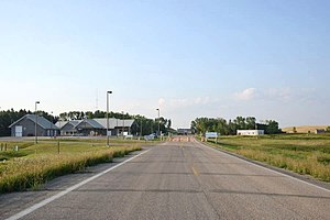
 US Border Inspection Station at Fortuna, North Dakota looking north | |
| Location | |
| Country | United States; Canada |
| Location |
|
| Coordinates | 48°59′58″N 103°48′34″W / 48.999544°N 103.809461°W |
| Details | |
| US Phone | (701) 834-2493 |
| Fortuna Hours | Open 9:00AM - 5:00PM |
| Oungre Hours | Open 8:00AM - 9:00PM 2nd Sunday in March to first Saturday in November. Open 9:00AM - 10:00PM remainder of the year |
| Website https://www.cbp.gov/contact/ports/fortuna-north-dakota-3417 https://www.cbsa-asfc.gc.ca/do-rb/offices-bureaux/624-eng.html | |
The Fortuna–Oungre Border Crossing connects the towns of
Oungre, Saskatchewan on the Canada–US border. It is located along the CanAm Highway: U.S. Route 85 on the American side and Saskatchewan Highway 35 on the Canadian side. It is the westernmost border crossing in the state of North Dakota. It is a lightly-used crossing with the reduction in local population due to agricultural automation and the 1984 closure of the Fortuna Air Force Station.[1]
The US replaced its 1950s-era yellow brick border station in 2004 with a sprawling grey inspection complex. The Canada border station was built in 1978. This crossing was established as a port of entry in 1930.
See also
References
- ^ Larson, Troy (13 July 2013). "A LAST LOOK AT THE ABANDONED FORTUNA AIR FORCE STATION". Ghosts of North Dakota. Retrieved 22 November 2015.
