
New Bern, North Carolina
New Bern, North Carolina | ||
|---|---|---|
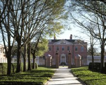
.jpg) Main façade of the New Bern City Hall | ||
|
FIPS code 37-46340[5] | | |
| GNIS feature ID | 2404358[4] | |
| Website | newbernnc | |
New Bern (formerly Newbern
It is located at the confluence of the Neuse and the Trent rivers, near the headwaters of Pamlico Sound on the North Carolina coast. It lies 112 miles (180 km) east of Raleigh, 89 miles (143 km) north of Wilmington, and 162 miles (261 km) south of Norfolk. New Bern is the birthplace of Pepsi.
New Bern was founded in October 1710 by the
New Bern is the second-oldest European-settled colonial town in North Carolina, after Bath.[9] It served as the capital of North Carolina from 1770 to 1792. After the American Revolution (1775–1783), New Bern became wealthy and quickly developed a rich cultural life. At one time New Bern was called "the Athens of the South,"[9] renowned for its Masonic Temple and Athens Theater. These are both still very active today.
New Bern has four historic districts listed on the National Register of Historic Places; their numerous contributing buildings include residences, stores and churches dating back to the early eighteenth century. Within walking distance of the waterfront are more than 164 homes and buildings listed on the National Register. Also nearby are several bed and breakfasts, hotels, restaurants, banks, antiques stores and specialty shops. The historic districts contain many of the city's 2,000 crape myrtles—its official flower—and developed gardens. New Bern has two "Local Historic Districts", a municipal zoning overlay that affords legal protection to the exteriors of New Bern's historic structures.
History
New Bern was settled in October 1710 by the
There was no printer in North Carolina until 1749, when the North Carolina Assembly commissioned
During the 19th-century Federal period, New Bern became the largest city in North Carolina, developed on the trade of goods and slaves associated with
In 1862 during the early stages of the

Due to the continuous occupation by the Union Army, New Bern avoided some of the destruction of the war years. There was much social disruption because of the occupation and the thousands of
The state legislature defined the city and county as part of
By 1890 New Bern had become the largest lumber center in North Carolina and one of the largest in all of the South. During this time, as many as 16 lumber mills were running and employing hundreds of men from New Bern and the area. The competitive nature of the lumber barons, the abundance of lumber and craftsmen, led to the construction in New Bern of some of the finest homes in the South, many of which have survived. The lumber boom lasted until the 1920s. One by one the lumber mills went out of business. Today only Weyerhaeuser manufactures lumber in the area.[citation needed]
The city has four National Historic Districts and two local ones, which have helped preserve the character of the architecture. The Downtown Local Historic District is 368.64 acres (149.18 ha) or 0.576 square miles (1.49 km2); the Riverside Local Historic District covers 51.94 acres (21.02 ha) or 0.081 square miles (0.21 km2). Union Point Park borders the Neuse and Trent rivers.
Hurricanes
New Bern's location near the Atlantic coast renders it subject to the effects of Atlantic hurricane seasons. For example, in the 18th century the town suffered severe damage in the Great Chesapeake Bay Hurricane of 1769.[16] Other hurricanes such as Ione in 1955 and Floyd in 1999 (just as examples) have also caused significant flooding and damage.[17]
In September 2018, Florence made landfall in the United States just south of Wrightsville Beach, 88.4 miles southwest of New Bern. A storm surge up to 13.5 feet in addition to days of heavy rains severely flooded various parts of the town. [National Hurricane Center Storm Surge Inundation Map, Sept 13, 2018]
Geography

New Bern is located at the confluence of the Trent and Neuse rivers, two tidal waterways, in North Carolina's Inner Banks region.
According to the United States Census Bureau, the city has a total area of 29.7 square miles (76.9 km2), of which 28.2 square miles (73.1 km2) is land and 1.4 square miles (3.7 km2), or 4.87%, is water.[7]
Climate
New Bern experiences a
| Climate data for New Bern, North Carolina (Coastal Carolina Regional Airport), 1991–2020 normals, extremes 1948–present | |||||||||||||
|---|---|---|---|---|---|---|---|---|---|---|---|---|---|
| Month | Jan | Feb | Mar | Apr | May | Jun | Jul | Aug | Sep | Oct | Nov | Dec | Year |
| Record high °F (°C) | 82 (28) |
88 (31) |
92 (33) |
95 (35) |
100 (38) |
105 (41) |
106 (41) |
103 (39) |
101 (38) |
97 (36) |
87 (31) |
83 (28) |
106 (41) |
| Mean maximum °F (°C) | 75.1 (23.9) |
77.0 (25.0) |
82.5 (28.1) |
87.3 (30.7) |
92.0 (33.3) |
95.8 (35.4) |
96.7 (35.9) |
95.8 (35.4) |
91.8 (33.2) |
86.9 (30.5) |
80.6 (27.0) |
75.6 (24.2) |
97.8 (36.6) |
| Mean daily maximum °F (°C) | 55.1 (12.8) |
58.5 (14.7) |
64.9 (18.3) |
73.6 (23.1) |
80.4 (26.9) |
86.7 (30.4) |
89.6 (32.0) |
87.9 (31.1) |
83.1 (28.4) |
74.9 (23.8) |
65.6 (18.7) |
58.5 (14.7) |
73.2 (22.9) |
| Daily mean °F (°C) | 44.5 (6.9) |
47.1 (8.4) |
53.2 (11.8) |
61.8 (16.6) |
69.5 (20.8) |
77.0 (25.0) |
80.4 (26.9) |
78.9 (26.1) |
74.2 (23.4) |
64.2 (17.9) |
54.2 (12.3) |
47.7 (8.7) |
62.7 (17.1) |
| Mean daily minimum °F (°C) | 33.8 (1.0) |
35.8 (2.1) |
41.5 (5.3) |
49.9 (9.9) |
58.7 (14.8) |
67.2 (19.6) |
71.2 (21.8) |
70.0 (21.1) |
65.2 (18.4) |
53.5 (11.9) |
42.8 (6.0) |
36.9 (2.7) |
52.2 (11.2) |
| Mean minimum °F (°C) | 17.6 (−8.0) |
21.5 (−5.8) |
25.9 (−3.4) |
35.2 (1.8) |
46.1 (7.8) |
56.5 (13.6) |
63.6 (17.6) |
62.8 (17.1) |
54.4 (12.4) |
38.0 (3.3) |
27.7 (−2.4) |
22.5 (−5.3) |
16.1 (−8.8) |
| Record low °F (°C) | 1 (−17) |
6 (−14) |
16 (−9) |
29 (−2) |
32 (0) |
44 (7) |
55 (13) |
50 (10) |
43 (6) |
26 (−3) |
17 (−8) |
−4 (−20) |
−4 (−20) |
| Average precipitation inches (mm) | 3.89 (99) |
3.32 (84) |
3.85 (98) |
3.18 (81) |
4.25 (108) |
4.60 (117) |
6.26 (159) |
6.81 (173) |
6.33 (161) |
3.56 (90) |
3.33 (85) |
3.63 (92) |
53.01 (1,346) |
| Average snowfall inches (cm) | 0.3 (0.76) |
0.3 (0.76) |
0.0 (0.0) |
0.1 (0.25) |
0.0 (0.0) |
0.0 (0.0) |
0.0 (0.0) |
0.0 (0.0) |
0.0 (0.0) |
0.0 (0.0) |
0.0 (0.0) |
0.9 (2.3) |
1.5 (3.8) |
| Average precipitation days (≥ 0.01 in) | 10.2 | 9.6 | 10.0 | 8.9 | 10.6 | 11.5 | 13.6 | 13.6 | 11.1 | 8.8 | 8.3 | 10.8 | 127.0 |
| Average snowy days (≥ 0.1 in) | 0.1 | 0.1 | 0.0 | 0.1 | 0.0 | 0.0 | 0.0 | 0.0 | 0.0 | 0.0 | 0.0 | 0.2 | 0.5 |
| Source: | |||||||||||||
Demographics
| Census | Pop. | Note | %± |
|---|---|---|---|
| 1800 | 2,467 | — | |
| 1820 | 3,663 | — | |
| 1830 | 3,796 | 3.6% | |
| 1840 | 3,690 | −2.8% | |
| 1850 | 4,681 | 26.9% | |
| 1860 | 5,432 | 16.0% | |
| 1870 | 5,849 | 7.7% | |
| 1880 | 6,443 | 10.2% | |
| 1890 | 7,843 | 21.7% | |
| 1900 | 9,090 | 15.9% | |
| 1910 | 9,961 | 9.6% | |
| 1920 | 12,198 | 22.5% | |
| 1930 | 11,981 | −1.8% | |
| 1940 | 11,815 | −1.4% | |
| 1950 | 15,812 | 33.8% | |
| 1960 | 15,717 | −0.6% | |
| 1970 | 14,660 | −6.7% | |
| 1980 | 14,557 | −0.7% | |
| 1990 | 17,363 | 19.3% | |
| 2000 | 23,128 | 33.2% | |
| 2010 | 29,524 | 27.7% | |
| 2020 | 31,291 | 6.0% | |
| U.S. Decennial Census[21] | |||
2020 census
| Race | Number | Percentage |
|---|---|---|
White (non-Hispanic)
|
17,281 | 55.23% |
Black or African American (non-Hispanic)
|
8,281 | 26.46% |
Native American
|
86 | 0.27% |
Asian
|
2,035 | 6.5% |
Pacific Islander
|
23 | 0.07% |
Other/Mixed
|
1,483 | 4.74% |
Latino
|
2,102 | 6.72% |
As of the 2020 United States census, there were 31,291 people, 13,757 households, and 8,070 families residing in the city.
2012
The population of the area was 30,291 (95% urban, 5% rural) people in 2014, a 31% increase in growth since 2000. Gender distribution is 47.5% male and 52.5% female with a median resident age of 38.8. The percentage of residents under the age of 18 was 24.2%. The 2012 racial breakdown includes White alone – 16,304 (54%), Black alone – 9,634 (31.9%),
The City of New Bern 2010 Census information shows the population of the area was approximately 29,524 people. From 2000 to 2010, the New Bern city population growth percentage was 27.7% (or from 23,128 people to 29,524 people). 22.8% of the New Bern city residents were under 18 years of age. Census 2010 race data for New Bern city include the racial breakdown percentages of 57.0 white, 32.8% black, 3.6% Asian, 5.8% Hispanic and less than 1% Native American, Also, there were 14,471 housing units in the City of New Bern, 88.2% of which were occupied housing units.
Arts and culture
This section needs expansion. You can help by adding to it. (September 2023) |
New Bern has several sites listed on the National Register of Historic Places.
Education
Colleges
High schools
- New Bern High School
- Craven Early College High School
Middle schools
- Grover C. Fields Middle School
- H.J. McDonald Middle School
- West Craven Middle School
Elementary schools
- Trent Park Elementary School
- Oaks Road Elementary School
- J.T. Barber Elementary School
- Brinson Memorial Elementary School
- Ben D. Quinn Elementary School
- Albert H. Bangert Elementary School
- Creekside Elementary School
- Bridgeton Elementary School
Private schools
- Calvary Baptist Christian School
- St. Paul Catholic School (St. Paul Education Center)
- The Epiphany School of Global Studies
- New Bern Christian Academy
Media
Radio stations
- 1450 AM / 104.3 FM WNOS – News/Talk/Sports
- 1490 AM / 103.9 FM WWNB - ESPN Radio – sports talk
- 88.5 FM WZNB- Public Radio East – Classical Music
- 89.3 FM WTEB- Public Radio East – NPR/News/Talk
- 89.9 FM W210BS - Classical WCPE
- 92.7 FM WBNK - K-Love - Christian Contemporary
- 91.9 FM WAAE- American Family Radio – Religious
- 93.3 FM WERO - Bob 93.3 - Top 40
- 94.1 FM WNBU - Talk
- 95.1 FM WRNS - Country
- 95.7 FM W239BC- R&B Oldies
- 97.5 FM WLGT - The Bridge – Contemporary Christian
- 97.9 FM WNBB – Classic Country
- 99.5 FM WMJV – 99.5/97.5 The Wave – Hot Adult Contemporary
- 99.9 FM WTTY-LP - Oldies
- 101.9 FM WIKS - Kiss FM – Hip Hop & R&B
- 103.3 FM WMGV - V103.3 - Soft AC
- 104.5 FM WSTK - Variety
- 105.1 FM WBKZ - Air 1 - Christian Contemporary
- 105.5 FM WXQR– Pure Rock
- 107.9 FM WNCT – Classic Hits
- 106.5 FM WSFL – Classic Rock
- 107.1 FM WTKF-FM – The Talk Station
Infrastructure
Transportation
Coastal Carolina Regional Airport is a public airport located 3 miles (5 km) south of the central business district of New Bern. The airport offers connecting flights to Charlotte daily.
The New Bern Transport Corporation, a business entity owned by
The north-south U.S. Route 17 and the east-west U.S. Route 70 pass through New Bern.
As late as 1950, the
Notable people
- Charles Laban Abernethy (1872–1955), US Congressman from North Carolina between 1922 and 1935[26]
- Lewis Addison Armistead (1817–1863), Confederate States Army general [27]
- MLBpitcher
- George Edmund Badger (1795–1866), US Senator from 1846 to 1855
- Bessie Banks (born 1938), singer, first to record the song "Go Now"
- Graham Arthur Barden (1896–1967), 13-term US congressmanfrom 1935 to 1961
- Cullen A. Battle (1829–1905), postbellum mayor of New Bern
- Samuel J. Battle (1883–1966), first African-American policeman in New York City
- NBAHall of Fame basketball player
- Sarah Boone (1832–1904), inventor
- Bill Bunting (born 1947), NBA Basketball player
- Christoph von Graffenried, 1st Baron of Bernberg (1661–1743), British peer from the Canton of Bern, who founded New Bern in 1710[8]
- Caleb Bradham (1867–1934), pharmacist, best known as inventor of Pepsi
- John Heritage Bryan (1798–1870), US congressman from 1825 to 1829
- Chase Crawford (born 1996), actor and producer
- North-Carolina Gazette, North Carolina's first newspaper.
- coach
- Davon Drew (born 1985), NFL tight end
- Elwood Edwards (born 1949), voice of AOL's "You've got mail"
- William Gaston (1778–1834), jurist and US congressman from 1813 to 1817
- African American state senator in Ohio.
- NFL running back for Cleveland Browns
- Nathan Healy (born 1990), professional basketball player[28]
- William J. Hutchins (1813–1884), mercantilist, railroad owner, and Mayor of Houston from 1861 to 1862[29]
- Donna Hutchinson (born 1949), former member of Arkansas House of Representatives, born in New Bern[30]
- Jumpin Jackie Jackson (1940–2019), Harlem Globetrotter basketball player
- NFL player for Green Bay Packers and Seattle Seahawks; Athletic Director of University of Wisconsin–Milwaukee
- Peter Loftin (1958–2019), entrepreneur
- Bob Mann (1924–2006), NFL player; first African American to play for Detroit Lions and later Green Bay Packers
- Washington Redskins
- Eliza Jane McKissack (1828–1900), director and founding member of Conservatory of Music at University of North Texas
- World Wrestling Entertainment
- David B. Mintz (fl. 1805–1806), Methodist minister and circuit rider
- Supreme Court of North Carolina
- New York Timeslist "The 25 Greatest Actors of the 21st Century"
- Dan Neil (born 1960), Pulitzer Prize-winning automotive journalist
- Bob Perry (1934–2017), MLB outfielder[31]
- James E.C. Perry (born 1944), justice of Supreme Court of Florida
- Chandler Seagle (born 1996), MLB catcher
- Flying Tiger during World War II
- Brian Simmons (born 1975), NFL player for Cincinnati Bengals and New Orleans Saints
- Furnifold Simmons (1854–1940), former U.S. senator
- William Henry Singleton (1843–1938), former slave who became noted American Civil War soldier
- Richard Dobbs Spaight (1758–1802), 8th Governor of North Carolina from 1792 to 1795, and US congressman for the 10th District from 1798 to 1801
- Sara Stanley(1837–1918) Abolitionist, educator
- Edward Stanly (1810–1872), son of John Stanly, congressman 1837–1843, appointed military governor of North Carolina in 1862
- USS Stanly (DD-478)
- John Stanly (1774–1834), father of Edward Stanly, US congressman (1801–1803 and 1809–1811)
- MMA fighter, currently competing in the middleweight division of the UFCas of August 2021
- Adam Warren (born 1987), MLB pitcher
- George Henry White (1852–1918), attorney, banker, last of four African-American US congressmen from North Carolina in the 19th century; next was not elected until 1992
- Kevin Meade Williamson (born 1966), screenwriter, involved with Scream, I Know What You Did Last Summer, and television series Dawson's Creek
- Bayard Wootten (1875–1959), photographer and suffragette
In popular culture
- Jules Verne's 1896 novel Face au Drapeau (Facing the Flag) featured New Bern as the place where one of that story's main characters is committed to an asylum by the U.S. government.[32]
- Nicholas Sparks set a few of his novels (The Notebook, A Bend in the Road, The Wedding, and The Return) in the city.
References
- ^ Gary (August 3, 2021). "Visit The Birthplace of Pepsi - NC!". Island Life NC. Retrieved April 1, 2023.
- ^ "Board of Aldermen". New Bern, Official Website.
- ^ "ArcGIS REST Services Directory". United States Census Bureau. Retrieved September 20, 2022.
- ^ a b U.S. Geological Survey Geographic Names Information System: New Bern, North Carolina
- ^ "U.S. Census website". United States Census Bureau. Retrieved January 31, 2008.
- OL 24141080M.
- ^ a b "Geographic Identifiers: 2010 Demographic Profile Data (G001): New Bern city, North Carolina". U.S. Census Bureau, American Factfinder. Archived from the original on February 12, 2020. Retrieved January 2, 2015.
- ^ OCLC 2864657 – via Internet Archive.
- ^ a b "New Bern History". New Bern Visitors. Retrieved April 9, 2019.
- ISBN 9780807856246.
- ^ Dill, A.T. (1986). "Graffenried, Christoph, Baron Von". Dictionary of North Carolina Biography. University of North Carolina Press.
- ^ Powell, 2000, pp. 34-35
- ^ Lee, 1923, p. 53
- ^ ISBN 9780807856246.
- ^ Whitelaw Reid, After the War: A Southern Tour, May, 1865 to May 1, 1866, p.29, Moore, Wilstach & Baldwin, 1866.
- ^ Hand, Bill (31 July 2016). Awash in a hurricane’s wrath in 1769, New Bern Sun Journal
- ^ Hand, Bill (17 September 2017). Hurricane Ione was a storm to remember, New Bern Sun Journal
- ^ "NowData – NOAA Online Weather Data". National Oceanic and Atmospheric Administration. Retrieved May 14, 2021.
- ^ "Station: New Bern Craven CO AP, NC". U.S. Climate Normals 2020: U.S. Monthly Climate Normals (1991-2020). National Oceanic and Atmospheric Administration. Retrieved May 14, 2021.
- ^ "Station: New Bern Craven CO Regional Airport, NC". U.S. Monthly Climate Normals (1981-2010). National Oceanic and Atmospheric Administration. Retrieved May 14, 2021.
- ^ "Census of Population and Housing". Census.gov. Retrieved June 4, 2015.
- ^ "Explore Census Data". data.census.gov. Retrieved December 24, 2021.
- ^ "New Bern, North Carolina (NC 28560) profile: Population, maps, real estate, averages, homes, statistics, relocation, travel, jobs, hospitals, schools, crime, moving, houses, news, sex offenders".
- ^ "Southern Railway, Table 8". Official Guide of the Railways. 82 (8). National Railway Publication Company. January 1950.
- ^ "Atlantic and East Carolina Railway". Official Guide of the Railways. 84 (7). National Railway Publication Company. December 1951.
- ^ Abernathy, Charles Laban. history.house.gov. Retrieved November 2, 2020.
- ^ Who Was Who in America, Historical Volume, 1607–1896. Marquis Who's Who. 1963.
- ^ Nathan Healy Stats, News, Bio. ESPN. Retrieved November 2, 2020.
- ^ Julia Beazley (April 6, 2017). "HUTCHINS, WILLIAM J." Handbook of Texas Online. Texas State Historical Association. Retrieved November 17, 2017.
- ^ "Donna Hutchinson". ballotpedia.org. Retrieved August 17, 2013.
- ^ Bob Perry Stats. Baseball-Reference. Retrieved November 2, 2020.
- ^ Backwards to Britain, edited by William Butcher (Chambers, 1992)
Further reading
- Browning, Judkin. Shifting Loyalties: The Union Occupation of Eastern North Carolina (Univ of North Carolina Press, 2011). focus on Craven County
- Farmer, Vina Hutchinson. New Bern (Arcadia Publishing, 2007).
- Kinsey, Marissa N. "Beyond the Vale: Visualizing Slavery in Craven County, North Carolina." (2017). online
- Todd, Vincent H., ed. (1920). Christoph von Graffenried's Account of the Founding of New Bern. Publications of the North Carolina Historical Commission. Raleigh: Edwards & Broughton Printing Co. OL 6640211M – via Internet Archive.
- Watson, Alan D. A History of New Bern and Craven County (Tryon Palace Commission, 1987).
- Lee, James Melvin (1923). History of American journalism. Boston, New York, Houghton Mifflin Company. (Alternative publication)
- Powell, William S., ed. (2000). Dictionary of North Carolina biography. Vol. II. University of North Carolina Press.
External links
- Official website

 Geographic data related to New Bern, North Carolina at OpenStreetMap
- New Bern Convention and Visitors Bureau
- Works by or about New Bern, North Carolina at Internet Archive
- . Encyclopædia Britannica. Vol. 19 (11th ed.). 1911. p. 463.
Municipalities and communities of Craven County, North Carolina, United States | ||
|---|---|---|
| Cities |  | |
| Towns | ||
| CDPs | ||
| Other community | ||
| ||
| International | |
|---|---|
| National | |
| Geographic | |
| Other | |