
Great Strickland
| Great Strickland | ||
|---|---|---|
Shire county | ||
| Region | ||
| Country | England | |
| Sovereign state | United Kingdom | |
| Post town | PENRITH | |
| Postcode district | CA10 | |
| Dialling code | 01931 | |
| Police | Cumbria | |
| Fire | Cumbria | |
| Ambulance | North West | |
Penrith and the Border | ||
Great Strickland is a village and
Cumbrian mountains in the west and the Pennines in the east. It is 5 miles (8.0 km) south east of Penrith, and is in the former county of Westmorland.[2] At the 2011 Census Great Strickland was grouped with Little Strickland, itself enlarged to include Thrimby after 2001, to give a total population of 370.[1] The equivalent figure from the 2001 census was 342.[3]
The sandstone village church is dedicated to
Saint Barnabas and was constructed in 1872. It has a bell turret.[2]
To the west of the village lies the River Leith, the West Coast Main Line and the M6 Motorway. To the south lies the small settlement of Little Strickland.
-
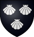 Strickland Coat of Arms
 -
 St Barnabas' Church, Great Strickland


History
The village gets its name from a Scandinavian term for pastureland around the 9th and 10th centuries.
In 1179, the local heiress Christian de Leteham married Walter de Castlecarrock and he changed his name to de Strikeland.[4]
See also
References
- ^ Office for National Statistics. Retrieved 4 April 2021.
- ^ a b Great Stickland
- ^ UK Census (2001). "Local Area Report – Great Strickland/Little Strickland/Thrimby Parish (16UF025)". Nomis. Office for National Statistics. Retrieved 4 April 2021.
- ^ Strickland family
External links
- Cumbria County History Trust: Great Strickland (nb: provisional research only – see Talk page)
![]() Media related to Great Strickland at Wikimedia Commons
Media related to Great Strickland at Wikimedia Commons