
Gyirong County
This article includes a list of general references, but it lacks sufficient corresponding inline citations. (October 2021) |
Kyirong County
吉隆县 • སྐྱིད་གྲོང་རྫོང་། Gyirong, Jilong | |
|---|---|
China Standard) | |
| Website | www |
| Gyirong County | |||||||||
|---|---|---|---|---|---|---|---|---|---|
| Chinese name | |||||||||
Tibetan | སྐྱིད་གྲོང་རྫོང་། | ||||||||
| |||||||||
Kyirong
It is one of the four counties that comprise the Qomolangma National Nature Preserve (Kyirong, Dinggyê, Nyalam, and Tingri).[5]
In 1945,
The local Kyirong language has been researched thoroughly and folk literature of this region was collected and published during the 1980s.
Special places
Of outstanding importance are the Byams-sprin lha-khang temple, which was built in the 7th century A. D., and the ´Phags-pa lha-khang temple. The ´Phags-pa lha-khang formerly contained one of the holiest Avalokiteshvara statues of Tibet, the statue of the Ārya Va-ti bzang-po. This statue was brought to India in 1959 and is now kept in
Of some importance is the bKra-shis bdam-gtan gling monastery, founded by yongs-´dzin Ye-shes rgyal-mtshan (1713–1793), who was one of the teachers of the 8th Dalai Lama.
Administration divisions
Gyirong County is divided into 2 towns and 4 townships.
| Name | Chinese | Hanyu Pinyin
|
Tibetan
|
Wylie | ||
|---|---|---|---|---|---|---|
| Towns | ||||||
| Dzongka Town (Zongga) |
宗嘎镇 | Zōnggā zhèn | རྫོང་དགའ་གྲོང་རྡལ། | rdzong dga' grong rdal | ||
| Kyirong Town (Gyirong) |
吉隆镇 | Jílóng zhèn | སྐྱིད་གྲོང་གྲོང་རྡལ། | skyid grong grong rdal | ||
| Townships | ||||||
| Drakna Township | 差那乡 | Chànà xiāng | བྲག་སྣ་ཤང་། | brag sna shang | ||
| Trepa Township | 折巴乡 | Zhébā xiāng | ཀྲེ་པ་ཤང་། | kre pa shang | ||
| Gungtang Township | 贡当乡 | Gòngdāng xiāng | གུང་ཐང་ཤང་། | gung thang shang | ||
| Sale Township | 萨勒乡 | Sàlè xiāng | ས་ལེ་ཤང་། | sa le shang | ||
Transportation
Up to 1960, one of the main trade routes between Nepal and Tibet passed through this region. Easily accessible from Nepal, it was used several times as an entrance gate for military actions from the site of Nepal against Tibet. In 2017, Chinese soldiers began building a new road on the Tibetan side of the border, and intend to continue construction into Nepal via
A possibility of a transborder railway link along a similar route (Gyirong to Kathmandu via Rasuwa) is considered as well.[7]
Maps
-
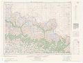 Map including part of Kyirong County (AMS, 1955)
 -
 Map including "Gyirong (Zongga)" (DMA, 1985)


References
- ^ "日喀则市第七次全国人口普查主要数据公报" (in Chinese). Government of Xigazê. 2021-07-20.
- ^ Dorje 2004, p. 327.
- ^ "Geographical names of Tibet AR (China): Xigazê Prefecture-Level City". KNAB Place Name Database. Institute of the Estonian Language. 2018-06-03.
- ISBN 978-3-031-09165-0. Retrieved 2024-03-07.
- ^ Department of Forestry, Government of the Tibet Autonomous Region, People’s Republic of China, ‘’Report on Protected Lands in the Tibet Autonomous Region’’ Lhasa: Tibet Autonomous Region Government Publishing House, 2006
- ^ Lhuboom; Richard Finney (September 8, 2017). "China Builds Road to Nepal Border, Sets Up Flag". Translated by Damdul, Dorjee. Radio Free Asia.
The group, which appeared on Sept. 1 at Nepal's border with Kyirong county in the Tibet Autonomous Region, distributed food and clothing to the Nepalese, promising to help them with the roadwork and other construction projects in Nepal if permission can be obtained from government authorities in Kathmandu, a resident of the area told RFA's Tibetan Service.
- ^ "The Uneasy Future of the Nepal-China Railway". 2019-06-20.
Bibliography
- Chan, Victor (1994), Tibet Handbook, Moon Publications – via archive.org
- Diemberger, Hildegard (2014). When a Woman Becomes a Religious Dynasty: The Samding Dorje Phagmo of Tibet. Columbia University Press. ISBN 978-0-231-14321-9.
- Dorje, Gyurme (2004), Footprint Tibet Handbook with Bhutan (3rd ed.), Bath: Footprint Handbooks, ISBN 1-903471-30-3– via archive.org
- Jackson, David P. (1976), "The early history of Lo (Mustang) and Ngari" (PDF), Journal of the Institute of Nepal and Asian Studies, 4 (1), Kathmandu: Tribhuvan University: 39–56
- Roberts, Peter Alan (2007). The Biographies of Rechungpa: The Evolution of a Tibetan Hagiography. Routledge. ISBN 978-1-135-98912-5.
- Roberts, Peter Alan (2000), The Biographies of Ras-chung-pa: The Evolution of a Tibetan Hagiography, University of Oxford
- Ryavec, Karl E. (2015), A Historical Atlas of Tibet, University of Chicago Press, ISBN 978-0-226-24394-8
- Roland Bielmeier, Silke Herrmann: Märchen, Sagen und Schwänke vom Dach der Welt. Tibetisches Erzählgut in Deutscher Fassung, Band 3. Viehzüchtererzählungen sowie Erzählgut aus sKyid-grong und Ding-ri, gesammelt und ins Deutsche übertragen. Vereinigung für Geschichtswissenschaft Hochasiens Wissenschaftsverlag (= Beiträge zur tibetischen Erzählforschung, 3), Sankt Augustin 1982
- Harrer, Heinrich: Seven Years in Tibet; Beyond Seven Years in Tibet: My Life Before, During, and After (2007)
- Aufschnaiter, Peter: Land and Places of Milarepa. East and West, 26 (1976):1-2, S. 175-189
- Brauen, Martin: Heinrich Harrers Impressionen aus Tibet. Innsbruck, 1974
- Brauen, Martin: Peter Aufschnaiter. Sein Leben in Tibet. Innsbruck, 1983
- Ehrhard, Franz-Karl: Die Statue des Ārya Va-ti bzang-po. Wiesbaden, 2004
- Huber, Brigitte: The Tibetan Dialect of Lende (Kyi-rong): a grammatical description with historical annotations. Bonn, 2005
- Dieter Schuh: Das Archiv des Klosters bKra-shis bsam-gtan gling von sKyid-grong. Bonn, 1988
| Counties | ||
|---|---|---|

- Changmoche Monastery
- Chokorgyel Monastery
- Daklha Gampo
- Donggar Monastery
- Dorje Pakmo
- Drongtse Monastery
- Garju Monastery
- Manmogang Monastery
- Menri Monastery
- Milarepa's Cave
- Narthang Monastery
- Ngor
- Palcho Monastery
- Ralung Monastery
- Sakya Monastery
- Shalu Monastery
- Tashilhunpo
- Tsi Nesar
| International | |
|---|---|
| National | |