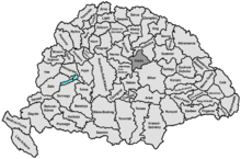
Hajdú County
This article needs additional citations for verification. (December 2012) |
| Hajdú County Comitatus Hajdonicalis ( County of the Kingdom of Hungary (1876-1946) County of the Second Hungarian Republic (1946-1949) County of the Hungarian People's Republic (1949-1950) | |
|---|---|
 | |
| Capital | Debrecen |
| Area | |
| • Coordinates | 47°32′N 21°38′E / 47.533°N 21.633°E |
• 1910 | 3,343 km2 (1,291 sq mi) |
| Population | |
• 1910 | 253,863 |
| History | |
• Established | 1876 |
• Merged into Hajdú-Bihar County | 16 March 1950 |
| Today part of | Hungary |
Hajdú, formerly known as Hajdúság, was an administrative county (
Hajdú-Bihar
.
Geography
Hajdú county shared borders with the counties
Jász-Nagykun-Szolnok. The river Tisza touched its western border. The Hortobágy National Park
steppe lies in the county. Its area was 3343 km² around 1910.
History
The Hajdúság region had a special status in the Kingdom of Hungary, but was turned into the proper county Hajdú in the 19th century. At the 1950 county reform, it was merged with
Demographics

| Census | Total | Hungarian | German | Other or unknown |
|---|---|---|---|---|
| 1880[2] | 173,329 | 164,320 (97.75%) | 2,788 (1.66%) | 998 (0.59%) |
| 1890[3] | 190,978 | 189,193 (99.07%) | 1,132 (0.59%) | 653 (0.34%) |
| 1900[4] | 223,612 | 221,798 (99.19%) | 972 (0.43%) | 842 (0.38%) |
| 1910[5] | 253,863 | 251,918 (99.23%) | 1,044 (0.41%) | 901 (0.35%) |
| Census | Total | Calvinist |
Roman Catholic | Greek Catholic | Jewish | Other or unknown |
|---|---|---|---|---|---|---|
| 1880 | 173,329 | 135,744 (78.32%) | 18,014 (10.39%) | 9,986 (5.76%) | 8,444 (4.87%) | 1,141 (0.66%) |
| 1890 | 190,978 | 147,141 (77.05%) | 21,795 (11.41%) | 10,999 (5.76%) | 9,749 (5.10%) | 1,294 (0.68%) |
| 1900 | 223,612 | 166,063 (74.26%) | 29,549 (13.21%) | 13,509 (6.04%) | 12,806 (5.73%) | 1,685 (0.75%) |
| 1910 | 253,863 | 185,648 (73.13%) | 35,059 (13.81%) | 15,336 (6.04%) | 15,301 (6.03%) | 2,519 (0.99%) |
Subdivisions

In the early 20th century, the subdivisions of Hajdú county were:
| Districts (járás) | |
|---|---|
| District | Capital |
| Hajdúböszörmény | Hajdúböszörmény |
| Hajdúszoboszló | Hajdúszoboszló |
| Központ | Debrecen |
| Urban counties (törvényhatósági jogú város) | |
| Debrecen | |
| Urban districts (rendezett tanácsú város) | |
| Hajdúböszörmény | |
| Hajdúnánás | |
| Hajdúszoboszló | |
Notes
References
- ^ Party state and county system 1949-1950 Archived 2020-08-05 at the Wayback Machine, Zempléni Múzsa
- ^ "Az 1881. év elején végrehajtott népszámlálás főbb eredményei megyék és községek szerint rendezve, II. kötet (1882)". library.hungaricana.hu. Retrieved 2021-09-28.
- ^ "A Magyar Korona országainak helységnévtára (1892)". library.hungaricana.hu. Retrieved 2021-09-29.
- ^ "A MAGYAR KORONA ORSZÁGAINAK 1900". library.hungaricana.hu. Retrieved 2021-09-29.
- ^ "KlimoTheca :: Könyvtár". Kt.lib.pte.hu. Retrieved 2021-09-29.


