Kaminoseki
Kaminoseki
上関町 | |
|---|---|
Town | |
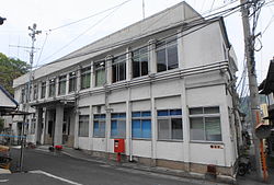
 Kaminoseki town hall | |
 Location of Kaminoseki in Yamaguchi Prefecture | |
 | |
| Coordinates: 33°49′51″N 132°7′38″E / 33.83083°N 132.12722°E | |
| Country | Japan |
| Region | Chūgoku San'yō |
| Prefecture | Yamaguchi |
| District | Kumage |
| Area | |
| • Total | 34.69 km2 (13.39 sq mi) |
| Population (May 31, 2023) | |
| • Total | 2,340 |
| • Density | 67/km2 (170/sq mi) |
| Time zone | UTC+09:00 (JST) |
| City hall address | 503 Nagashima, Kaminoseki, Yamaguchi-ken 742-1402 |
| Website | Official website |
| Symbols | |
| Fish | Red seabream |
| Flower | Chrysanthemum |
| Tree | Chamaecyparis obtusa |


Kaminoseki (上関町, Kaminoseki-chō) is a town located in Kumage District, Yamaguchi Prefecture, Japan.[1]As of 31 May 2023[update], the town had an estimated population of 2340 in 6947 households and a population density of 67 inhabitants per square kilometre (173.53/sq mi).[2] The total area of the town is 34.69 km2 (13.39 sq mi).
Geography
Kaminoseki is located in southeastern Yamaguchi Prefecture. The town area consists of the tip of the Murotsu Peninsula and islands such as Nagashima, Iwaishima, and Yashima, and the center of the town is the Murotsu district at the tip of the peninsula and the opposite shore of the Murotsu district, which is connected to the mainland by the Kaminoseki Ohashi Bridge. It is almost completely surrounded by the Seto Inland Sea.
Islands
- Iwaishima
- Yashima
- Nagashima
Neighbouring municipalities
Yamaguchi Prefecture
Climate
Kaminoseki has a humid subtropical climate (Köppen climate classification Cfa) with very warm summers and cool winters. The average annual temperature in Kaminoseki is 16.0 °C. The average annual rainfall is 1719 mm with September as the wettest month. The temperatures are highest on average in July, at around 26.2 °C, and lowest in January, at around 6.6 °C.[3]
Demographics
Per Japanese census data, the population of Kaminoseki, the population has decreased to one-third in the last 40 years, and the population is rapidly aging.
| Year | Pop. | ±% |
|---|---|---|
| 1940 | 10,542 | — |
| 1950 | 13,220 | +25.4% |
| 1960 | 11,196 | −15.3% |
| 1970 | 8,308 | −25.8% |
| 1980 | 6,773 | −18.5% |
| 1990 | 5,516 | −18.6% |
| 2000 | 4,307 | −21.9% |
| 2010 | 3,332 | −22.6% |
| Waki population statistics[4] | ||
History
The area of Kaminoseki was part of an ancient
Government
Kaminoseki has a
Economy
Tabuse has a rural economy based on agriculture and commercial fishing.
Education
Kaminoseki has two public elementary school and one public junior high school operated by the town government. The town does not have a high school.
Transportation
Railway
Kaminoseki does not have any passenger rail service. The nearest train station is
Highways
The town is not on any national highway or expressway. Japan National Route 188 is 15 kilometers from the center of town.
References
- ^ 日本放送協会. "上関町長選告示 新人2人の選挙戦に|NHK 山口県のニュース". NHK NEWS WEB. Retrieved 2022-10-21.
- ^ "Kaminoseki town official statistics" (in Japanese). Japan. 4 January 2023.
- ^ Kaminoseki climate data
- ^ Tabuse population statistics
External links
- Kaminoseki official website (in Japanese)


