List of World Heritage Sites in Burkina Faso

The United Nations Educational, Scientific and Cultural Organization (UNESCO) World Heritage Sites are places of importance to cultural or natural heritage as described in the UNESCO World Heritage Convention, established in 1972.[1] Burkina Faso accepted the convention on April 2, 1987, making its historical sites eligible for inclusion on the list. As of 2023, Burkina Faso has three World Heritage Sites, one of them shared with neighbouring countries of Benin and Niger.[2]
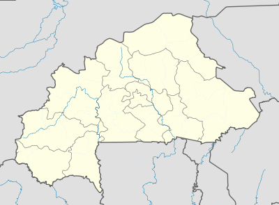
Location of sites
List of sites
* Transnational site
| Name | Image | Location | Criteria | Year | Description |
|---|---|---|---|---|---|
| W-Arly-Pendjari Complex | 
|
Est Region
|
Natural (ix) (x) | 1996 | This transnational extension (Benin, Burkina Faso) to the W National Park of Niger, inscribed in 1996 on the World Heritage List, cover a major expanse of intact Sudano-Sahelian savannah, with vegetation types including grasslands, shrub lands, wooded savannah and extensive gallery forests. It includes the largest and most important continuum of terrestrial, semi-aquatic and aquatic ecosystems in the West African savannah belt. The property is a refuge for wildlife species that have disappeared elsewhere in West Africa or are highly threatened. It is home to the largest population of elephants in West Africa and most of the large mammals typical of the region, such as the African Manatee, cheetah, lion and leopard. It also harbours the only viable population of lions in the region.[3] |
| Ruins of Loropéni | 
|
Sud-Ouest Region
|
Cultural (iii) | 2009 | The 11,130m2 property, the first to be inscribed in the country, with its imposing stone walls is the best preserved of ten fortresses in the Lobi area and is part of a larger group of 100 stone enclosures that bear testimony to the power of the trans-Saharan gold trade. Situated near the borders of Côte d’Ivoire, Ghana and Togo, the ruins have recently been shown to be at least 1,000 years old. The settlement was occupied by the Lohron or Koulango peoples, who controlled the extraction and transformation of gold in the region when it reached its apogee from the 14th to the 17th century. Much mystery surrounds this site large parts of which have yet to be excavated. The settlement seems to have been abandoned during some periods during its long history. The property which was finally deserted in the early 19th century is expected to yield much more information.[4] |
| Ancient Ferrous Metallurgy Sites of Burkina Faso | Centre-Nord Region
|
Cultural (iii) (iv) (vi) | 2019 | This property is composed of five elements located in different provinces of the country. It includes about fifteen standing, natural-draught furnaces, several other furnace structures, mines and traces of dwellings. Douroula, which dates back to the 8th century BCE, is the oldest evidence of the development of iron production found in Burkina Faso. The other components of the property – Tiwêga, Yamané, Kindibo and Békuy – illustrate the intensification of iron production during the second millennium CE. Even though iron ore reduction –obtaining iron from ore – is no longer practiced today, village blacksmiths still play a major role in supplying tools, while taking part in various rituals.[5] |
Tentative List
| Site | Image | Location | Criteria | Area ha (acre) |
Year of submission | Description |
|---|---|---|---|---|---|---|
| Bourzanga necropolis | Centre-Nord Region 13°40′41″N 1°32′46″W / 13.678056°N 1.546111°W
|
Cultural (iii) (iv) | 1996 | [6] | ||
| Tiébélé royal court | 
|
Centre-Sud Region 11°06′N 0°57′W / 11.1°N 0.95°W
|
Cultural (iii) (vi) | 2012 | [7] | |
| Mare aux Hippopotames Biosphere Reserve | 
|
Hauts-Bassins Region 11°36′43″N 3°55′00″W / 11.611944°N 3.916667°W | Natural (ix) (x) | 2012 | [8] | |
| Rock engravings of the Burkinabè Sahel: Pobé-Mengao, Arbinda and Markoye | Sahel Region 14°15′N 0°45′W / 14.25°N 0.75°W | Cultural (ii) (iii) | 2012 | [9] | ||
| Sya, Historic Center of Bobo-Dioulasso | 
|
Hauts-Bassins Region 11°11′00″N 4°17′00″W / 11.183333°N 4.283333°W | Cultural (iii) (iv) | 2012 | [10] |
References
- ^ "The World Heritage Convention". UNESCO. Retrieved December 11, 2023.
- ^ "Burkina Faso". UNESCO. Retrieved November 20, 2023.
- ^ "W-Arly-Pendjari Complex". UNESCO World Heritage Centre. Retrieved 2023-11-20.
 Text was copied from this source, which is available under a Creative Commons Attribution 3.0 IGO (CC BY 3.0 IGO) license.
- ^ "Ruins of Loropéni". UNESCO World Heritage Centre. Retrieved 2023-11-20.
 Text was copied from this source, which is available under a Creative Commons Attribution 3.0 IGO (CC BY 3.0 IGO) license.
- ^ "Ancient Ferrous Metallurgy Sites of Burkina Faso". UNESCO World Heritage Centre. Retrieved 2023-11-20.
 Text was copied from this source, which is available under a Creative Commons Attribution 3.0 IGO (CC BY 3.0 IGO) license.
- ^ "Bourzanga necropolis". UNESCO World Heritage Centre. Retrieved 2023-11-20.
- ^ "Tiébélé royal court". UNESCO World Heritage Centre. Retrieved 2023-11-20.
- ^ "Mare aux Hippopotames Biosphere Reserve". UNESCO World Heritage Centre. Retrieved 2023-11-20.
- ^ "Rock engravings of the Burkinabè Sahel: Pobé-Mengao, Arbinda and Markoye". UNESCO World Heritage Centre. Retrieved 2023-11-20.
- ^ "Sya, Historic Center of Bobo-Dioulasso". UNESCO World Heritage Centre. Retrieved 2023-11-20.


