
Macanal
Macanal | |
|---|---|
Municipality and town | |
 Church of Macanal | |
|
UTC-5 (Colombia Standard Time) | |
| Website | Official website |
Macanal is a town and municipality in the Colombian Department of Boyacá, part of the subregion of the Neira Province. The urban centre is located in the Tenza Valley in the Eastern Ranges of the Colombian Andes at an elevation of 1,680.3 metres (5,513 ft) but parts of the municipality reach elevations of 2,500 metres (8,200 ft). It borders Campohermoso in the east, Almeida in the west, Garagoa in the north and in the south Santa María and Chivor.[1]
Etymology
The name Macanal is either derived from the Chibcha word Macana, meaning garrote, or from the Macana palm tree (Wettinia kalbreyeri).[1][2]
History
The area of Macanal was part of the
Modern Macanal was founded on May 4, 1807.[1]
Geology
The Macanal Formation, an organic shale, outcrops near and has been named after Macanal.
Economy
Main economical activities of Macanal are
Gallery
-
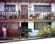 House in Macanal
 -
 Landscape around Macanal
 -
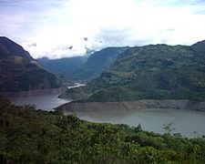 Artificial lake near Macanal


References
- ^ a b c d (in Spanish) Official website Macanal
- ^ (in Spanish) Etymology Municipalities Boyacá - Excelsio.net