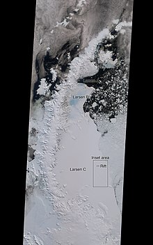
Multi-angle imaging spectroradiometer


The multi-angle imaging spectroradiometer (MISR) is a scientific instrument on the
atmospheric sciences, climatology
and monitoring terrestrial processes.
The MISR instrument consists of an innovative configuration of nine separate
near-infrared
).
The data gathered by MISR are useful in climatological studies concerning the disposition of the solar
aerosol particle concentrations including those formed by natural sources and by human activities, upper air winds and cloud cover, type, height, as well as the characterization of land surface properties, including the structure of vegetation canopies, the distribution of land cover types, or the properties of snow and ice fields
, amongst many other biogeophysical variables.
References
- IEEE Transactions on Geoscience and Remote Sensing (July 2002) Special issue on MISR, Volume 40, No. 7.
- Diner, D. J., B. H. Braswell, R. Davies, N. Gobron, J. Hu, Y. Jin, R. A. Kahn, Y. Knyazikhin, N. Loeb, J.-P. Muller, A. W. Nolin, B. Pinty, C. B. Schaaf, G. Seiz, and J. Stroeve (2005) 'The value of multiangle measurements for retrieving structurally and radiatively consistent properties of clouds, aerosols, and surfaces', Remote Sensing of Environment, 97, 495–518.
- Remote Sensing of Environment (March 2007) Multi-angle Imaging SpectroRadiometer (MISR) Special Issue, Volume 107, Issues 1–2.
External links
- Official NASA site
- Visible Earth: Latest MISR images
- JPL MISR homepage
- Langley Atmospheric Science Data Center MISR data page
