
New Hampshire Route 112
| ||||
| East end | ||||
| Location | ||||
| Country | United States | |||
| State | New Hampshire | |||
| Counties | Grafton, Carroll | |||
| Highway system | ||||
| ||||
New Hampshire Route 112 (abbreviated NH 112) is a 56.39-mile-long (90.75 km) east–west state highway in northern New Hampshire. The highway winds across the state, connecting Bath to Conway through the heart of the scenic and mountainous White Mountain National Forest.
The eastern portion of NH 112 is known as the Kancamagus Highway, running 32 miles (51 km) through the
The Kancamagus Highway stays open all winter, although it occasionally closes for short periods while crews clear heavy snows. Its only major intersection is Bear Notch Road, which connects with the town of Bartlett, but it is closed all winter.[3]
Much of the western portion of NH 112 is also in the White Mountain National Forest, passing through Kinsman Notch with the Lost River tourist attraction. The section between NH 116 and North Woodstock is called Lost River Road.[4]
Route description
Bath to Lincoln
NH 112 begins in the town of Bath at
. NH 112 passes through downtown Lincoln as Main Street.
Lincoln to Conway (Kancamagus Highway)

The Kancamagus Highway portion of NH 112 begins just east of the town center. The state highway reenters the White Mountain National Forest, following the
The Kancamagus Highway is a very popular tourist destination due to its many scenic views and locations. Two scenic outlook sites are located along the Kancamagus Highway, including one from near the crest of Kancamagus Pass. There are six National Forest campground sites, along with numerous hiking trails.
History

The Kancamagus Highway opened in August 1959, after two dead-end stretches of road were linked,[5] creating a connection between US 3 in Lincoln and NH 16 in Conway. Locally known as "The Kanc", the road was paved in 1964,[6] and in the winter of 1966–67 it was plowed for the first time.[7]
The highway is named after
On February 9, 2004, University of Massachusetts Amherst student Maura Murray crashed her car on Route 112 near Woodsville.[11] She disappeared shortly after this incident and her fate remains unknown.[12]
Following Hurricane Irene in August 2011, two sections of NH 112 were closed, pending repair work and evaluation of damage. The Kancamagus Highway was closed from the Sabbaday Falls picnic area across Kancamagus Pass to the Discovery Trail parking area in the eastern part of Lincoln. A section of the western portion of NH 112 along the Wild Ammonoosuc River was closed; as of September 6, 2011, a single lane of the western section had been reopened.[13] As of late June 2012, the highway had been completely reopened, though some stretches were in the process of being repaved.
Major intersections
| County | Location[1][14] | mi[1][14] | km | Destinations | Notes |
|---|---|---|---|---|---|
| Western terminus | |||||
| Easton | 8.664 | 13.943 | Western end of concurrency with NH 116 | ||
| 9.546 | 15.363 | Eastern end of concurrency with NH 116 | |||
| Woodstock | 17.906 | 28.817 | Northern terminus of NH 118 | ||
| 20.471 | 32.945 | US 3 (Main Street) – North Lincoln, Thornton | Village of North Woodstock | ||
| 20.824– 21.172 | 33.513– 34.073 | Exit 32 on I-93 | |||
| Carroll | Conway | 56.387 | 90.746 | Eastern terminus | |
1.000 mi = 1.609 km; 1.000 km = 0.621 mi
| |||||
Images along the highway
-
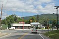
 At intersection of Cemetery Rd in Swiftwater, about two miles east of its western terminus at US 302
 -
 Intersection with US 3
 -
 Intersection with I-93


References
- ^ a b c Bureau of Planning & Community Assistance (February 20, 2015). "NH Public Roads". Concord, New Hampshire: New Hampshire Department of Transportation. Retrieved April 7, 2015.
- ^ "Kancamagus Scenic Byway". USFHA America's Byways program. Retrieved March 23, 2015.
- ^ Kancamagus Highway Closures
- ^ Town of Woodstock official website: Interactive Mapping
- ^ "It Climbs the Mountains In Lincoln-Woodstock Area". The Boston Globe. September 13, 1959. p. 16-A. Retrieved February 8, 2019 – via newspapers.com.
- ^ Erickson, J. O'Brien (July 5, 1964). "Take Plenty of Film For This Shunpike Trip". The Boston Globe. p. 43. Retrieved February 8, 2019 – via newspapers.com.
- ^ Beatrice, Mike (January 1, 1967). "All Skiers Will Find Mount Loon a Boon". The Boston Globe. p. 44. Retrieved February 8, 2019 – via newspapers.com.
- ^ Lewis, Bea (9 August 2009). "How to say Kancamagus". Fosters.com. Retrieved 18 July 2014.
- ISBN 9781843530657. Retrieved 18 July 2014.
- ^ Sidis, William James (1916). "Passaconaway in the White Mountains". Charles Edward Beals (pseudonym). Boston: Richard G. Badger. p. 77. Archived from the original on 2011-05-18. Retrieved 2013-06-13.
- ^ "Maura Murray - Maura Murray Official".
- ^ "Maura Murray | Cold Case Unit | NH Department of Justice".
- ^ "511 Info". NH Department of Transportation. Archived from the original on April 12, 2013. Retrieved September 6, 2011.
- ^ a b Bureau of Planning & Community Assistance (April 3, 2015). "Nodal Reference 2015, State of New Hampshire". New Hampshire Department of Transportation. Retrieved April 7, 2015.[permanent dead link]
External links
- Kancamagus Scenic Byway from FHWA
- kancamagushighway.com, unofficial website
- New Hampshire State Route 112 on Flickr