
Ockley
| Ockley | ||
|---|---|---|
Shire county | ||
| Region | ||
| Country | England | |
| Sovereign state | United Kingdom | |
| Post town | Dorking | |
| Postcode district | RH5 | |
| Dialling code | 01306 | |
| Police | Surrey | |
| Fire | Surrey | |
| Ambulance | South East Coast | |
| UK Parliament | ||
Ockley is a rural village in
History
Finds of small
Ockley's name initially appears to fit the uncertain site where battle took place described in the entry for the year 851 of the
Ockley appears in
Nicholas Culpeper, a leading Stuart period herbalist, was probably born here on 18 October 1616.[5]
In 1911 the parish was "agricultural, except for a little brick and tile making".[2]
Sports
Informal football is generally played on Ockley Green which has football posts in place.
Ockley Cricket Club celebrated its 170th anniversary in 2022. League matches are played on Saturdays with friendly games on Sundays.
Ockley has Gatton Manor Golf Course on the outskirts of the village, within the parish bounds.[6]
The village has featured in longer routes of the
Geography
Between
Nearest Settlements | |
|---|---|
Transport
Roads
The A29 is the main road through the village with Horsham to the south and Dorking to the north. Local minor roads provide relatively straight access from just north of the village's developed area to Ewhurst and Cranleigh to the west and Capel to the east.
Rail
The village is served by Ockley railway station which is 2 miles (3.2 km) to the east, due to a Victorian aristocrat having imposed his manor's name on a station closer to Capel, Surrey.
Demography and housing
| Output area | Detached | Semi-detached | Terraced | Flats and apartments | Caravans/temporary/mobile homes | shared between households[1] |
|---|---|---|---|---|---|---|
| (Civil Parish) | 147 | 132 | 44 | 18 | 11 | 0 |
The average level of accommodation in the region composed of detached houses was 28%, the average that was apartments was 22.6%.
| Output area | Population | Households | % Owned outright | % Owned with a loan | hectares[1] |
|---|---|---|---|---|---|
| (Civil Parish) | 871 | 352 | 34.7% | 26.7% | 1375 |
The proportion of households in the civil parish who owned their home outright compares to the regional average of 35.1%. The proportion who owned their home with a loan compares to the regional average of 32.5%. The remaining % is made up of rented dwellings (plus a negligible % of households living rent-free).
Gallery
-
 Village Green
 -
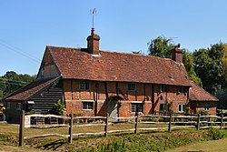 Old Cottage
 -
 Weaver's Pond
 -
 St Margaret's Church
 -
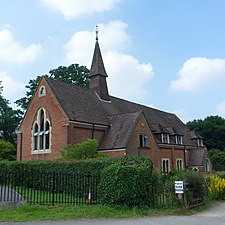 St John's Church
 -
 Aerial view


.JPG)

.jpg)
See also
References
- ^ United Kingdom Census 2011 Office for National StatisticsRetrieved 21 November 2013
- ^ a b c H.E. Malden, ed. (1911). "Parishes: Ockley". A History of the County of Surrey: Volume 3. Institute of Historical Research. Retrieved 29 November 2013.
- ISBN 9780192801395
- ^ Surrey Domesday Book
- ISBN 978-0-19-861412-8. (Subscription or UK public library membershiprequired.)
- ^ Gatton Manor Retrieved 2013-11-29
External links
![]() Media related to Ockley at Wikimedia Commons
Media related to Ockley at Wikimedia Commons
|
|  | ||||||||||||||||
|---|---|---|---|---|---|---|---|---|---|---|---|---|---|---|---|---|---|---|
| Parks | ||||||||||||||||||
| Places of worship |
| |||||||||||||||||
| Education | ||||||||||||||||||
| Transport |
| |||||||||||||||||
Buildings and structures | ||||||||||||||||||
| Sport |
| |||||||||||||||||
Places listed are articles notable as settlements, arranged by post town The two principal towns are emboldened | ||||||||||||||||||