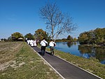
Opatovac, Vukovar-Syrmia County
Opatovac | |
|---|---|
UTC+2 (CEST ) |
Opatovac (pronounced grasslands in Croatia at the section of the Vukovar Plateau.[3]
History
The
Serbian Orthodox Church of St. George was built in 1802 with the iconostasis dating back to 1769.[4]
During the so-called
European migrant crisis the village hosted the temporary refugee camp where thousands of individuals received primary medical support and registration.[5]
See also
References
- Wikidata Q119585703.
- ^ "Population by Age and Sex, by Settlements, 2021 Census". Census of Population, Households and Dwellings in 2021. Zagreb: Croatian Bureau of Statistics. 2022.
- ^ n.a. (n.d.). "Stepska staništa kod Opatovca". Natura 2000. Retrieved 8 June 2023.
- ^ "Crkve u Veri, Kneževu, Marincima i Opatovcu". Srbi.hr, Joint Council of Municipalities. 23 March 2018. Retrieved 9 June 2023.
- ^ N1 info (7 June 2015). "EKSKLUZIVNE SNIMKE kampa u Opatovcu snimljene dronom" (in Croatian). N1 (TV channel). Retrieved 9 June 2023.
{{cite web}}: CS1 maint: numeric names: authors list (link)

