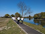
Mohovo
Mohovo | |
|---|---|
Vukovar-Syrmia | |
| Municipality | Ilok |
| Area | |
| • Total | 11.6 km2 (4.5 sq mi) |
| Elevation | 83 m (272 ft) |
| Population (2021)[2] | |
| • Total | 183 |
| • Density | 16/km2 (41/sq mi) |
| Demonym(s) | Mohovljanin (♂) Mohovljanka (♀) (per UTC+2 (CEST) |
| Postal code | 32234 Šarengrad |
| Area code | +385 0(32) |

Mohovo (
Vukovar-Syrmia County in easternmost part of Croatia. It is administratively part of the town of Ilok
.
Geography
It is located by the
Opatovac in the west and Šarengrad
to the east.
Demographics
Settlement of Mohovo: Population trends 1857–2021
| population | 489 | 505 | 378 | 406 | 485 | 481 | 479 | 449 | 360 | 178 | 465 | 465 | 386 | 344 | 303 | 239 | 183 |
| 1857 | 1869 | 1880 | 1890 | 1900 | 1910 | 1921 | 1931 | 1948 | 1953 | 1961 | 1971 | 1981 | 1991 | 2001 | 2011 | 2021 |
1991 census
| Mohovo[3] |
|---|
| 1991 |
total: 344 Croats 218 (63.37%) Serbs 115 (33.43%) Roma 4 (1.16%) Hungarians 1 (0.29%) Yugoslavs 1 (0.29%) nondeclared 5 (1.45%)
|
1910 census
According to the 1910 census, settlement of Mohovo had 481 inhabitants, which were linguistically and religiously declared as this:
| Mohovo[4] | |
|---|---|
| Population by language | Population by religion |
total: 481 | |
See also
References
- Wikidata Q119585703.
- ^ "Population by Age and Sex, by Settlements, 2021 Census". Census of Population, Households and Dwellings in 2021. Zagreb: Croatian Bureau of Statistics. 2022.
- ISBN 978-953-6667-07-9;
- ISBN 978-953-6667-07-9;
External links
Wikimedia Commons has media related to Mohovo.

