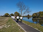
Orolik
Appearance
Orolik | |
|---|---|
Vukovar-Syrmia | |
| Municipality | Stari Jankovci |
| Government | |
| • Body | Local Committee |
| Area | |
• Total | 6.3 sq mi (16.4 km2) |
| Elevation | 292 ft (89 m) |
| Population (2021)[2] | |
• Total | 355 |
| • Density | 56/sq mi (22/km2) |
| Demonym(s) | Oroličanin (♂) Oroličanka (♀) (per UTC+2 (CEST ) |
Serbian Orthodox Church of St. Peter and Paul and Roman Catholic church
Orolik (
M105 railway
.
History
One
Austro-Hungarian Empire.[3]
Orolik was established in the 16th century during the
Roman Catholic families in the village.[4]
According to the 1890 census, Orolik had 936 inhabitants, of which 521 were Roman Catholics, 384 Orthodox, 20 Jews, 5 Lutherans, 5 Nazarenes and 1 Greek Catholic.[5]
On 19 December 1993
UNPROFOR peacekeeping forces were attacked by local Serb residents of the village.[6]
See also
References
- Wikidata Q119585703.
- ^ "Population by Age and Sex, by Settlements" (xlsx). Census of Population, Households and Dwellings in 2021. Zagreb: Croatian Bureau of Statistics. 2022.
- ^ Austrian Academy of Sciences Press: 31–48. Retrieved 22 January 2019.
- ^ ISBN 9532221239.
- ^ "Orolik". o-jankovci.hr. Retrieved 2023-02-19.
- ISBN 978-953-358-654-0.
External links
45°13′N 18°59′E / 45.217°N 18.983°E


