
Pennant Hills Road
Pennant Hills Road Cumberland Highway | |
|---|---|
Pennant_Hills_Road_Thornleigh.jpg) | |
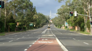
| Pennant Hills Road at Thornleigh in 2016 | |
 Northeast end Southwest end | |
| Coordinates |
|
| General information | |
| Type | Highway |
| Length | 16.1 km (10 mi) |
| Route number(s) | (Wahroonga–North Parramatta) |
| Former route number |
|
| Major junctions | |
| Northeast end | Wahroonga, Sydney |
| |
| Southwest end | Church Street Parramatta, Sydney |
| Location(s) | |
| Major suburbs | Normanhurst, Thornleigh, Pennant Hills, Carlingford |
| Highway system | |
Pennant Hills Road is a 16.1-kilometre-long (10.0 mi)
In 2015
Route
Pennant Hills Road commences at Pearce's Corner, the intersection with
At Pennant Hills, the road crosses the
The road continues south to the interchange with M2 Hills Motorway and the southern end of NorthConnex, narrowing back to a four-lane road and continuing south through Carlingford and the intersection with North Rocks Road and to the intersection with Carlingford Road. South of the Carlingford Road intersection lies the intersection with Marsden Road, and the road then continues southwest towards Parramatta, crossing the former Carlingford railway line, through Telopea to the major interchange with James Ruse Drive in North Parramatta; Cumberland Highway heads north along James Ruse Drive, whereas Pennant Hills Road continues southwest into Parramatta where it eventually terminates at the intersection with Church Street.
The road has a 60 km/h (37 mph) speed limit from Pearce's Corner for the short distance to the M1 intersection. From the M1 intersection it is 70 km/h (43 mph) for the entire distance to the M2 Motorway interchange. From here, the road reverts to a 60 km/h (37 mph) limit to Parramatta, with numerous 40 km/h (25 mph) "school zones" (8:00am–9:30am and 2:30pm–4:00pm), and two fixed speed cameras, between Evans Road and Coleman Avenue in Carlingford and between Castle Street and Bellevue Street in North Parramatta. Both are 60 km/h (37 mph) zones.[6]
Pennant Hills Road frontage is a mix of businesses, schools and homes. The biggest concentration of businesses are at Thornleigh, Pennant Hills, West Pennant Hills (Thompson's Corner) and Carlingford, with the Carlingford area being the biggest.
History
Pennant Hills Road began its life in 1820 as a bullock track used by timbermen. It was surveyed by government surveyor
The passing of the Main Roads Act of 1924
With the declaration of Pennant Hills Road as a constituent part of Cumberland Highway on 26 August 1988, the western end of State Highway 13 was altered to use the Parramatta Bypass (today James Ruse Drive) around Parramatta and continue along Cumberland Highway to Liverpool; Main Road 637 was declared along the remaining section from James Ruse Drive to Church Street.[2] Despite this, much of the signage today still identifies Pennant Hills Road under its own name.
The passing of the Roads Act of 1993[9] updated road classifications and the way they could be declared within New South Wales. Under this act, and as part of Cumberland Highway, Pennant Hills Road today retains its declaration as Highway 13, from Wahroonga to Parramatta (and continuing southwest along Cumberland Highway eventually to Liverpool).[10]
State Highway 13 eventually assumed the role of a western bypass of Sydney, made official when it was declared as part of Ring Road 5 in 1964. Ring Road 5 was superseded by State Route 55 in 1974, but by this stage, the growth of Sydney's west had turned the bypass road into a primary arterial road with a huge increase in freight traffic. With the declaration of Pennant Hills Road as part of Cumberland Highway, State Route 55 was replaced with State Route 77, from Pearce's Corner to the interchange with James Ruse Drive, in 1988 (with the remaining southwestern section into Parrramatta now unallocated); it was replaced with Metroad 7 in 1993. State Route 30 was allocated along Pennant Hills Road between Beecroft and Castle Hill Roads from 1974; this was replaced with Metroad 2 in 1993, until it was rerouted along M2 Hills Motorway when it opened in 1997. With the opening of the Westlink M7 motorway in December 2005, the Metroad 7 route south of M2 Hills Motorway was decommissioned and rerouted onto the Westlink M7, leaving only the section north of M2 Hills Motorway along Pennant Hills Road designated as Metroad 7; Metroad 6 was extended northwards from Carlingford along Pennant Hills Road to meet M2 Hills Motorway at the same time, leaving the rest of Cumberland Highway west of Carlingford without a route number. With the conversion to the newer alphanumeric system in 2013, Pennant Hills Road was re-designated part of route A28, replacing the last remnant of Metroads 6 and 7 along it.[11]
Traffic congestion
Pennant Hills Road has always been the main road north from Parramatta to Hornsby, but with traffic from major arterial roads of James Ruse Drive, Marsden Road, Carlingford Road, North Rocks Road, Castle Hill Road, Beecroft Road, The Comenarra Parkway and the Pacific Highway adding to that, plus the relatively recent additions of the M2 Motorway and the M1 Motorway extension to Wahroonga, the highway can get quite congested during the morning and afternoon peaks and is often characterised by the heavy population of trucks and other logistic vehicles. Pennant Hills Road is the only direct road linking the M1 and the M2, forcing interstate commercial traffic, travellers, and commuters to all compete for passage with local Hornsby Shire traffic. The average traffic flow on Pennant Hills Rd, according to a 2002 survey by the RTA, was 62,656, with the busiest area occurring around Thompsons Corner.
Plans to link the M1 with a planned
After undergoing significant studies the government constructed an M1-M2 link, dubbed the NorthConnex. Opened on 31 October 2020, NorthConnex will help alleviate traffic travelling between Western Sydney and the Central Coast.
Pennant Hills Road regulation
Since the opening of NorthConnex on 31 October 2020, a fine of A$194 with no demerit points will be imposed on truck and bus drivers who use the Pennant Hills Road instead of the new tolled tunnel, detected using gantries on either side of Pennant Hills Road.[12] The fine only applies to drivers of trucks and buses over 12.5 metres long or over 2.8 metres clearance height, with the exception of vehicles transporting dangerous goods and oversize vehicles approved to use Pennant Hills Road.
Exits and interchanges
| LGA | Location | km[3] | mi | Destinations | Notes |
|---|---|---|---|---|---|
| Hornsby | Wahroonga | 0.0 | 0.0 | Pearces Corner intersection: northeastern terminus of highway and route A28 Northern end of Pennant Hills Road | |
| 0.25 | 0.16 | ||||
| NorthConnex tunnel, southbound entry and northbound exit only | |||||
| Pennant Hills | 4.6 | 2.9 | Northern railway line | ||
| 5.3 | 3.3 | Beecroft Road – Beecroft, Epping | Southbound and northbound exits only | ||
| 5.6 | 3.5 | Beecroft Road – Beecroft, Epping | Southbound and northbound entrances only | ||
| Hornsby–The Hills boundary | West Pennant Hills–Beecroft boundary | 7.0 | 4.3 | Castle Hill Road – Castle Hill, Windsor | |
| 7.9 | 4.9 | Gosford, Newcastle | NorthConnex tunnel, northbound entry and southbound exit only | ||
Lane Cove | |||||
Silverwater, Sydney Olympic Park | |||||
| 11.4 | 7.1 | Parramatta Light Rail (former Carlingford railway line) | |||
North Parramatta–Oatlands boundary | 14.9 | 9.3 | Cumberland Highway and route A28 continue north along James Ruse Drive | ||
Parramatta | Southwestern terminus of road | ||||
| |||||
Gallery
-
 Pennant Hills Road, Cardinal Avenue Intersection, with cars edited out

See also
References
- ^ a b "Main Roads Act, 1924-1927". Government Gazette of the State of New South Wales. No. 110. National Library of Australia. 17 August 1928. pp. 3814–20. Archived from the original on 3 August 2022. Retrieved 1 August 2022.
- ^ a b "State Roads Act". Government Gazette of the State of New South Wales. No. 138. National Library of Australia. 26 August 1988. p. 4505. Archived from the original on 16 January 2023. Retrieved 16 January 2023.
- ^ a b c Google (26 August 2022). "Pennant Hills Road" (Map). Google Maps. Google. Retrieved 26 August 2022.
- ^ Vaughan, Craig (28 October 2015). "Pennant Hills Rd was voted the second worst road in NSW and the ACT in the NRMA's annual survey". Hornsby Advocate. Retrieved 23 October 2016.
- ^ "Frequently asked questions - NorthConnex". www.northconnex.com.au. Retrieved 9 October 2020.
- ^ "Speed camera locations - List of fixed speed camera locations in NSW", Roads and Traffic Authority, NSW Accessed 28 September 2006
- ^ State of New South Wales, An Act to provide for the better construction, maintenance, and financing of main roads; to provide for developmental roads; to constitute a Main Roads Board Archived 11 August 2022 at the Wayback Machine 10 November 1924
- ^ State of New South Wales, An Act to amend the Main Roads Act, 1924-1927; to confer certain further powers upon the Main Roads Board; to amend the Local Government Act, 1919, and certain other Acts; to validate certain payments and other matters; and for purposes connected therewith. Archived 12 August 2022 at the Wayback Machine 8 April 1929
- ^ State of New South Wales, An Act to make provision with respect to the roads of New South Wales; to repeal the State Roads Act 1986, the Crown and Other Roads Act 1990 and certain other enactments; and for other purposes. Archived 11 August 2022 at the Wayback Machine 10 November 1924
- ^ Transport for NSW (August 2022). "Schedule of Classified Roads and Unclassified Regional Roads" (PDF). Government of New South Wales. Retrieved 1 August 2022.
- Roads & Maritime Services. Government of New South Wales. 2012. Archived from the original(PDF) on 25 March 2016. Retrieved 7 November 2016.
- ^ "Pennant Hills Road regulation". Transport for NSW - Roads and Maritime. Archived from the original on 29 October 2020. Retrieved 30 October 2020.