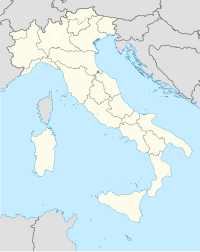
Pollino National Park
| Parco Nazionale del Pollino | |
|---|---|
| Location | Basilicata and Calabria, Italy |
| Nearest city | Morano Calabro |
| Coordinates | 39°55′36″N 16°06′41″E / 39.92667°N 16.11139°E |
| Area | 1,925.65 km2 (743.50 sq mi) |
| Established | 1993 |
| Governing body | Ministero dell'Ambiente |
Pollino National Park (
Bosnian pine tree. Since November 2015, with the inclusion in the global list of geoparks by UNESCO, the Pollino Park is considered a World Heritage Site. Encompassing a total of 88,650 ha in the Lucanian side (Muro lucano) and 103,915 in the Calabrian one is the largest park in the country covering 1,925.65 square kilometers[2][3] and among the 50 largest in the world. The common beech is the park's most prevalent tree and the park is also home to a variety of important medicinal herbs.[4]
Towns with interesting sights include
Hippopotamus major
.
Rivers and streams include the
, and Raganello.Wildlife include
European otter, Calabrian black squirrel, forest dormouse (Dryomys nitedula), black woodpecker, chough, peregrine falcon, red kite, lanner falcon, Egyptian vulture and red deer
(were introduced in the 2000s).
References
- ^ "Oldest European Tree Found—And It's Having a Growth Spurt". National Geographic. Archived from the original on May 25, 2018. Retrieved 2018-05-26.
- ^ "Profilo geografico e storico del Parco del Pollino". Parco Nazionale del Pollino (in Italian). Retrieved 2017-12-23.
- ISBN 1405389222.
- ^ "Piante, fiori e erbe officinali del Parco del Pollino". Parco Nazionale del Pollino (in Italian). Retrieved 2017-12-23.
External links
- Parco Nazionale del Pollino official website (in English)
- Parco Nazionale del Pollino official website (in Italian)


