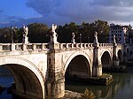
Ponte Salario
Ponte Salario | |
|---|---|
 Engraving of the Ponte Salario by Giovanni Battista Piranesi from between 1754–1760 | |
| Coordinates | 41°56′22″N 12°30′30″E / 41.939444°N 12.508333°E |
| Carries | Via Salaria (SS4) |
| Crosses | Aniene |
| Locale | Rome, Italy |
| Followed by | Current bridge (1874) |
| Characteristics | |
| Design | Arch bridge |
| Total length | 72 m (historical bridge) |
| Width | 6.52 m (historical bridge) |
| Longest span | 24.86 m (historical bridge) |
| History | |
| Opened | 2nd–1st century BC (historical bridge) |
| Closed | 1867 (historical bridge) |
| Location | |
 | |
The Ponte Salario, also called Ponte Salaro during the
antiquity, it lay outside the city limits, 3 km north of the Porta Collina, at the point where the Via Salaria (modern SS4) crossed the Aniene, a tributary of the Tiber. The visible side arches are assumed to originate from the first stone structure built during the 1st century BC.[1]
In the
clear span of 24.86 m.[2]

The large
medieval tower was demolished, and in 1849 the bridge was cut on a length of 15 m by French soldiers. In 1867, the bridge once and for all lost its historical character, when papal troops blew up the central arch. The Ponte Salario was reconstructed in its current form in 1874, with the roadway widened in 1930.[1]
Apart from the Ponte Salario, there were other fortified bridges across the Aniene, such as the extant
Subiaco.[4]
See also
- List of Roman bridges
- Roman architecture
- Roman engineering
References
- ^ a b c Galliazzo 1994, p. 45
- ^ Galliazzo 1994, p. 48
- ^ O’Connor 1993, p. 68
- ^ Il Ponte di S. Francesco (in Italian)
Sources
- Galliazzo, Vittorio (1994), I ponti romani. Catalogo generale, vol. 2, Treviso: Edizioni Canova, pp. 45–48 (No. 32), ISBN 88-85066-66-6
- O’Connor, Colin (1993), Roman Bridges, Cambridge University Press, p. 68 (I14), ISBN 0-521-39326-4
External links
![]() Media related to Ponte Salario at Wikimedia Commons
Media related to Ponte Salario at Wikimedia Commons
- Illustrated article at Romeartlover
- Ponte Salario at Structurae

