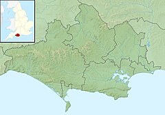
River Hooke
| River Hooke | |
|---|---|
 River Hooke at Kingcombe Meadows | |
| Location | |
| Country | England |
| County | Dorset |
| Physical characteristics | |
| Source | |
| • location | Dorset |
| Mouth | |
• location | Maiden Newton, Dorset |
• coordinates | 50°46′38″N 2°34′26″W / 50.7772°N 2.5740°W |
The River Hooke is a small river in the county of
the hundred of Tollerford. At some point, however, this former name was replaced in use by reference to a particular feature in the river's course: "Hooke" is a derivation of hoc, Old English for "sharp bend in a stream".[1]
It is possible that this description gave the village of Hooke its name, which then transferred to the river by back-formation.
Although the River Hooke is flanked on both sides by chalk slopes of the Dorset Downs, in its course it has cut down to greensand. According to the Dorset-born author and broadcaster Ralph Wightman, this has resulted in "many springy and boggy patches which are not typical of chalk valleys."[2] Writing in 1965, Wightman commented that at Hooke village itself "the largest spring I have ever seen used to gush out of the steep hillside, and was immediately used for watercress."[3]
There is a river level monitoring stations on the River Frome at Hooke.[4]
See also
References
- ^ Gant, R., Dorset Villages, Hale, 1980, p134
- ^ Wightman, R., Portrait of Dorset, Hale, 1983, p93
- ^ Wightman, R., Portrait of Dorset, Hale, 1983, p94
- ^ "River Hooke level at Hooke - GOV.UK". check-for-flooding.service.gov.uk. Retrieved 5 January 2024.
External links

